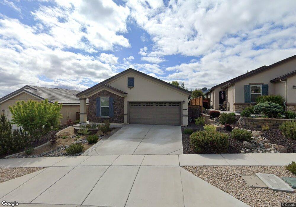
9220 Andover Trail Reno, NV 89523
Somersett NeighborhoodEstimated Value: $556,573 - $566,000
2
Beds
2
Baths
1,335
Sq Ft
$422/Sq Ft
Est. Value
About This Home
This home is located at 9220 Andover Trail, Reno, NV 89523 and is currently estimated at $563,143, approximately $421 per square foot. 9220 Andover Trail is a home located in Washoe County with nearby schools including B D Billinghurst Middle School and Robert McQueen High School.
Ownership History
Date
Name
Owned For
Owner Type
Purchase Details
Closed on
Apr 17, 2020
Sold by
Rather Geri Loraine and Rather Geri Loraine
Bought by
Brawley Donald H
Current Estimated Value
Home Financials for this Owner
Home Financials are based on the most recent Mortgage that was taken out on this home.
Original Mortgage
$185,000
Outstanding Balance
$163,576
Interest Rate
3.3%
Mortgage Type
New Conventional
Estimated Equity
$399,567
Purchase Details
Closed on
Jan 15, 2014
Sold by
Pn Ii Inc
Bought by
Rather Geri Loraine and The Geri Loraine Rather 2004 Revocable F
Create a Home Valuation Report for This Property
The Home Valuation Report is an in-depth analysis detailing your home's value as well as a comparison with similar homes in the area
Home Values in the Area
Average Home Value in this Area
Purchase History
| Date | Buyer | Sale Price | Title Company |
|---|---|---|---|
| Brawley Donald H | $380,000 | First Centennial Title Reno | |
| Rather Geri Loraine | $280,000 | First American Title Sparks |
Source: Public Records
Mortgage History
| Date | Status | Borrower | Loan Amount |
|---|---|---|---|
| Open | Brawley Donald H | $185,000 |
Source: Public Records
Tax History Compared to Growth
Tax History
| Year | Tax Paid | Tax Assessment Tax Assessment Total Assessment is a certain percentage of the fair market value that is determined by local assessors to be the total taxable value of land and additions on the property. | Land | Improvement |
|---|---|---|---|---|
| 2025 | $3,063 | $119,188 | $42,805 | $76,383 |
| 2024 | $3,063 | $113,264 | $36,680 | $76,584 |
| 2023 | $2,160 | $115,255 | $43,190 | $72,065 |
| 2022 | $2,887 | $93,665 | $33,775 | $59,890 |
| 2021 | $2,804 | $85,525 | $26,215 | $59,310 |
| 2020 | $2,720 | $87,582 | $28,385 | $59,197 |
| 2019 | $2,641 | $86,647 | $30,310 | $56,337 |
| 2018 | $2,564 | $76,038 | $21,000 | $55,038 |
| 2017 | $2,490 | $74,670 | $19,775 | $54,895 |
| 2016 | $2,426 | $74,130 | $18,235 | $55,895 |
| 2015 | $609 | $71,476 | $15,995 | $55,481 |
| 2014 | $2,347 | $68,136 | $15,085 | $53,051 |
| 2013 | -- | $9,535 | $8,624 | $911 |
Source: Public Records
Map
Nearby Homes
- 9225 Sassafras Trail
- 1124 Dutch Hollow Trail
- 1014 Herndon Trail
- 1380 Wakefield Trail
- 1335 Wakefield Trail
- 1170 Cliff Park Way
- 828 Larrimore Trail
- 0 Mountain Daisy Rd
- 0 Mountain Haven Ln
- 1395 Walking Stick Way
- 270 Mogul Mountain Dr
- 1266 Firefly Ct
- 80 Bobcat Dr
- 9052 Cabin Creek Trail
- 150 Mule Deer Dr
- 1591 Elk Run Trail
- 9172 Mount Pleasant Dr
- 1590 Scott Valley Rd
- 1640 Scott Valley Rd
- 1610 Verdi Vista Ct
- 9210 Andover Trail
- 9230 Andover Trail
- 9240 Andover Trail
- 9250 Andover Trail
- 1101 Callaway Trail
- 1120 Wakefield Trail
- 1130 Wakefield Trail
- 1110 Wakefield Trail
- 1140 Wakefield Trail
- 1107 Callaway Trail
- 1100 Sugar Creek Trail
- 1086 Callaway Trail
- 1150 Wakefield Trail
- 1092 Callaway Trail
- 1098 Callaway Trail
- 1080 Callaway Trail
- 1101 Dutch Hollow Trail
- 1074 Callaway Trail
- 1110 Sugar Creek Trail
- 1160 Wakefield Trail