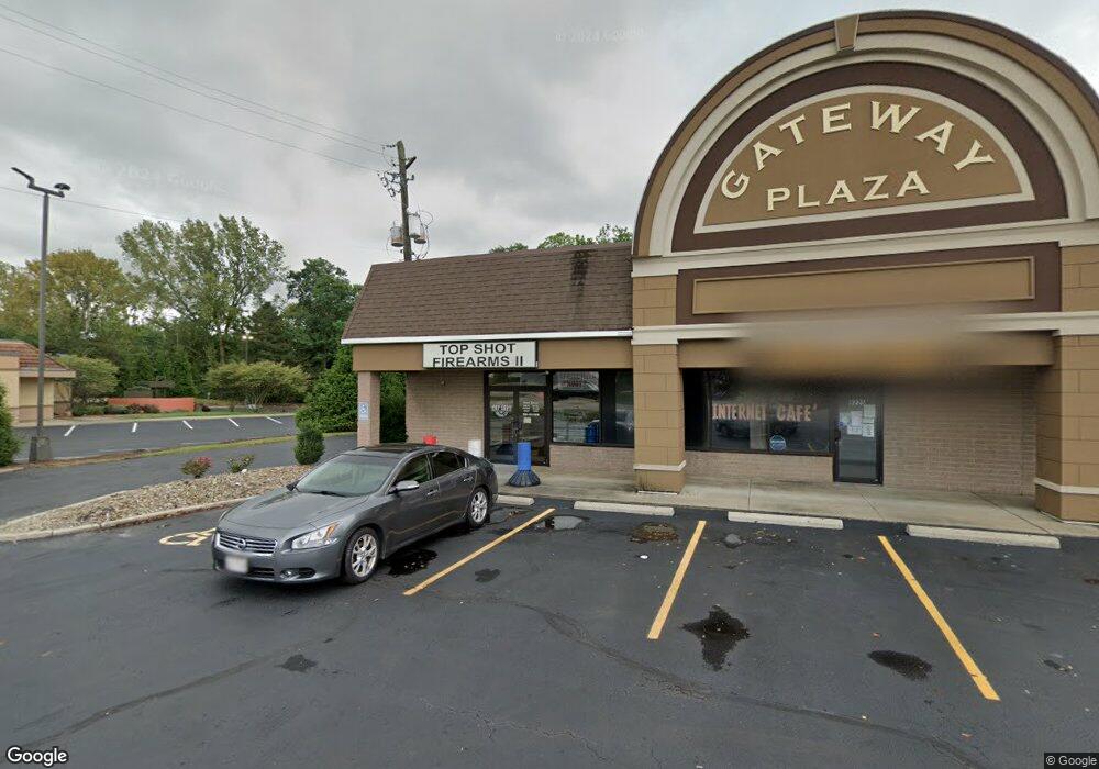
9225 State Route 14 Unit A Streetsboro, OH 44241
--
Bed
1
Bath
7,800
Sq Ft
0.85
Acres
About This Home
This home is located at 9225 State Route 14 Unit A, Streetsboro, OH 44241. 9225 State Route 14 Unit A is a home located in Portage County with nearby schools including Streetsboro High School and Crossroads Christian Academy.
Ownership History
Date
Name
Owned For
Owner Type
Purchase Details
Closed on
May 22, 2012
Sold by
Estate Of Frank L Gallucci Jr
Bought by
Gallucci Jane
Purchase Details
Closed on
Sep 29, 2006
Sold by
Gallucci Jane K
Bought by
G N I Group Llc
Purchase Details
Closed on
Sep 11, 2006
Sold by
Concord Properties Partners Co Ltd
Bought by
Gallucci Jane K and Frank I Gallucci Jr Trust
Purchase Details
Closed on
Feb 5, 2004
Sold by
Gallucci Jane and Gallucci Gust
Bought by
Concord Properties Partners Co Ltd
Purchase Details
Closed on
Mar 2, 1989
Bought by
Gallucci Frank L
Create a Home Valuation Report for This Property
The Home Valuation Report is an in-depth analysis detailing your home's value as well as a comparison with similar homes in the area
Home Values in the Area
Average Home Value in this Area
Purchase History
| Date | Buyer | Sale Price | Title Company |
|---|---|---|---|
| Gallucci Jane | -- | None Available | |
| G N I Group Llc | -- | None Available | |
| Gallucci Jane K | -- | None Available | |
| Concord Properties Partners Co Ltd | -- | Surety Title Agency Inc | |
| Gallucci Frank L | $385,000 | -- |
Source: Public Records
Tax History Compared to Growth
Tax History
| Year | Tax Paid | Tax Assessment Tax Assessment Total Assessment is a certain percentage of the fair market value that is determined by local assessors to be the total taxable value of land and additions on the property. | Land | Improvement |
|---|---|---|---|---|
| 2024 | $11,234 | $203,250 | $104,410 | $98,840 |
| 2023 | $10,748 | $162,090 | $84,840 | $77,250 |
| 2022 | $10,816 | $162,090 | $84,840 | $77,250 |
| 2021 | $10,978 | $162,090 | $84,840 | $77,250 |
| 2020 | $10,909 | $162,090 | $84,840 | $77,250 |
| 2019 | $10,979 | $162,090 | $84,840 | $77,250 |
| 2018 | $9,422 | $159,290 | $84,840 | $74,450 |
| 2017 | $9,422 | $159,290 | $84,840 | $74,450 |
| 2016 | $9,449 | $159,290 | $84,840 | $74,450 |
| 2015 | $9,483 | $159,290 | $84,840 | $74,450 |
| 2014 | $9,624 | $159,290 | $84,840 | $74,450 |
| 2013 | $9,576 | $159,290 | $84,840 | $74,450 |
Source: Public Records
Map
Nearby Homes
- 9018 Patriot Dr
- 9012 Patriot Dr
- 1440 Trader Dr
- 1446 Trader Dr Unit H5
- 9315 June Dr
- 1490 Evergreen Dr
- 8807 Kelly Ln
- 1489 Crescent Dr
- 1648 Maple View Ct
- 1280 Shawnee Trail
- 9244 Lakeside Dr
- 1516 Gillie Dr
- 1013 Ashwood Ln
- 1011 Ashwood Ln
- 9247 Chestnut Ct
- 1405 Gillie Dr
- 9251 Chestnut Ct
- 1159 Shawnee Trail
- 9431 Briar Dr
- 1223 Cherokee Trail
- 9225 State Route 14 Unit B
- 9227 State Route 14 Unit 3
- 9227 State Route 14
- 9233 State Route 14
- v/l St Rt 14
- 9230 State Route 14
- 9230 State Route 14
- 9243 State Route 14
- 9096 State Route 43
- 1393 Colony Dr
- 1389 Colony Dr Unit 15
- 1389 Colony Dr Unit I-5
- 1385 Colony Dr
- 1385 Colony Dr Unit I-4
- 1381 Colony Dr
- 1377 Colony Dr
- 1373 Colony Dr Unit I1
- 1401 Colony Dr
- 1401 Colony Dr Unit J2
- 1397 Colony Dr Unit J1