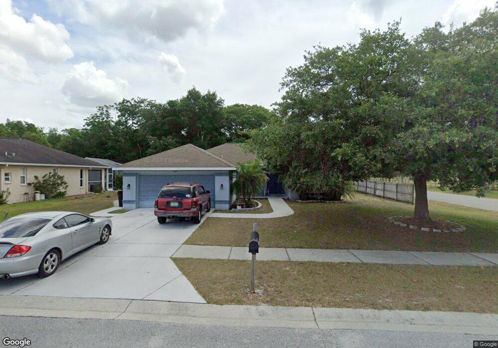
9227 Robin Nest Dr Hudson, FL 34669
Estimated Value: $284,000 - $381,000
Studio
2
Baths
1,605
Sq Ft
$202/Sq Ft
Est. Value
About This Home
This home is located at 9227 Robin Nest Dr, Hudson, FL 34669 and is currently estimated at $323,798, approximately $201 per square foot. 9227 Robin Nest Dr is a home located in Pasco County with nearby schools including West Pasco Education Academy, Hudson Middle School, and Fivay High School.
Ownership History
Date
Name
Owned For
Owner Type
Purchase Details
Closed on
Jun 23, 2003
Sold by
Woodland Oaks Development Inc
Bought by
Montenare Russell
Current Estimated Value
Home Financials for this Owner
Home Financials are based on the most recent Mortgage that was taken out on this home.
Original Mortgage
$125,000
Outstanding Balance
$51,969
Interest Rate
5.43%
Mortgage Type
Purchase Money Mortgage
Estimated Equity
$271,829
Create a Home Valuation Report for This Property
The Home Valuation Report is an in-depth analysis detailing your home's value as well as a comparison with similar homes in the area
Purchase History
| Date | Buyer | Sale Price | Title Company |
|---|---|---|---|
| Montenare Russell | $144,600 | Action Title Services Inc |
Source: Public Records
Mortgage History
| Date | Status | Borrower | Loan Amount |
|---|---|---|---|
| Open | Montenare Russell | $125,000 |
Source: Public Records
Tax History
| Year | Tax Paid | Tax Assessment Tax Assessment Total Assessment is a certain percentage of the fair market value that is determined by local assessors to be the total taxable value of land and additions on the property. | Land | Improvement |
|---|---|---|---|---|
| 2026 | $1,702 | $136,790 | -- | -- |
| 2025 | $1,702 | $136,790 | -- | -- |
| 2024 | $1,702 | $129,200 | -- | -- |
| 2023 | $1,629 | $125,440 | $0 | $0 |
| 2022 | $1,452 | $121,790 | $0 | $0 |
| 2021 | $1,414 | $118,250 | $29,989 | $88,261 |
| 2020 | $1,385 | $116,620 | $18,637 | $97,983 |
| 2019 | $1,352 | $114,000 | $0 | $0 |
| 2018 | $1,319 | $111,874 | $0 | $0 |
| 2017 | $1,307 | $111,874 | $0 | $0 |
| 2016 | $1,074 | $96,941 | $0 | $0 |
| 2015 | $1,088 | $96,267 | $0 | $0 |
| 2014 | $1,053 | $100,092 | $15,007 | $85,085 |
Source: Public Records
Map
Nearby Homes
- 9315 Haas Dr
- 13615 Arden Dr
- 9147 Jiminez Dr
- 13711 Landers Dr
- 12125 Little Rd
- 9147 Duffer Ct
- 13625 Deventer Ct
- 13842 Greyhawk Ct Unit 4
- 8827 Helmsly Ln
- 13748 Bryndlewood Ct
- 9633 Jim St
- 9633 Norm St
- 9104 Water Hazard Dr
- 9301 Tournament Dr
- 9208 Water Hazard Dr
- 9607 Bud St
- 9641 Norm St
- 9255 Grouse Way
- 13018 Sirius Ln
- 9229 Water Hazard Dr
- 9219 Robin Nest Dr
- 9211 Robin Nest Dr
- 9228 Robin Nest Dr
- 9220 Robin Nest Dr
- 9142 Debbie Ln
- 9212 Robin Nest Dr
- 9219 Debbie Ln
- 9203 Robin Nest Dr
- 13531 Canton Ave
- 13614 Lightning Rod Ct
- 9146 Robin Nest Dr
- 13620 Lightning Rod Ct
- 9147 Robin Nest Dr
- 13628 Lightning Rod Ct
- 13611 Lightning Rod Ct
- 9143 Robin Nest Dr
- 9135 Robin Nest Dr
- 13515 Canton Ave
- 9236 Debbie Ln
- 9129 Robin Nest Dr
Your Personal Tour Guide
Ask me questions while you tour the home.