Estimated Value: $292,000 - $310,000
3
Beds
1
Bath
1,040
Sq Ft
$293/Sq Ft
Est. Value
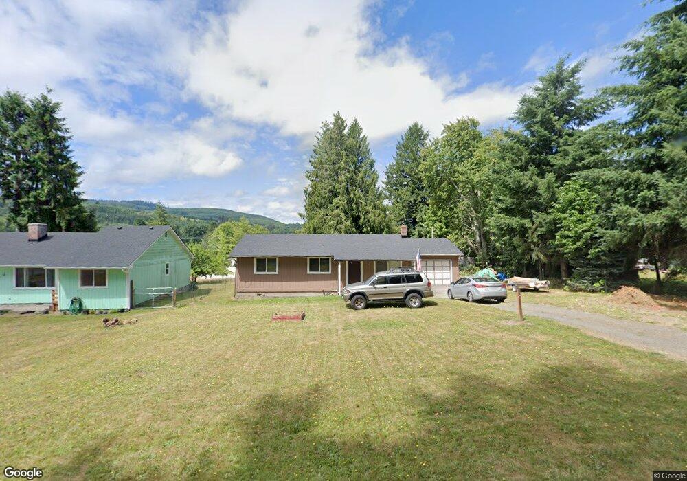
About This Home
This home is located at 923 E St, Vader, WA 98593 and is currently estimated at $304,364, approximately $292 per square foot. 923 E St is a home located in Lewis County with nearby schools including Castle Rock Elementary School, Castle Rock Middle School, and Castle Rock High School.
Ownership History
Date
Name
Owned For
Owner Type
Purchase Details
Closed on
Apr 13, 2023
Sold by
Sanford Christina
Bought by
Crooks Matthew Raymond
Current Estimated Value
Home Financials for this Owner
Home Financials are based on the most recent Mortgage that was taken out on this home.
Original Mortgage
$284,000
Outstanding Balance
$274,998
Interest Rate
6.65%
Mortgage Type
VA
Estimated Equity
$29,366
Create a Home Valuation Report for This Property
The Home Valuation Report is an in-depth analysis detailing your home's value as well as a comparison with similar homes in the area
Purchase History
| Date | Buyer | Sale Price | Title Company |
|---|---|---|---|
| Crooks Matthew Raymond | -- | None Listed On Document |
Source: Public Records
Mortgage History
| Date | Status | Borrower | Loan Amount |
|---|---|---|---|
| Open | Crooks Matthew Raymond | $284,000 |
Source: Public Records
Tax History
| Year | Tax Paid | Tax Assessment Tax Assessment Total Assessment is a certain percentage of the fair market value that is determined by local assessors to be the total taxable value of land and additions on the property. | Land | Improvement |
|---|---|---|---|---|
| 2025 | $1,843 | $242,200 | $56,900 | $185,300 |
| 2024 | $1,843 | $236,000 | $50,700 | $185,300 |
| 2023 | $1,609 | $226,700 | $41,400 | $185,300 |
| 2022 | $1,555 | $187,600 | $32,600 | $155,000 |
| 2021 | $1,421 | $187,600 | $32,600 | $155,000 |
| 2020 | $1,121 | $156,500 | $28,500 | $128,000 |
| 2019 | $1,042 | $119,000 | $15,200 | $103,800 |
| 2018 | $1,038 | $108,900 | $13,800 | $95,100 |
| 2017 | $964 | $95,900 | $13,800 | $82,100 |
Source: Public Records
Map
Nearby Homes
- 1017 C St
- 1110 D St
- 606 G St
- 817 B St
- 0 Park Place Unit NWM2479713
- 0 Park Place
- 106 Olequa Place
- 111 Spring Ct
- 516 D St
- 177 Olequa Dr
- 324 6th St
- 0 Olequa Ct Unit NWM2204809
- 105 Enchanted Valley Dr N
- 416 Main St
- 220 Tara Ln
- 115 Maschke Rd
- 1397 State Route 506
- 180 Trinity Dr
- 148 Rupp Rd
- 0 Smokey Valley Rd Unit NWM2494894
Your Personal Tour Guide
Ask me questions while you tour the home.