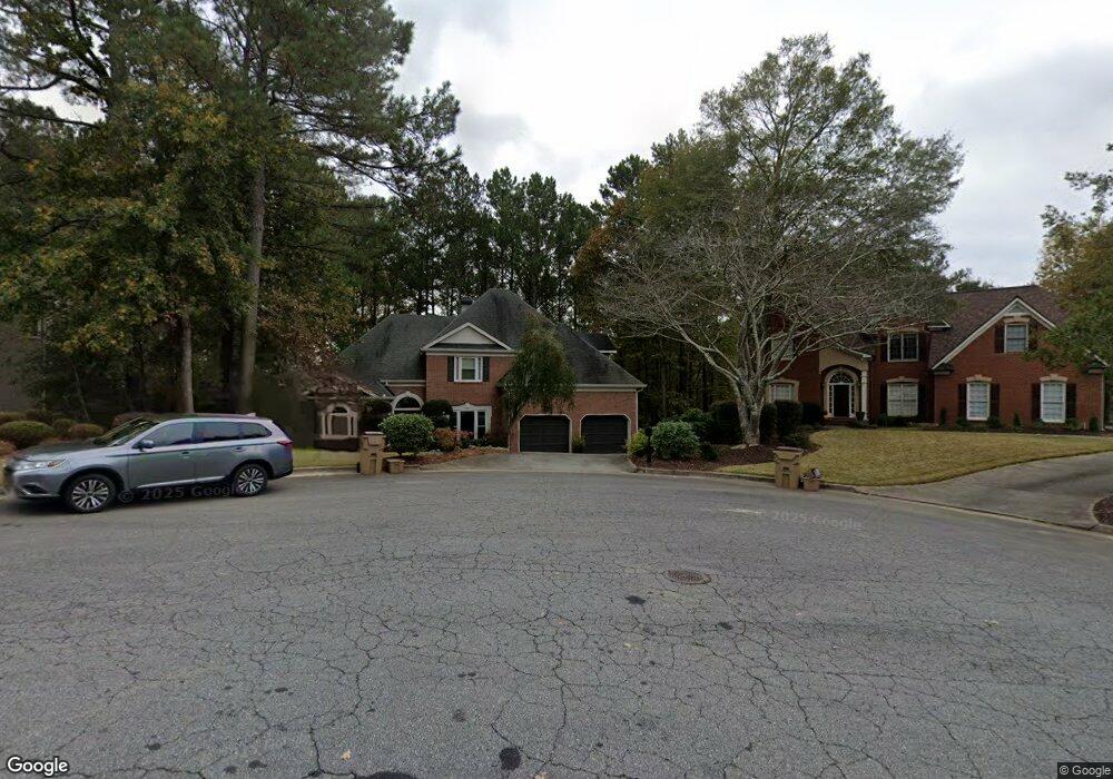
923 Laurel Crest Dr Woodstock, GA 30189
Oak Grove NeighborhoodEstimated Value: $576,718 - $591,000
4
Beds
3
Baths
2,886
Sq Ft
$202/Sq Ft
Est. Value
About This Home
This home is located at 923 Laurel Crest Dr, Woodstock, GA 30189 and is currently estimated at $583,859, approximately $202 per square foot. 923 Laurel Crest Dr is a home located in Cherokee County with nearby schools including Bascomb Elementary School, E. T. Booth Middle School, and Etowah High School.
Ownership History
Date
Name
Owned For
Owner Type
Purchase Details
Closed on
Jul 29, 2010
Sold by
Thompson Rob L and Thompson Karen S
Bought by
Helgerson Margaret A and Barrows Paul
Current Estimated Value
Home Financials for this Owner
Home Financials are based on the most recent Mortgage that was taken out on this home.
Original Mortgage
$259,011
Outstanding Balance
$169,539
Interest Rate
4.5%
Mortgage Type
FHA
Estimated Equity
$414,320
Purchase Details
Closed on
Jun 26, 2003
Sold by
Kullmann Thomas F and Kullmann Polly D
Bought by
Thompson Rob L and Thompson Karen
Home Financials for this Owner
Home Financials are based on the most recent Mortgage that was taken out on this home.
Original Mortgage
$225,600
Interest Rate
5.43%
Mortgage Type
New Conventional
Create a Home Valuation Report for This Property
The Home Valuation Report is an in-depth analysis detailing your home's value as well as a comparison with similar homes in the area
Home Values in the Area
Average Home Value in this Area
Purchase History
| Date | Buyer | Sale Price | Title Company |
|---|---|---|---|
| Helgerson Margaret A | $262,500 | -- | |
| Thompson Rob L | $282,000 | -- |
Source: Public Records
Mortgage History
| Date | Status | Borrower | Loan Amount |
|---|---|---|---|
| Open | Helgerson Margaret A | $259,011 | |
| Previous Owner | Thompson Rob L | $225,600 |
Source: Public Records
Tax History Compared to Growth
Tax History
| Year | Tax Paid | Tax Assessment Tax Assessment Total Assessment is a certain percentage of the fair market value that is determined by local assessors to be the total taxable value of land and additions on the property. | Land | Improvement |
|---|---|---|---|---|
| 2025 | $1,176 | $226,412 | $47,200 | $179,212 |
| 2024 | $1,366 | $213,128 | $47,200 | $165,928 |
| 2023 | $1,020 | $211,524 | $47,200 | $164,324 |
| 2022 | $1,040 | $166,520 | $29,960 | $136,560 |
| 2021 | $1,050 | $146,076 | $29,960 | $116,116 |
| 2020 | $1,019 | $136,712 | $28,000 | $108,712 |
| 2019 | $995 | $130,320 | $28,000 | $102,320 |
| 2018 | $996 | $125,960 | $28,000 | $97,960 |
| 2017 | $1,027 | $319,000 | $28,000 | $99,600 |
| 2016 | $1,022 | $295,400 | $24,000 | $94,160 |
| 2015 | $1,014 | $271,700 | $24,000 | $84,680 |
| 2014 | $2,937 | $255,000 | $24,000 | $78,000 |
Source: Public Records
Map
Nearby Homes
- 703 Overlook Point
- 1052 Longwood Dr
- 1017 Fairway Valley Dr
- 1704 Amberwood Pointe
- 1512 Maplewood Ct
- 523 Sycamore Point
- 525 Sycamore Point
- 409 Misty Ridge Way
- 701 Whisper Wind Ct
- 1722 Indian Ridge Dr
- 608 Wedgewood Dr
- 1514 Mosswood Ln
- 258 Strawberry Ln
- 250 Strawberry Ln
- 242 Strawberry Ln
- 3607 Broken Arrow Dr Unit I
- 925 Laurel Crest Dr
- 1304 Amberwood Dr
- 0 Laurel Crest Dr Unit 7448284
- 0 Laurel Crest Dr Unit 7058835
- 0 Laurel Crest Dr Unit 8860724
- 0 Laurel Crest Dr Unit 8782975
- 0 Laurel Crest Dr Unit 8581016
- 0 Laurel Crest Dr Unit 7267021
- 0 Laurel Crest Dr
- 919 Laurel Crest Dr
- 1306 Amberwood Dr
- 1302 Amberwood Dr
- 1302 Amberwood Dr
- 924 Laurel Crest Dr
- 1308 Amberwood Dr Unit 1
- 1308 Amberwood Dr Unit 103
- 0 Amberwood Dr Unit 8990402
- 0 Amberwood Dr Unit 7321049
- 0 Amberwood Dr Unit 7452909
- 0 Amberwood Dr Unit 7455709