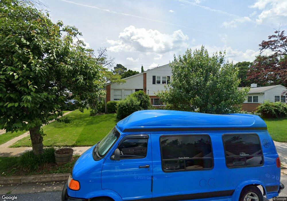
923 Marksworth Rd Catonsville, MD 21228
Estimated Value: $292,464 - $403,000
--
Bed
2
Baths
1,853
Sq Ft
$188/Sq Ft
Est. Value
About This Home
This home is located at 923 Marksworth Rd, Catonsville, MD 21228 and is currently estimated at $347,866, approximately $187 per square foot. 923 Marksworth Rd is a home located in Baltimore County with nearby schools including Johnnycake Elementary School, Southwest Academy, and Woodlawn High School.
Ownership History
Date
Name
Owned For
Owner Type
Purchase Details
Closed on
Mar 3, 2017
Sold by
Johnson Robert M and Johnson Olga
Bought by
Johnson Robert M
Current Estimated Value
Purchase Details
Closed on
Aug 23, 2013
Sold by
Everbank
Bought by
Johnson Robert M and Johnson Olga
Purchase Details
Closed on
Jun 5, 1992
Sold by
Warner Douglas R 3Rd
Bought by
Johnson Robert M and Johnson Olga
Create a Home Valuation Report for This Property
The Home Valuation Report is an in-depth analysis detailing your home's value as well as a comparison with similar homes in the area
Home Values in the Area
Average Home Value in this Area
Purchase History
| Date | Buyer | Sale Price | Title Company |
|---|---|---|---|
| Johnson Robert M | -- | None Available | |
| Johnson Robert M | -- | None Available | |
| Johnson Robert M | $2,000 | None Available | |
| Johnson Robert M | $112,000 | -- |
Source: Public Records
Tax History Compared to Growth
Tax History
| Year | Tax Paid | Tax Assessment Tax Assessment Total Assessment is a certain percentage of the fair market value that is determined by local assessors to be the total taxable value of land and additions on the property. | Land | Improvement |
|---|---|---|---|---|
| 2025 | $3,424 | $261,033 | -- | -- |
| 2024 | $3,424 | $240,700 | $76,900 | $163,800 |
| 2023 | $1,666 | $231,133 | $0 | $0 |
| 2022 | $3,142 | $221,567 | $0 | $0 |
| 2021 | $2,959 | $212,000 | $76,900 | $135,100 |
| 2020 | $2,959 | $211,400 | $0 | $0 |
| 2019 | $2,969 | $210,800 | $0 | $0 |
| 2018 | $2,882 | $210,200 | $63,400 | $146,800 |
| 2017 | $2,666 | $195,400 | $0 | $0 |
| 2016 | $2,225 | $180,600 | $0 | $0 |
| 2015 | $2,225 | $165,800 | $0 | $0 |
| 2014 | $2,225 | $165,800 | $0 | $0 |
Source: Public Records
Map
Nearby Homes
- 1007 Marksworth Rd
- 1007 Kent Ave
- 6028 Moorehead Rd
- 930 Sedgley Rd
- 920 Vanderwood Rd
- 908 Vanderwood Rd
- 6001 Johnnycake Rd
- 6011 Johnnycake Rd
- 1009 Rowe Ln
- 1068 Craftswood Rd
- 1109 Marksworth Rd
- 1113 Kent Ave
- 1124 Brigadoon Trail
- 800 Crosby Rd
- 67 Walden Mill Way
- 3 Mcgrady Square
- 6031 Burnt Oak Rd
- 1124 Dorchester Ave
- 5911 Carroll St
- 5932 Saint Marys St
- 925 Marksworth Rd
- 921 Marksworth Rd
- 924 Kent Ave
- 922 Kent Ave
- 927 Marksworth Rd
- 926 Kent Ave
- 920 Kent Ave
- 912 Marksworth Rd
- 910 Marksworth Rd
- 914 Marksworth Rd
- 928 Kent Ave
- 917 Marksworth Rd
- 918 Kent Ave
- 908 Marksworth Rd
- 916 Kent Ave
- 906 Marksworth Rd
- 6034 Craigmont Rd
- 915 Marksworth Rd
- 925 Kent Ave
- 927 Kent Ave