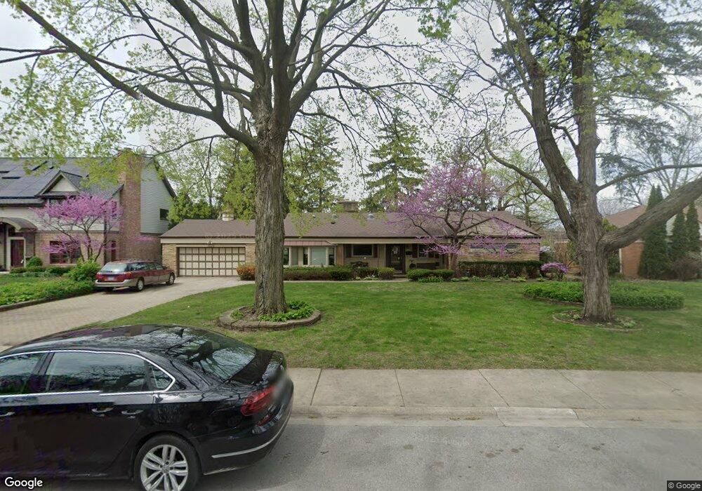
9230 Central Park Ave Evanston, IL 60203
North Skokie NeighborhoodEstimated Value: $531,000 - $724,000
4
Beds
3
Baths
1,595
Sq Ft
$410/Sq Ft
Est. Value
About This Home
This home is located at 9230 Central Park Ave, Evanston, IL 60203 and is currently estimated at $653,934, approximately $409 per square foot. 9230 Central Park Ave is a home located in Cook County with nearby schools including Walker Elementary School, Chute Middle School, and Evanston Township High School.
Ownership History
Date
Name
Owned For
Owner Type
Purchase Details
Closed on
Feb 10, 2023
Sold by
Saxonberg Elisabeth
Bought by
Eusabeth Saxonberg Living Trust
Current Estimated Value
Purchase Details
Closed on
Feb 4, 2011
Sold by
Revocabl Saxonberg Elisabeth S
Bought by
Saxonberg Elisabeth S
Purchase Details
Closed on
Feb 7, 1994
Sold by
Saxonberg Elizabeth S
Bought by
Saxonberg Elizabeth S
Create a Home Valuation Report for This Property
The Home Valuation Report is an in-depth analysis detailing your home's value as well as a comparison with similar homes in the area
Home Values in the Area
Average Home Value in this Area
Purchase History
| Date | Buyer | Sale Price | Title Company |
|---|---|---|---|
| Eusabeth Saxonberg Living Trust | -- | None Listed On Document | |
| Saxonberg Elisabeth S | -- | None Available | |
| Saxonberg Elisabeth S | -- | None Available | |
| Saxonberg Elizabeth S | -- | -- |
Source: Public Records
Tax History Compared to Growth
Tax History
| Year | Tax Paid | Tax Assessment Tax Assessment Total Assessment is a certain percentage of the fair market value that is determined by local assessors to be the total taxable value of land and additions on the property. | Land | Improvement |
|---|---|---|---|---|
| 2024 | $11,901 | $56,000 | $22,825 | $33,175 |
| 2023 | $11,381 | $56,000 | $22,825 | $33,175 |
| 2022 | $11,381 | $56,000 | $22,825 | $33,175 |
| 2021 | $7,400 | $48,224 | $13,695 | $34,529 |
| 2020 | $6,785 | $48,224 | $13,695 | $34,529 |
| 2019 | $6,734 | $52,994 | $13,695 | $39,299 |
| 2018 | $7,918 | $47,341 | $11,738 | $35,603 |
| 2017 | $7,602 | $47,341 | $11,738 | $35,603 |
| 2016 | $8,152 | $47,341 | $11,738 | $35,603 |
| 2015 | $9,048 | $39,465 | $10,108 | $29,357 |
| 2014 | $8,762 | $39,465 | $10,108 | $29,357 |
| 2013 | $9,052 | $39,465 | $10,108 | $29,357 |
Source: Public Records
Map
Nearby Homes
- 3500 Church St Unit 204
- 9101 Sleeping Bear Rd
- 8950 Ewing Ave
- 2113 Forestview Rd
- 8822 Central Park Ave
- 1633 Mcdaniel Ave
- 2022 Mcdaniel Ave
- 8822 Forestview Rd
- 2221 Lincolnwood Dr
- 2440 Simpson St
- 2633 Crawford Ave
- 8728 Trumbull Ave
- 1808 Laurel Ave
- 8713 Drake Ave
- 9628 Keystone Ave
- 3639 Crain St
- 1311 Mcdaniel Ave Unit C
- 3358 Dempster St
- 2422 Grant St
- 2101 Pioneer Rd
- 9224 Central Park Ave
- 9236 Central Park Ave
- 9236 Central Park Ave
- 9236 Central Park Ave
- 9252 Central Park Ave
- 9216 Central Park Ave
- 9216 Central Park Ave
- 9235 Central Park Ave
- 9239 Central Park Ave
- 9243 Central Park Ave
- 3601 Lyons St
- 9249 Central Park Ave
- 9215 Central Park Ave
- 9200 Central Park Ave
- 3608 Church St
- 3614 Church St
- 3555 Lyons St
- 3618 Church St
- 9209 Central Park Ave