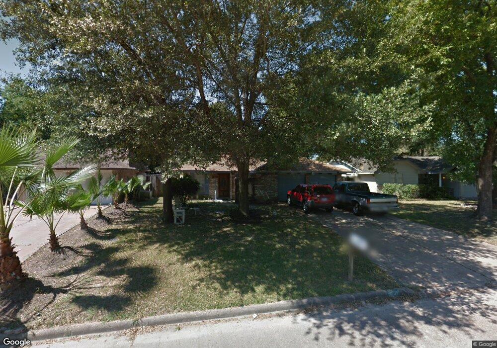
9231 Vanwood St Houston, TX 77040
Greater Inwood NeighborhoodEstimated Value: $172,000 - $204,000
3
Beds
2
Baths
976
Sq Ft
$195/Sq Ft
Est. Value
About This Home
This home is located at 9231 Vanwood St, Houston, TX 77040 and is currently estimated at $189,927, approximately $194 per square foot. 9231 Vanwood St is a home located in Harris County with nearby schools including Edward a Vines EC/Pre-K/K School, Ermel Elementary School, and Dr. Viola K. Garcia Middle School.
Ownership History
Date
Name
Owned For
Owner Type
Purchase Details
Closed on
Feb 28, 2001
Sold by
Diaz Roland C and Diaz Delia
Bought by
Saenz Ismael and Esparza Erika A
Current Estimated Value
Home Financials for this Owner
Home Financials are based on the most recent Mortgage that was taken out on this home.
Original Mortgage
$60,750
Outstanding Balance
$22,038
Interest Rate
6.97%
Estimated Equity
$167,889
Create a Home Valuation Report for This Property
The Home Valuation Report is an in-depth analysis detailing your home's value as well as a comparison with similar homes in the area
Home Values in the Area
Average Home Value in this Area
Purchase History
| Date | Buyer | Sale Price | Title Company |
|---|---|---|---|
| Saenz Ismael | -- | American Title Co |
Source: Public Records
Mortgage History
| Date | Status | Borrower | Loan Amount |
|---|---|---|---|
| Open | Saenz Ismael | $60,750 |
Source: Public Records
Tax History Compared to Growth
Tax History
| Year | Tax Paid | Tax Assessment Tax Assessment Total Assessment is a certain percentage of the fair market value that is determined by local assessors to be the total taxable value of land and additions on the property. | Land | Improvement |
|---|---|---|---|---|
| 2025 | $2,190 | $173,348 | $36,898 | $136,450 |
| 2024 | $2,190 | $169,076 | $35,141 | $133,935 |
| 2023 | $2,190 | $165,148 | $35,141 | $130,007 |
| 2022 | $3,140 | $137,797 | $29,870 | $107,927 |
| 2021 | $2,990 | $119,017 | $29,870 | $89,147 |
| 2020 | $2,929 | $111,298 | $14,642 | $96,656 |
| 2019 | $2,791 | $103,306 | $14,642 | $88,664 |
| 2018 | $958 | $94,741 | $14,642 | $80,099 |
| 2017 | $2,212 | $94,741 | $14,642 | $80,099 |
| 2016 | $2,011 | $84,586 | $14,642 | $69,944 |
| 2015 | $1,310 | $80,132 | $14,642 | $65,490 |
| 2014 | $1,310 | $68,739 | $14,642 | $54,097 |
Source: Public Records
Map
Nearby Homes
- 9331 Deanwood St
- 9350 Guywood St
- 7318 Shady Grove Ln
- 7718 Breezeway St
- 7259 Shady Arbor Ln
- 9523 Vanwood St
- 9207 Loren Ln
- 7218 Stonegate Dr
- 7731 Deadwood Dr
- 7706 Deadwood Dr
- 7051 Majestic Oaks Dr
- 9214 Woodland Oaks Dr
- 8615 Black Tern Ln
- 6902 Anson Point Ln
- 8610 Twillingate Ln
- 7606 Battlepine Dr
- 8007 E Oakwood Ct
- 7911 Battleoak Dr
- 8020 Oakwood Forest Dr
- 6407 Deirdre Anne Dr
- 9302 Deanwood St
- 7419 Mosewood St
- 9307 Vanwood St
- 7410 Breezeway St
- 9306 Deanwood St
- 7414 Breezeway St
- 9226 Vanwood St
- 9311 Vanwood St
- 9306 Vanwood St
- 7418 Breezeway St
- 9310 Deanwood St
- 7423 Mosewood St
- 9222 Vanwood St
- 9310 Vanwood St
- 9218 Vanwood St
- 7422 Breezeway St
- 9315 Vanwood St
- 9314 Deanwood St
- 7427 Mosewood St
- 9314 Vanwood St