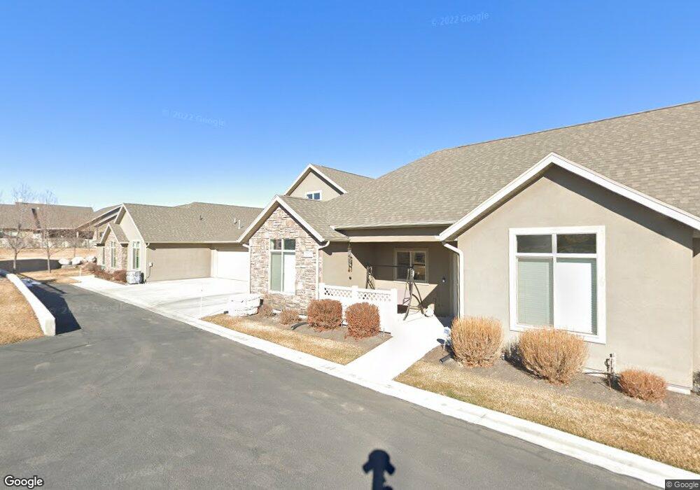
9232 S 1870 W Unit D West Jordan, UT 84088
Estimated Value: $591,887 - $644,000
2
Beds
3
Baths
2,372
Sq Ft
$255/Sq Ft
Est. Value
About This Home
This home is located at 9232 S 1870 W Unit D, West Jordan, UT 84088 and is currently estimated at $604,972, approximately $255 per square foot. 9232 S 1870 W Unit D is a home located in Salt Lake County with nearby schools including Westvale Elementary School, West Jordan Middle School, and West Jordan High School.
Ownership History
Date
Name
Owned For
Owner Type
Purchase Details
Closed on
Sep 19, 2016
Sold by
Redford Connie R
Bought by
Redford Connie P and The Connie P Redford Trust
Current Estimated Value
Purchase Details
Closed on
Sep 16, 2016
Sold by
King Janice Whitlock
Bought by
Redford Connie P
Purchase Details
Closed on
Jan 23, 2015
Sold by
King Janice W and Creason Angela Kaye Hobbs
Bought by
King Janice Whitlock and Janice Whitlock King Family Trust
Purchase Details
Closed on
Nov 3, 2014
Sold by
King Janice W
Bought by
King Janice W and Hobbs Creason Angela Kay
Create a Home Valuation Report for This Property
The Home Valuation Report is an in-depth analysis detailing your home's value as well as a comparison with similar homes in the area
Home Values in the Area
Average Home Value in this Area
Purchase History
| Date | Buyer | Sale Price | Title Company |
|---|---|---|---|
| Redford Connie P | -- | Accommodation | |
| Redford Connie P | -- | Metro National Title | |
| King Janice Whitlock | -- | None Available | |
| King Janice W | -- | Accommodation | |
| King Janice W | -- | Metro National Title |
Source: Public Records
Tax History Compared to Growth
Tax History
| Year | Tax Paid | Tax Assessment Tax Assessment Total Assessment is a certain percentage of the fair market value that is determined by local assessors to be the total taxable value of land and additions on the property. | Land | Improvement |
|---|---|---|---|---|
| 2025 | $3,177 | $641,000 | $135,100 | $505,900 |
| 2024 | $3,177 | $611,200 | $128,700 | $482,500 |
| 2023 | $2,957 | $536,100 | $119,200 | $416,900 |
| 2022 | $3,150 | $561,900 | $116,800 | $445,100 |
| 2021 | $2,793 | $453,600 | $93,500 | $360,100 |
| 2020 | $2,921 | $445,200 | $93,500 | $351,700 |
| 2019 | $2,924 | $437,000 | $93,500 | $343,500 |
| 2018 | $2,837 | $420,500 | $91,000 | $329,500 |
| 2017 | $2,671 | $394,200 | $91,000 | $303,200 |
| 2016 | $2,073 | $309,100 | $91,000 | $218,100 |
| 2015 | $2,073 | $280,200 | $121,300 | $158,900 |
| 2014 | $1,183 | $86,600 | $86,600 | $0 |
Source: Public Records
Map
Nearby Homes
- 1968 W 9270 S Unit C
- 9252 S 2040 W Unit D
- 2116 W Abbey View Rd
- 9414 S 1980 W
- 2097 Jordan Villa Dr
- 1753 Rylie Ann Cir
- 2177 W 9240 S
- 9496 S 1930 W
- 2223 W Williamsburg Cir
- 9511 S Tirado Cove Unit 204
- Brook Haven Plan at Jordan Woods
- Maple Plan at Jordan Woods
- The Maple Basement Plan at Jordan Woods
- The Evergreen Basement Plan at Jordan Woods
- 9503 S Tirado Cove Unit 203
- 1719 W Brocious Way Unit 301
- 1673 Peaceful Cir
- 2286 Williamsburg Cir
- 2041 W 8820 S
- 8859 S Long Dr
- 9232 S 1870 W Unit A
- 9223 S 1870 W Unit D
- 9223 S 1870 W Unit A
- 9216 S 1870 W Unit C
- 9241 S 1870 W Unit B
- 9237 S Covered Wagon Cir Unit A
- 9237 S Covered Wagon Cir Unit B
- 9237 S Covered Wagon Cir Unit B
- 9188 S 1870 W Unit B
- 9188 S 1870 W Unit C
- 9203 S 1870 W Unit B
- 1926 W 9270 S Unit B
- 1926 W 9270 S Unit A
- 1926 W 9270 S Unit B
- 9217 S Covered Wagon Cir Unit D
- 1897 W 9270 S Unit D
- 1897 W 9270 S Unit A
- 1897 W 9270 S Unit B
- 1851 W 9170 S Unit A
- 1851 W 9170 S Unit D