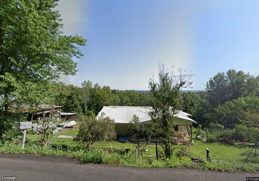
9232 State Highway 176 Walnut Shade, MO 65771
Estimated Value: $307,804 - $485,000
Studio
--
Bath
1,577
Sq Ft
$237/Sq Ft
Est. Value
About This Home
This home is located at 9232 State Highway 176, Walnut Shade, MO 65771 and is currently estimated at $373,201, approximately $236 per square foot. 9232 State Highway 176 is a home located in Taney County with nearby schools including Buchanan Intermediate School, Buchanan Elementary School, and Branson Junior High School.
Ownership History
Date
Name
Owned For
Owner Type
Purchase Details
Closed on
Aug 26, 2025
Sold by
Clutts Jimmie G and Ballew-Clutts Shirley
Bought by
Jeremy William Mcqueen and Jeremy Kathryn Nichole
Current Estimated Value
Purchase Details
Closed on
Sep 5, 2019
Sold by
Mcqueen Jeremy W and Mcqueen Kathryn N
Bought by
Mcqueen Jeremy William and Mcqueen Kathryn Nichole
Purchase Details
Closed on
Aug 22, 2011
Sold by
Secretary Of Hud
Bought by
Mcqueen Jeremy W and Mcqueen Kathryn N
Home Financials for this Owner
Home Financials are based on the most recent Mortgage that was taken out on this home.
Original Mortgage
$115,129
Interest Rate
4.53%
Mortgage Type
New Conventional
Purchase Details
Closed on
Aug 27, 2010
Sold by
King Chance
Bought by
Citimortgage Inc
Create a Home Valuation Report for This Property
The Home Valuation Report is an in-depth analysis detailing your home's value as well as a comparison with similar homes in the area
Purchase History
| Date | Buyer | Sale Price | Title Company |
|---|---|---|---|
| Jeremy William Mcqueen | -- | None Listed On Document | |
| Mcqueen Jeremy William | -- | Fadden Land & Title | |
| Mcqueen Jeremy W | -- | -- | |
| Citimortgage Inc | -- | None Available |
Source: Public Records
Mortgage History
| Date | Status | Borrower | Loan Amount |
|---|---|---|---|
| Previous Owner | Mcqueen Jeremy W | $115,129 |
Source: Public Records
Tax History
| Year | Tax Paid | Tax Assessment Tax Assessment Total Assessment is a certain percentage of the fair market value that is determined by local assessors to be the total taxable value of land and additions on the property. | Land | Improvement |
|---|---|---|---|---|
| 2025 | $1,679 | $29,100 | -- | -- |
| 2023 | $1,679 | $32,370 | $0 | $0 |
| 2022 | $1,632 | $32,370 | $0 | $0 |
| 2021 | $1,624 | $32,370 | $0 | $0 |
| 2019 | $1,469 | $28,560 | $0 | $0 |
| 2018 | $1,472 | $28,560 | $0 | $0 |
| 2017 | $1,457 | $28,560 | $0 | $0 |
| 2016 | $1,455 | $28,560 | $0 | $0 |
| 2015 | $1,442 | $28,560 | $0 | $0 |
| 2014 | $1,394 | $28,860 | $0 | $0 |
Source: Public Records
Map
Nearby Homes
- 500 Briggs Rd
- 000 US Highway 160
- 6041 Highway 65
- 000 Wolf
- 7565 State Highway 176
- 2163 Round Mountain Rd
- 300 Ridgecrest Dr
- 149 Appaloosa Trail
- 145 Appaloosa Trail
- 6659 State Highway 176
- 53 Mustang Draw Unit 3.45+/- Acres!
- 768 Seven Pines Dr
- Lot 14 Appaloosa Trail
- Tbd Hwy 160
- 7764 U S 160
- Lot 34a Trail
- 109 Appaloosa Trail
- 56 Ranch Rd
- 270 Craig Rd
- Lot 2 Arabian Way
- 9232 State Highway 176
- 9244 State Highway 176
- 9110 State Highway 176
- 153 Goodnight Hollow Rd
- 275 Goodnight Hollow Rd
- 0 Goodnight Hollow Unit 30320256
- 0 Goodnight Hollow Unit 30320251
- 0 Goodnight Hollow Unit 30320255
- 0 Goodnight Hollow Unit 30321510
- 0 Goodnight Hollow Unit 10816395
- 0 Goodnight Hollow Unit 30323193
- 0 Goodnight Hollow Unit 30324592
- 0 Goodnight Hollow Unit 30326516
- 0 Goodnight Hollow Unit 10816486
- 0 Goodnight Hollow Unit 30331043
- 0 Goodnight Hollow Unit 30336918
- 0 Goodnight Hollow Unit 30338838
- 0 Goodnight Hollow Unit 30344749
- 0 Goodnight Hollow Unit 11208293
- 0 Goodnight Hollow Unit 11208292
Your Personal Tour Guide
Ask me questions while you tour the home.