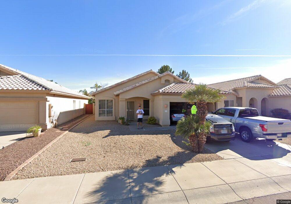
9233 E Pershing Ave Scottsdale, AZ 85260
Horizons NeighborhoodEstimated Value: $618,932 - $778,000
--
Bed
3
Baths
1,720
Sq Ft
$408/Sq Ft
Est. Value
About This Home
This home is located at 9233 E Pershing Ave, Scottsdale, AZ 85260 and is currently estimated at $701,983, approximately $408 per square foot. 9233 E Pershing Ave is a home located in Maricopa County with nearby schools including Redfield Elementary School, Desert Canyon Middle School, and Desert Mountain High School.
Ownership History
Date
Name
Owned For
Owner Type
Purchase Details
Closed on
Sep 2, 2021
Sold by
Prior William L
Bought by
Prior 1998 Trust
Current Estimated Value
Purchase Details
Closed on
Mar 27, 2019
Sold by
Prior William Lane and Prior Barbara J
Bought by
Prior 1998 Trust
Purchase Details
Closed on
Jul 9, 1998
Sold by
Swiateck Theodore M and Swiateck Phyllis D
Bought by
Prior William Lane and Prior Barbara Jean
Home Financials for this Owner
Home Financials are based on the most recent Mortgage that was taken out on this home.
Original Mortgage
$81,900
Interest Rate
7.01%
Mortgage Type
New Conventional
Create a Home Valuation Report for This Property
The Home Valuation Report is an in-depth analysis detailing your home's value as well as a comparison with similar homes in the area
Home Values in the Area
Average Home Value in this Area
Purchase History
| Date | Buyer | Sale Price | Title Company |
|---|---|---|---|
| Prior 1998 Trust | -- | -- | |
| Prior 1998 Trust | -- | None Available | |
| Prior William Lane | $179,900 | First American Title |
Source: Public Records
Mortgage History
| Date | Status | Borrower | Loan Amount |
|---|---|---|---|
| Previous Owner | Prior William Lane | $81,900 |
Source: Public Records
Tax History Compared to Growth
Tax History
| Year | Tax Paid | Tax Assessment Tax Assessment Total Assessment is a certain percentage of the fair market value that is determined by local assessors to be the total taxable value of land and additions on the property. | Land | Improvement |
|---|---|---|---|---|
| 2025 | $2,272 | $39,659 | -- | -- |
| 2024 | $2,222 | $37,771 | -- | -- |
| 2023 | $2,222 | $50,320 | $10,060 | $40,260 |
| 2022 | $2,114 | $39,360 | $7,870 | $31,490 |
| 2021 | $2,292 | $35,900 | $7,180 | $28,720 |
| 2020 | $2,272 | $33,900 | $6,780 | $27,120 |
| 2019 | $2,203 | $32,300 | $6,460 | $25,840 |
| 2018 | $2,155 | $30,820 | $6,160 | $24,660 |
| 2017 | $2,033 | $30,580 | $6,110 | $24,470 |
| 2016 | $1,981 | $29,210 | $5,840 | $23,370 |
| 2015 | $1,915 | $27,670 | $5,530 | $22,140 |
Source: Public Records
Map
Nearby Homes
- 13285 N 91st Place
- 9125 E Captain Dreyfus Ave
- 9382 E Aster Dr
- 9075 E Sahuaro Dr
- 9085 E Windrose Dr
- 9341 E Corrine Dr
- 8966 E Captain Dreyfus Ave
- 14346 E Davenport Dr Unit 7
- 14312 E Davenport Dr Unit 6
- 14303 E Davenport Dr Unit 5
- 14325 E Davenport Dr Unit 4
- 13211 N 95th Way
- 14000 N 94th St Unit 1133
- 14000 N 94th St Unit 1085
- 14000 N 94th St Unit 2140
- 14000 N 94th St Unit 1117
- 14000 N 94th St Unit 1129
- 14000 N 94th St Unit 3198
- 12469 N 93rd Way
- 13626 N 89th St
- 9241 E Pershing Ave
- 9225 E Pershing Ave
- 9217 E Pershing Ave
- 9249 E Pershing Ave
- 9238 E Wood Dr
- 9246 E Wood Dr
- 9254 E Wood Dr
- 9257 E Pershing Ave
- 9209 E Pershing Ave
- 9234 E Pershing Ave
- 9222 E Wood Dr
- 9242 E Pershing Ave
- 9226 E Pershing Ave
- 9262 E Wood Dr
- 9250 E Pershing Ave
- 9218 E Pershing Ave
- 9265 E Pershing Ave
- 9201 E Pershing Ave
- 9214 E Wood Dr
- 9258 E Pershing Ave