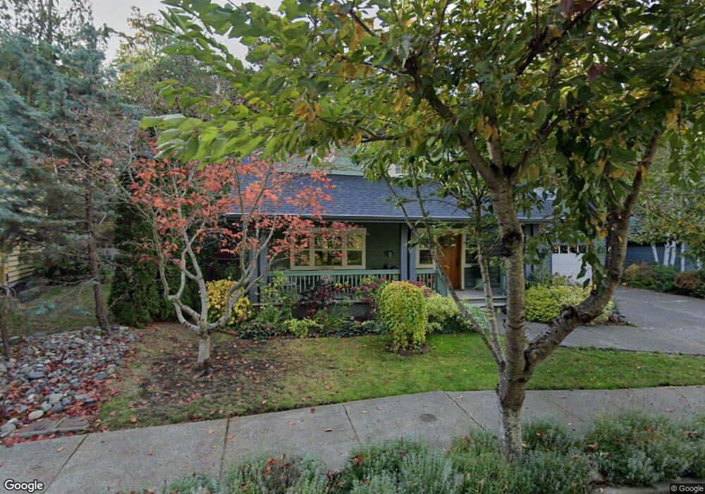
9235 Northtown Dr Bainbridge Island, WA 98110
Estimated Value: $1,094,000 - $1,247,000
3
Beds
3
Baths
2,160
Sq Ft
$542/Sq Ft
Est. Value
About This Home
This home is located at 9235 Northtown Dr, Bainbridge Island, WA 98110 and is currently estimated at $1,170,227, approximately $541 per square foot. 9235 Northtown Dr is a home located in Kitsap County with nearby schools including Bainbridge High School, St. Cecilia Catholic School, and Voyager Montessori.
Ownership History
Date
Name
Owned For
Owner Type
Purchase Details
Closed on
Oct 19, 2015
Sold by
Singer Pamela L
Bought by
Merrifield Judith B
Current Estimated Value
Purchase Details
Closed on
Mar 3, 2003
Sold by
Grice Corp
Bought by
Singer Pamela L
Home Financials for this Owner
Home Financials are based on the most recent Mortgage that was taken out on this home.
Original Mortgage
$332,900
Interest Rate
4.87%
Mortgage Type
Unknown
Purchase Details
Closed on
Jul 30, 2001
Sold by
Madison Avenue Development
Bought by
Grice Corp
Create a Home Valuation Report for This Property
The Home Valuation Report is an in-depth analysis detailing your home's value as well as a comparison with similar homes in the area
Home Values in the Area
Average Home Value in this Area
Purchase History
| Date | Buyer | Sale Price | Title Company |
|---|---|---|---|
| Merrifield Judith B | $669,000 | Pacific Nw Title | |
| Singer Pamela L | $369,900 | Transnation Title Insurance | |
| Grice Corp | $97,900 | Land Title Company |
Source: Public Records
Mortgage History
| Date | Status | Borrower | Loan Amount |
|---|---|---|---|
| Previous Owner | Singer Pamela L | $332,900 |
Source: Public Records
Tax History Compared to Growth
Tax History
| Year | Tax Paid | Tax Assessment Tax Assessment Total Assessment is a certain percentage of the fair market value that is determined by local assessors to be the total taxable value of land and additions on the property. | Land | Improvement |
|---|---|---|---|---|
| 2026 | $7,959 | $979,260 | $197,330 | $781,930 |
| 2025 | $7,959 | $979,260 | $197,330 | $781,930 |
| 2024 | $7,607 | $979,260 | $197,330 | $781,930 |
| 2023 | $7,935 | $979,260 | $197,330 | $781,930 |
| 2022 | $6,781 | $711,060 | $126,330 | $584,730 |
| 2021 | $6,606 | $660,490 | $116,680 | $543,810 |
| 2020 | $6,695 | $660,490 | $116,680 | $543,810 |
| 2019 | $6,526 | $656,870 | $111,460 | $545,410 |
| 2018 | $6,689 | $573,470 | $92,120 | $481,350 |
| 2017 | $6,000 | $573,470 | $92,120 | $481,350 |
| 2016 | $5,260 | $476,390 | $92,120 | $384,270 |
| 2015 | $4,660 | $429,390 | $92,120 | $337,270 |
| 2014 | -- | $389,090 | $92,120 | $296,970 |
| 2013 | -- | $389,090 | $92,120 | $296,970 |
Source: Public Records
Map
Nearby Homes
- 0 NE New Brooklyn Rd Unit NWM2211912
- 0 NE Lofgren (Lot A) Rd
- 0 Bucsit Ln NE Unit NWM2416116
- 9310 Hemlock Ave NE
- 8679 NE Fox Den Ln Unit Lot B
- 9300 NE New Brooklyn Rd
- 9380 Ferncliff Ave NE
- 1250 Weaver Rd NW Unit A8
- 9482 Green Spot Place NE
- 9631 Summer Hill Ln NE
- 9788 Manitou Beach Dr NE
- 300 High School Rd NE Unit 318
- 300 High School Rd NE Unit 325
- 300 High School Rd NE Unit 419
- 1116 Grow Ave NW
- 9882 Manitou Beach Dr NE
- 8784 NE Winslow Grove Ct
- 1339 Nolta Loop NE
- 1341 Nolta Loop NE
- 1349 Nolta Loop NE
- 9273 Northtown Dr
- 9195 Northtown Dr
- 9311 Northtown Dr
- 9300 N Town Dr NE
- 9300 Northtown Dr
- 9157 Northtown Dr
- 9338 N Town Dr NE
- 9338 Northtown Dr
- 9353 N Town Dr NE
- 9353 Northtown Dr
- 9117 Northtown Dr
- 9355 NE Northtown Loop
- 9084 Northtown Dr
- 9084 N Town Dr NE
- 9079 Northtown Dr
- 9391 Northtown Dr
- 9414 Northtown Dr
- 9046 Northtown Dr
- 9371 NE Northtown Loop
- 9371 NE North Town Loop