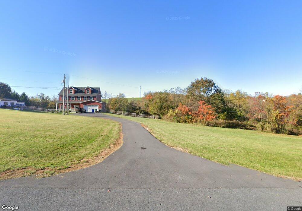
9236 Baltimore National Pike Middletown, MD 21769
Estimated Value: $578,740 - $682,000
--
Bed
1
Bath
2,146
Sq Ft
$290/Sq Ft
Est. Value
About This Home
This home is located at 9236 Baltimore National Pike, Middletown, MD 21769 and is currently estimated at $622,580, approximately $290 per square foot. 9236 Baltimore National Pike is a home located in Frederick County with nearby schools including Myersville Elementary School, Middletown Middle School, and Middletown High School.
Ownership History
Date
Name
Owned For
Owner Type
Purchase Details
Closed on
May 8, 2020
Sold by
Coreys Construction Llc
Bought by
Toole Samuel and Toole Emiri
Current Estimated Value
Home Financials for this Owner
Home Financials are based on the most recent Mortgage that was taken out on this home.
Original Mortgage
$437,500
Outstanding Balance
$387,686
Interest Rate
3.3%
Mortgage Type
VA
Estimated Equity
$234,894
Purchase Details
Closed on
Jun 17, 2010
Sold by
Ropp Grace Naomi
Bought by
Ropp Family Property Llc
Create a Home Valuation Report for This Property
The Home Valuation Report is an in-depth analysis detailing your home's value as well as a comparison with similar homes in the area
Home Values in the Area
Average Home Value in this Area
Purchase History
| Date | Buyer | Sale Price | Title Company |
|---|---|---|---|
| Toole Samuel | $437,500 | None Available | |
| Ropp Family Property Llc | -- | -- |
Source: Public Records
Mortgage History
| Date | Status | Borrower | Loan Amount |
|---|---|---|---|
| Open | Toole Samuel | $437,500 |
Source: Public Records
Tax History Compared to Growth
Tax History
| Year | Tax Paid | Tax Assessment Tax Assessment Total Assessment is a certain percentage of the fair market value that is determined by local assessors to be the total taxable value of land and additions on the property. | Land | Improvement |
|---|---|---|---|---|
| 2025 | $296 | $489,900 | -- | -- |
| 2024 | $296 | $444,900 | $0 | $0 |
| 2023 | $148 | $399,900 | $76,500 | $323,400 |
| 2022 | $4,641 | $386,867 | $0 | $0 |
| 2021 | $4,414 | $373,833 | $0 | $0 |
| 2020 | $4,338 | $360,800 | $72,500 | $288,300 |
| 2019 | $4,282 | $355,967 | $0 | $0 |
| 2018 | $4,115 | $351,133 | $0 | $0 |
| 2017 | $902 | $72,500 | $0 | $0 |
| 2016 | $1,375 | $72,500 | $0 | $0 |
| 2015 | $1,375 | $72,500 | $0 | $0 |
| 2014 | $1,375 | $72,500 | $0 | $0 |
Source: Public Records
Map
Nearby Homes
- 4202 Maryland Ct
- 8842 Hawbottom Rd
- 8541 Pete Wiles Rd
- 4402A Fishers Hollow Rd
- 55 Fox Rock Dr
- 8935 Hawbottom Rd
- 3101 Brethren Church Rd
- 8511 Rosebud Ct
- 9 Fox Rock Dr
- 33 Fox Rock Dr
- 3 Poplar St
- Lot 1 Wolfsville Rd
- Lot 2 Wolfsville Rd
- 226 Mountain Terrace
- 218 Mountain Terrace
- 2820 Milt Summers Rd
- 4509 Valley View Rd
- 421 Main St
- 4117 Crow Rock Rd
- 14 Deerwoods Ct
- 9236 Baltimore National Pike
- 9220 Baltimore National Pike
- 9223 Baltimore National Pike
- 9216 Baltimore National Pike
- 9233 Baltimore National Pike
- 9225 Baltimore National Pike
- 9215 Baltimore National Pike
- 9214 Baltimore National Pike
- 9206 Baltimore National Pike
- 9227 Baltimore National Pike
- 9210 Baltimore National Pike
- 9305 Baltimore National Pike
- 9198 Baltimore National Pike
- 9404 Harmony Rd
- 9196 Baltimore National Pike
- 9203 Baltimore National Pike
- 9232 Harmony Rd
- 9433 Harmony Rd
- 9428A Harmony Rd
- 9420 Harmony Rd