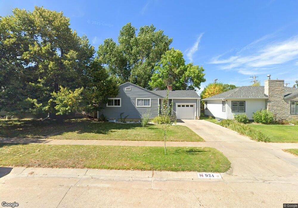
924 Colorado Ave Alliance, NE 69301
Estimated Value: $98,000 - $161,167
2
Beds
1
Bath
839
Sq Ft
$169/Sq Ft
Est. Value
About This Home
This home is located at 924 Colorado Ave, Alliance, NE 69301 and is currently estimated at $141,542, approximately $168 per square foot. 924 Colorado Ave is a home located in Box Butte County with nearby schools including Alliance High School, St. Agnes Academy, and Immanuel Evangelical Lutheran School.
Ownership History
Date
Name
Owned For
Owner Type
Purchase Details
Closed on
May 29, 2020
Sold by
Tyler Pavich
Bought by
Mayer Matthew M and Mayer Delaney R
Current Estimated Value
Purchase Details
Closed on
Jun 30, 2016
Sold by
Donald Brown and Donald Robert
Bought by
Pavich Tyler and Pavich Samantha
Purchase Details
Closed on
Feb 15, 2000
Sold by
Brown Arlene M
Bought by
Brown Robert and Brown Donald
Create a Home Valuation Report for This Property
The Home Valuation Report is an in-depth analysis detailing your home's value as well as a comparison with similar homes in the area
Home Values in the Area
Average Home Value in this Area
Purchase History
| Date | Buyer | Sale Price | Title Company |
|---|---|---|---|
| Mayer Matthew M | $143,500 | -- | |
| Pavich Tyler | $88,000 | -- | |
| Brown Robert | -- | -- |
Source: Public Records
Tax History Compared to Growth
Tax History
| Year | Tax Paid | Tax Assessment Tax Assessment Total Assessment is a certain percentage of the fair market value that is determined by local assessors to be the total taxable value of land and additions on the property. | Land | Improvement |
|---|---|---|---|---|
| 2024 | $1,768 | $141,150 | $6,480 | $134,670 |
| 2023 | $2,427 | $141,150 | $6,480 | $134,670 |
| 2022 | $1,528 | $83,925 | $6,120 | $77,805 |
| 2021 | $1,547 | $83,925 | $6,120 | $77,805 |
| 2020 | $1,543 | $83,925 | $6,120 | $77,805 |
| 2019 | $1,507 | $83,925 | $6,120 | $77,805 |
| 2018 | $1,499 | $83,925 | $6,120 | $77,805 |
| 2017 | $1,284 | $69,207 | $4,680 | $64,527 |
| 2016 | $1,270 | $69,207 | $4,680 | $64,527 |
| 2015 | -- | $65,590 | $4,680 | $60,910 |
| 2014 | -- | $65,590 | $4,680 | $60,910 |
Source: Public Records
Map
Nearby Homes
- 1021 Dakota Ave
- 819 Black Hills Ave
- 936 Platte Ave
- 911 Emerson Ave
- 907 Toluca Ave
- 1232 Emerson Ave
- 621 Emerson Ave
- 924 Big Horn Ave
- 719 Toluca Ave
- 1239 Toluca Ave
- 1232 Cheyenne Ave
- 904 Laramie Ave
- 1019 Laramie Ave
- 316 Big Horn Ave
- 420 Laramie Ave
- 672 W 20th St
- 20th St Emerson Ave To Colorado Ave
- 615 Sweetwater Ave
- 1004 Missouri Ave
- 917 Missouri Ave
- 920 Colorado Ave
- 928 Colorado Ave
- 916 Colorado Ave
- 931 Dakota Ave
- 935 Dakota Ave
- 927 Dakota Ave
- 923 Colorado Ave
- 912 Colorado Ave
- 908 W 10th St
- 919 Colorado Ave
- 927 Colorado Ave
- 919 Dakota Ave
- 915 Colorado Ave
- 911 Dakota Ave
- 908 Colorado Ave
- 916 W 10th St Unit ALLIANCE, NE
- 1003 Colorado Ave
- 1010 Colorado Ave
- 907 Colorado Ave
- 904 Colorado Ave