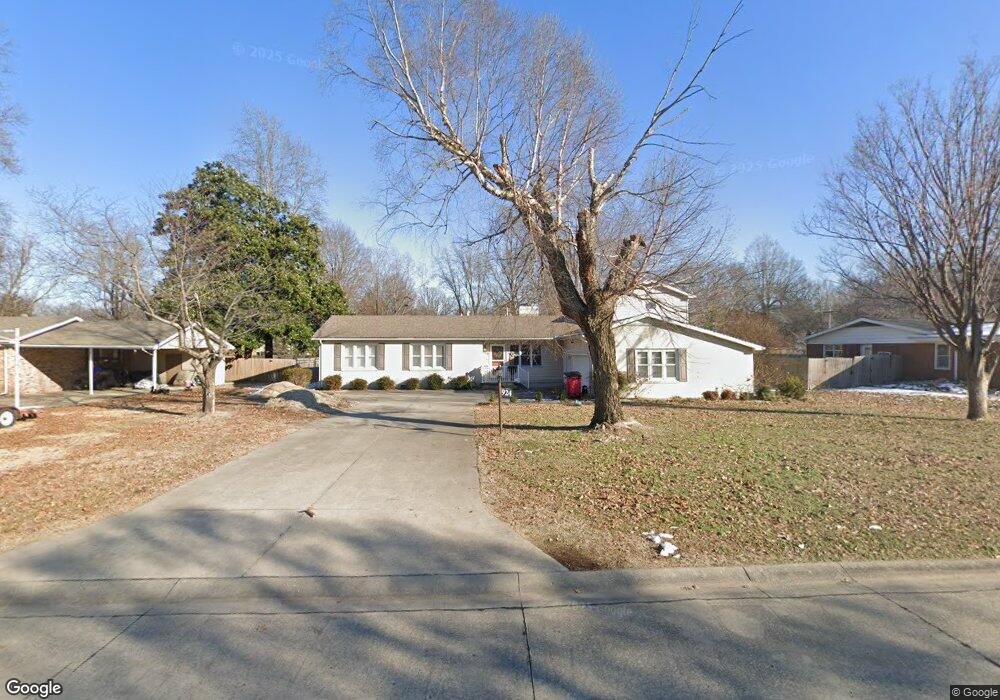
924 Hawthorn Dr Sikeston, MO 63801
Estimated Value: $226,000 - $320,000
--
Bed
--
Bath
1,935
Sq Ft
$131/Sq Ft
Est. Value
About This Home
This home is located at 924 Hawthorn Dr, Sikeston, MO 63801 and is currently estimated at $253,202, approximately $130 per square foot. 924 Hawthorn Dr is a home with nearby schools including Sikeston Senior High School, St. Francis Xavier School, and The Christian Academy.
Ownership History
Date
Name
Owned For
Owner Type
Purchase Details
Closed on
Feb 18, 2020
Sold by
Shelby Janie K
Bought by
Armstrong Bryan Lance and Armstrong Deanna
Current Estimated Value
Home Financials for this Owner
Home Financials are based on the most recent Mortgage that was taken out on this home.
Original Mortgage
$200,691
Outstanding Balance
$177,698
Interest Rate
3.6%
Mortgage Type
New Conventional
Estimated Equity
$75,504
Purchase Details
Closed on
Jan 20, 2017
Sold by
Waltrip William H and Waltrip Pamela Ann
Bought by
Shelby Janie K
Home Financials for this Owner
Home Financials are based on the most recent Mortgage that was taken out on this home.
Original Mortgage
$349,000
Interest Rate
4.16%
Mortgage Type
Future Advance Clause Open End Mortgage
Create a Home Valuation Report for This Property
The Home Valuation Report is an in-depth analysis detailing your home's value as well as a comparison with similar homes in the area
Home Values in the Area
Average Home Value in this Area
Purchase History
| Date | Buyer | Sale Price | Title Company |
|---|---|---|---|
| Armstrong Bryan Lance | -- | Semo Title Company | |
| Shelby Janie K | -- | Semo Title Company |
Source: Public Records
Mortgage History
| Date | Status | Borrower | Loan Amount |
|---|---|---|---|
| Open | Armstrong Bryan Lance | $200,691 | |
| Previous Owner | Shelby Janie K | $349,000 |
Source: Public Records
Tax History Compared to Growth
Tax History
| Year | Tax Paid | Tax Assessment Tax Assessment Total Assessment is a certain percentage of the fair market value that is determined by local assessors to be the total taxable value of land and additions on the property. | Land | Improvement |
|---|---|---|---|---|
| 2025 | $1,155 | $26,930 | $0 | $0 |
| 2024 | $1,155 | $24,300 | $0 | $0 |
| 2023 | $1,152 | $24,300 | $0 | $0 |
| 2022 | $1,158 | $23,430 | $0 | $0 |
| 2021 | $1,157 | $23,430 | $0 | $0 |
| 2020 | $862 | $22,550 | $0 | $0 |
| 2019 | -- | $22,550 | $0 | $0 |
| 2018 | -- | $20,720 | $0 | $0 |
| 2017 | -- | $20,720 | $0 | $0 |
| 2014 | -- | $18,750 | $0 | $0 |
| 2011 | -- | $18,750 | $0 | $0 |
Source: Public Records
Map
Nearby Homes
- 918 Hawthorn Dr
- 933 Hawthorn Dr
- 817 N Kingshighway St
- 4 N West St
- 1040 N Kingshighway St
- 1009 N West St
- 111 Linda Dr
- 1011 N Ranney St
- 202 College St
- 511 W Lindenwood Ave
- 123 Holmes Dr
- 627 Vernon Ave
- 630 Euclid Dr
- 202 E Woodlawn Ave
- 901 Moore Ave
- 701 Sikes Ave
- 1401 N Main St
- 1403 N Main St
- 1405 N Main St
- 208 Foust Dr
- 926 Hawthorn Dr
- 922 Hawthorn Dr
- 920 Hawthorn Dr
- 928 Hawthorn Dr
- 915 Allen Blvd
- 913 Allen Blvd
- 927 Hawthorn Dr
- 917 Allen Blvd
- 925 Hawthorn Dr
- 929 Hawthorn Dr
- 923 Hawthorn Dr
- 931 Hawthorn Dr
- 919 Allen Blvd
- 911 Allen Blvd
- 921 Hawthorn Dr
- 916 Hawthorn Dr
- 304 Powers Ave
- 306 Powers Ave
- 909 Allen Blvd
- 302 Powers Ave