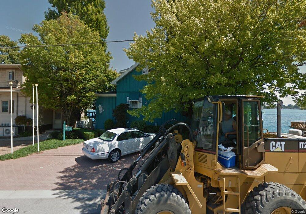
924 Merchant St Port Huron, MI 48060
Estimated Value: $154,000 - $234,123
2
Beds
2
Baths
1,579
Sq Ft
$132/Sq Ft
Est. Value
About This Home
This home is located at 924 Merchant St, Port Huron, MI 48060 and is currently estimated at $209,031, approximately $132 per square foot. 924 Merchant St is a home located in St. Clair County with nearby schools including H.D. Crull Elementary School, Holland Woods Middle School, and Port Huron Northern High School.
Ownership History
Date
Name
Owned For
Owner Type
Purchase Details
Closed on
Jun 19, 2024
Sold by
Crumback James H
Bought by
Carter Rodger and Pellegrini Amy
Current Estimated Value
Purchase Details
Closed on
Nov 3, 2021
Sold by
Crumback James H
Bought by
Crumback James H
Purchase Details
Closed on
Aug 2, 2021
Sold by
Crumback James H and The Orval D Bachus Jr Revocabl
Bought by
Crumback James H
Create a Home Valuation Report for This Property
The Home Valuation Report is an in-depth analysis detailing your home's value as well as a comparison with similar homes in the area
Home Values in the Area
Average Home Value in this Area
Purchase History
| Date | Buyer | Sale Price | Title Company |
|---|---|---|---|
| Carter Rodger | -- | Huron Title | |
| Crumback James H | -- | Touma Watson Whaling Coury Str | |
| Crumback James H | -- | None Available |
Source: Public Records
Tax History Compared to Growth
Tax History
| Year | Tax Paid | Tax Assessment Tax Assessment Total Assessment is a certain percentage of the fair market value that is determined by local assessors to be the total taxable value of land and additions on the property. | Land | Improvement |
|---|---|---|---|---|
| 2025 | $6,266 | $124,800 | $0 | $0 |
| 2024 | $5,724 | $123,800 | $0 | $0 |
| 2023 | $5,421 | $113,500 | $0 | $0 |
| 2022 | $5,671 | $89,900 | $0 | $0 |
| 2021 | $3,257 | $76,400 | $0 | $0 |
| 2020 | $3,294 | $72,900 | $72,900 | $0 |
| 2019 | $3,256 | $78,200 | $0 | $0 |
| 2018 | $3,219 | $78,200 | $0 | $0 |
| 2017 | $2,933 | $86,900 | $0 | $0 |
| 2016 | $2,528 | $86,900 | $0 | $0 |
| 2015 | $2,480 | $88,600 | $88,600 | $0 |
| 2014 | $2,480 | $82,300 | $82,300 | $0 |
| 2013 | -- | $72,700 | $0 | $0 |
Source: Public Records
Map
Nearby Homes
- 805 Pine Grove Ave
- 201 Beers St Unit 32
- 201 Beers St Unit 44
- 201 Beers St Unit 53
- 201 Beers St Unit 34
- 1002 Erie St
- 822 Saint Clair St
- 815 Saint Clair St
- 1401 Stanton St
- 915 10th Ave
- 1503 Elk St
- 1433 Poplar St
- 1704 Edison Shores Ln Unit 52
- 1013 Miller St
- 1011 Pearl St
- 443 11th St
- 604 11th St
- 1123 Wells St
- 1203 Varney St
- 1227 Young St
- 920 Merchant St
- 308 Rawlins St
- V/L Merchant St Vacant
- VL Merchant St
- 918 Merchant St
- 914 Merchant St
- 914 Michigan St
- 402 Rawlins St
- 912 Michigan St
- 917 Michigan St
- 317 Rawlins St
- 904 Michigan St
- 406 Rawlins St
- 910 Merchant St
- 921 Michigan St
- 907 Michigan St
- 902 Merchant St
- 901 Michigan St
- 409 Stanton St
- 920 Huron Ave