Estimated Value: $251,000 - $307,000
2
Beds
2
Baths
1,712
Sq Ft
$162/Sq Ft
Est. Value
About This Home
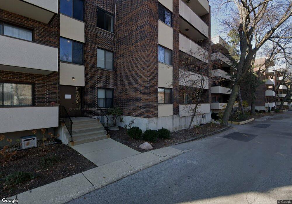
This home is located at 9240 Gross Point Rd Unit 409A, Skokie, IL 60077 and is currently estimated at $276,713, approximately $161 per square foot. 9240 Gross Point Rd Unit 409A is a home located in Cook County with nearby schools including Old Orchard Jr High School, Jane Stenson School, and Arie Crown Hebrew Day School.
Ownership History
Date
Name
Owned For
Owner Type
Purchase Details
Closed on
Feb 18, 2011
Sold by
Rosenberg Helen and Gertz Morie A
Bought by
Sitt John
Current Estimated Value
Purchase Details
Closed on
May 19, 2003
Sold by
Vaisberg Feliks and Vaisberg Ella
Bought by
Gertz Hannah and Rosenberg Helen
Purchase Details
Closed on
Dec 23, 1997
Sold by
Maskaleris Gus and Maskaleris Chris
Bought by
Vaisberg Feliks and Vaisberg Ella
Home Financials for this Owner
Home Financials are based on the most recent Mortgage that was taken out on this home.
Original Mortgage
$110,000
Interest Rate
7.37%
Create a Home Valuation Report for This Property
The Home Valuation Report is an in-depth analysis detailing your home's value as well as a comparison with similar homes in the area
Home Values in the Area
Average Home Value in this Area
Purchase History
| Date | Buyer | Sale Price | Title Company |
|---|---|---|---|
| Sitt John | $130,500 | Rtc | |
| Gertz Hannah | $215,000 | -- | |
| Gertz Hannah | $215,000 | -- | |
| Vaisberg Feliks | $137,500 | Mercury Title Company |
Source: Public Records
Mortgage History
| Date | Status | Borrower | Loan Amount |
|---|---|---|---|
| Previous Owner | Vaisberg Feliks | $110,000 |
Source: Public Records
Tax History Compared to Growth
Tax History
| Year | Tax Paid | Tax Assessment Tax Assessment Total Assessment is a certain percentage of the fair market value that is determined by local assessors to be the total taxable value of land and additions on the property. | Land | Improvement |
|---|---|---|---|---|
| 2024 | $3,742 | $18,294 | $2,542 | $15,752 |
| 2023 | $3,616 | $18,294 | $2,542 | $15,752 |
| 2022 | $3,616 | $18,294 | $2,542 | $15,752 |
| 2021 | $3,462 | $15,980 | $1,906 | $14,074 |
| 2020 | $3,490 | $15,980 | $1,906 | $14,074 |
| 2019 | $3,523 | $17,729 | $1,906 | $15,823 |
| 2018 | $2,583 | $13,025 | $1,679 | $11,346 |
| 2017 | $2,618 | $13,025 | $1,679 | $11,346 |
| 2016 | $2,731 | $13,025 | $1,679 | $11,346 |
| 2015 | $2,650 | $12,118 | $1,452 | $10,666 |
| 2014 | $2,603 | $12,118 | $1,452 | $10,666 |
| 2013 | $2,581 | $12,118 | $1,452 | $10,666 |
Source: Public Records
About This Building
Map
Nearby Homes
- 9242 Gross Point Rd Unit B402
- 9244 Gross Point Rd Unit A103
- 9012 Lamon Ave
- 9121 Niles Center Rd Unit 2W
- 9011 Bronx Ave
- 4801 Grove St
- 4840 Foster St Unit 107
- 4840 Foster St Unit 304
- 4900 Foster St Unit 304
- 4900 Foster St Unit 412
- 9100 Kenton Ave
- 4735 Grove St Unit 103
- 4940 Foster St Unit 108
- 9234 Kolmar Ave
- 9529 Bronx Place Unit 314
- 4901 Golf Rd Unit 310
- 9445 Kenton Ave Unit P30
- 9445 Kenton Ave Unit P14
- 9457 Kenton Ave Unit F
- 4950 Greenwood St
- 9240 Gross Point Rd Unit 406A
- 9240 Gross Point Rd Unit 403A
- 9240 Gross Point Rd Unit 405D
- 9240 Gross Point Rd Unit 109A
- 9240 Gross Point Rd Unit 301B
- 9240 Gross Point Rd Unit 307C
- 9240 Gross Point Rd Unit 303A
- 9240 Gross Point Rd Unit 209A
- 9240 Gross Point Rd Unit 103A
- 9240 Gross Point Rd Unit 401B
- 9240 Gross Point Rd Unit 207C
- 9240 Gross Point Rd Unit 104A
- 9240 Gross Point Rd Unit 102B
- 9240 Gross Point Rd Unit 408C
- 9240 Gross Point Rd Unit 304A
- 9240 Gross Point Rd Unit 106A
- 9240 Gross Point Rd Unit 105D
- 9240 Gross Point Rd Unit 201B
- 9240 Gross Point Rd Unit 306A
- 9240 Gross Point Rd Unit 305A