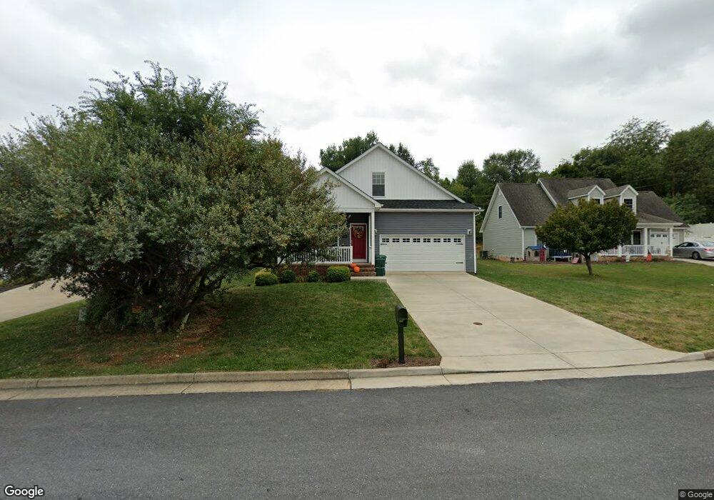
925 Battery Rd Waynesboro, VA 22980
Estimated Value: $401,000 - $428,974
3
Beds
3
Baths
2,270
Sq Ft
$184/Sq Ft
Est. Value
About This Home
This home is located at 925 Battery Rd, Waynesboro, VA 22980 and is currently estimated at $417,994, approximately $184 per square foot. 925 Battery Rd is a home located in Waynesboro City with nearby schools including Westwood Hills Elementary School, Kate Collins Middle School, and Waynesboro High School.
Ownership History
Date
Name
Owned For
Owner Type
Purchase Details
Closed on
Sep 28, 2021
Sold by
Holt Douglas A
Bought by
Holt Douglas A and Holt Kristine M
Current Estimated Value
Purchase Details
Closed on
Jun 6, 2019
Sold by
Holt Douglas A and Hendley Kendra Anne
Bought by
Holt Douglas A
Purchase Details
Closed on
Jun 28, 2017
Sold by
Haustrath William L
Bought by
Holt Douglas A and Hendley Kemdra Anne
Home Financials for this Owner
Home Financials are based on the most recent Mortgage that was taken out on this home.
Original Mortgage
$215,000
Outstanding Balance
$179,264
Interest Rate
4.02%
Mortgage Type
New Conventional
Estimated Equity
$238,730
Create a Home Valuation Report for This Property
The Home Valuation Report is an in-depth analysis detailing your home's value as well as a comparison with similar homes in the area
Home Values in the Area
Average Home Value in this Area
Purchase History
| Date | Buyer | Sale Price | Title Company |
|---|---|---|---|
| Holt Douglas A | -- | None Available | |
| Holt Douglas A | -- | None Available | |
| Holt Douglas A | $245,000 | Vs Title |
Source: Public Records
Mortgage History
| Date | Status | Borrower | Loan Amount |
|---|---|---|---|
| Open | Holt Douglas A | $215,000 |
Source: Public Records
Tax History Compared to Growth
Tax History
| Year | Tax Paid | Tax Assessment Tax Assessment Total Assessment is a certain percentage of the fair market value that is determined by local assessors to be the total taxable value of land and additions on the property. | Land | Improvement |
|---|---|---|---|---|
| 2025 | $3,389 | $413,300 | $65,000 | $348,300 |
| 2024 | $2,880 | $374,000 | $55,000 | $319,000 |
| 2023 | $2,880 | $374,000 | $55,000 | $319,000 |
| 2022 | $2,509 | $278,800 | $45,000 | $233,800 |
| 2021 | $2,509 | $278,800 | $45,000 | $233,800 |
| 2020 | $2,306 | $256,200 | $45,000 | $211,200 |
| 2019 | $2,306 | $256,200 | $45,000 | $211,200 |
| 2018 | $2,041 | $226,800 | $42,000 | $184,800 |
| 2017 | $925 | $106,300 | $42,000 | $64,300 |
| 2016 | $268 | $33,500 | $33,500 | $0 |
| 2015 | $268 | $33,500 | $33,500 | $0 |
| 2014 | -- | $33,500 | $33,500 | $0 |
| 2013 | -- | $0 | $0 | $0 |
Source: Public Records
Map
Nearby Homes
- 1073 Pendleton Dr
- 2224 Mount Vernon St
- 2418 Mount Vernon St
- 2404 Village Dr
- 656 Edwardian Ln
- 316 Lee Dr
- 2500 Forest Dr
- 112 Kings Ct
- 2509 Belvue Rd Unit 18
- 2509 Belvue Rd
- 505 Pelham Dr
- 2814 Jefferson Ln
- 2524 Belvue Rd
- PENWELL Plan at Kira Heights
- SALEM Plan at Kira Heights
- NEUVILLE Plan at Kira Heights
- 200 Bedford Rd
- 340 Kingsport Rd
- 1905 Monroe St
- 203 Pelham Dr
- 919 Battery Rd
- 931 Battery Rd
- 913 Battery Rd
- 937 Battery Rd
- 937 Battery Rd
- 930 Battery Rd
- 924 Battery Rd
- 907 Battery Rd
- 943 Battery Rd
- 936 Battery Rd
- 918 Battery Rd
- 942 Battery Rd
- 901 Battery Rd
- 1072 Pendleton Dr
- 1078 Pendleton Dr
- 1066 Pendleton Dr
- 906 Battery Rd
- 319 Taylor St
- 1084 Pendleton Dr
- 1090 Pendleton Dr