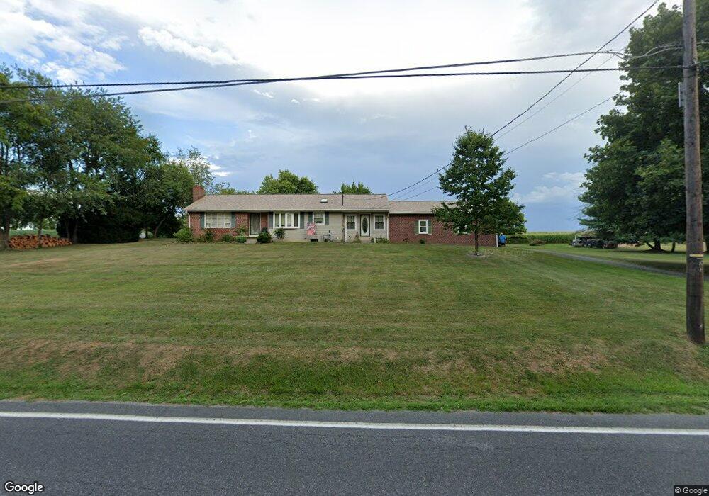
925 Littlestown Rd Littlestown, PA 17340
Estimated Value: $324,000 - $392,000
3
Beds
1
Bath
1,528
Sq Ft
$233/Sq Ft
Est. Value
About This Home
This home is located at 925 Littlestown Rd, Littlestown, PA 17340 and is currently estimated at $355,942, approximately $232 per square foot. 925 Littlestown Rd is a home located in Adams County with nearby schools including Rolling Acres El School, Maple Avenue Middle School, and Littlestown Senior High School.
Ownership History
Date
Name
Owned For
Owner Type
Purchase Details
Closed on
Aug 27, 2007
Sold by
Garman Tammy L
Bought by
Garman Tammy L and Bolitski Cari
Current Estimated Value
Home Financials for this Owner
Home Financials are based on the most recent Mortgage that was taken out on this home.
Original Mortgage
$165,600
Interest Rate
5.72%
Mortgage Type
New Conventional
Create a Home Valuation Report for This Property
The Home Valuation Report is an in-depth analysis detailing your home's value as well as a comparison with similar homes in the area
Purchase History
| Date | Buyer | Sale Price | Title Company |
|---|---|---|---|
| Garman Tammy L | $56,000 | -- |
Source: Public Records
Mortgage History
| Date | Status | Borrower | Loan Amount |
|---|---|---|---|
| Closed | Garman Tammy L | $165,600 |
Source: Public Records
Tax History
| Year | Tax Paid | Tax Assessment Tax Assessment Total Assessment is a certain percentage of the fair market value that is determined by local assessors to be the total taxable value of land and additions on the property. | Land | Improvement |
|---|---|---|---|---|
| 2025 | $5,351 | $282,700 | $54,100 | $228,600 |
| 2024 | $5,115 | $282,700 | $54,100 | $228,600 |
| 2023 | $5,014 | $282,700 | $54,100 | $228,600 |
| 2022 | $5,011 | $282,700 | $54,100 | $228,600 |
| 2021 | $4,834 | $282,700 | $54,100 | $228,600 |
| 2020 | $4,765 | $282,700 | $54,100 | $228,600 |
| 2019 | $4,663 | $282,700 | $54,100 | $228,600 |
| 2018 | $4,562 | $282,700 | $54,100 | $228,600 |
| 2017 | $4,404 | $282,700 | $54,100 | $228,600 |
| 2016 | -- | $282,700 | $54,100 | $228,600 |
| 2015 | -- | $282,700 | $54,100 | $228,600 |
| 2014 | -- | $282,700 | $54,100 | $228,600 |
Source: Public Records
Map
Nearby Homes
- 780 White Hall Rd
- 345 Smoketown Rd
- 24 St Michaels Way Unit 32
- 1 Hickory Ln
- 464 Locust Ln
- 2779 Centennial Rd
- 43 Ashfield Dr Unit 14
- 13 Fieldcrest Dr Unit 154
- 86 Barley Cir Unit 9
- 3211 Centennial Rd
- 41 Smith Cir
- 162 Newark St
- 0 Locust Dr Unit PAAD2015910
- 20c Locust Dr
- 5160 Baltimore Pike Unit 3
- 111 Eagle Ln Unit 7
- 87 Eagle Ln Unit 5
- 1120 Hanover Pike
- 73 Eagle Ln
- 124 Flint Dr Unit 61
- 901 Littlestown Rd
- 891 Littlestown Rd
- 881 Littlestown Rd
- 871 Littlestown Rd Unit 6
- 861 Littlestown Rd
- 841 Littlestown Rd Unit 3
- 1000 Littlestown Rd
- 1005 Littlestown Rd
- 831 Littlestown Rd
- 819 Littlestown Rd
- 1030 Littlestown Rd Unit 2
- 820 Littlestown Rd
- 1040 Littlestown Rd Unit 3
- 1098 Littlestown Rd
- 1055 Littlestown Rd
- 1050 Littlestown Rd Unit 4
- 791 Littlestown Rd
- 1064 Littlestown Rd
- 775 Littlestown Rd
- 765 Littlestown Rd Unit 16
Your Personal Tour Guide
Ask me questions while you tour the home.