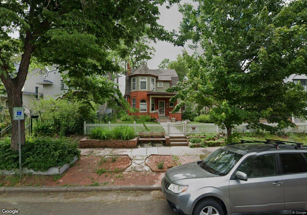
925 S Pennsylvania St Denver, CO 80209
Washington Park West NeighborhoodEstimated Value: $913,000 - $1,148,000
4
Beds
3
Baths
2,082
Sq Ft
$488/Sq Ft
Est. Value
About This Home
This home is located at 925 S Pennsylvania St, Denver, CO 80209 and is currently estimated at $1,014,993, approximately $487 per square foot. 925 S Pennsylvania St is a home located in Denver County with nearby schools including Lincoln Elementary School, Grant Beacon Middle School, and South High School.
Ownership History
Date
Name
Owned For
Owner Type
Purchase Details
Closed on
Sep 30, 2015
Sold by
Bridge Shelley
Bought by
Hevenor Adam David and Hevenor Darya Anisimova
Current Estimated Value
Home Financials for this Owner
Home Financials are based on the most recent Mortgage that was taken out on this home.
Original Mortgage
$342,000
Outstanding Balance
$269,902
Interest Rate
3.97%
Mortgage Type
New Conventional
Estimated Equity
$745,091
Create a Home Valuation Report for This Property
The Home Valuation Report is an in-depth analysis detailing your home's value as well as a comparison with similar homes in the area
Home Values in the Area
Average Home Value in this Area
Purchase History
| Date | Buyer | Sale Price | Title Company |
|---|---|---|---|
| Hevenor Adam David | $660,000 | Equity Title |
Source: Public Records
Mortgage History
| Date | Status | Borrower | Loan Amount |
|---|---|---|---|
| Open | Hevenor Adam David | $342,000 |
Source: Public Records
Tax History Compared to Growth
Tax History
| Year | Tax Paid | Tax Assessment Tax Assessment Total Assessment is a certain percentage of the fair market value that is determined by local assessors to be the total taxable value of land and additions on the property. | Land | Improvement |
|---|---|---|---|---|
| 2024 | $5,183 | $65,440 | $29,520 | $35,920 |
| 2023 | $5,071 | $65,440 | $29,520 | $35,920 |
| 2022 | $4,201 | $52,820 | $28,450 | $24,370 |
| 2021 | $4,055 | $54,340 | $29,270 | $25,070 |
| 2020 | $4,260 | $57,420 | $27,740 | $29,680 |
| 2019 | $4,141 | $57,420 | $27,740 | $29,680 |
| 2018 | $3,697 | $47,780 | $24,810 | $22,970 |
| 2017 | $3,685 | $47,780 | $24,810 | $22,970 |
| 2016 | $2,917 | $35,770 | $24,859 | $10,911 |
| 2015 | $2,795 | $35,770 | $24,859 | $10,911 |
| 2014 | $2,465 | $29,680 | $20,585 | $9,095 |
Source: Public Records
Map
Nearby Homes
- 969 S Pearl St Unit 204
- 1001 S Pennsylvania St Unit 1005
- 857 S Grant St
- 838 S Sherman St
- 1056 S Pennsylvania St
- 794 S Pearl St
- 130 E Ohio Ave Unit 140
- 981 S Emerson St
- 1023 S Emerson St
- 1209 S Pennsylvania St
- 646 S Lincoln St
- 589 S Grant St
- 1127 S Ogden St
- 1050 S Corona St
- 571 S Sherman St
- 501 S Pearl St
- 1260 S Emerson St
- 1144 S Cherokee St
- 533 S Emerson St
- 0 S Corona St
- 917 S Pennsylvania St
- 931 S Pennsylvania St
- 911 S Pennsylvania St
- 935 S Pennsylvania St
- 924 S Logan St
- 905 S Pennsylvania St
- 943 S Pennsylvania St
- 934 S Logan St
- 440 E Kentucky Ave
- 949 S Pennsylvania St Unit B
- 949 S Pennsylvania St
- 949 S Pennsylvania St Unit A
- 936 S Pennsylvania St
- 918 S Logan St Unit 201
- 918 S Logan St Unit 305
- 918 S Logan St Unit 103
- 918 S Logan St Unit 301
- 918 S Logan St Unit 202
- 918 S Logan St Unit 306
- 918 S Logan St