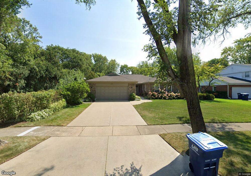
925 Summit Dr Deerfield, IL 60015
Estimated Value: $764,088 - $881,000
4
Beds
3
Baths
2,578
Sq Ft
$315/Sq Ft
Est. Value
About This Home
This home is located at 925 Summit Dr, Deerfield, IL 60015 and is currently estimated at $812,022, approximately $314 per square foot. 925 Summit Dr is a home located in Lake County with nearby schools including Walden Elementary School, Alan B Shepard Middle School, and Deerfield High School.
Ownership History
Date
Name
Owned For
Owner Type
Purchase Details
Closed on
Mar 24, 2016
Sold by
Lurie Frederick A and Lurie Patricia
Bought by
Lurie Frederick A and Lurie Patricia
Current Estimated Value
Purchase Details
Closed on
Nov 8, 2007
Sold by
Lurie Frederick A
Bought by
Lurie Patricia and Lurie Frederick A
Purchase Details
Closed on
Nov 6, 2006
Sold by
Lurie Frederick and Lurie Patricia
Bought by
Lurie Frederick A and The Frederick A Lurie Trust
Purchase Details
Closed on
Jul 30, 1999
Sold by
Loftus Brian A and Loftus Ilse L
Bought by
Lurie Frederick and Lurie Patricia
Home Financials for this Owner
Home Financials are based on the most recent Mortgage that was taken out on this home.
Original Mortgage
$175,000
Outstanding Balance
$50,761
Interest Rate
7.77%
Estimated Equity
$761,261
Create a Home Valuation Report for This Property
The Home Valuation Report is an in-depth analysis detailing your home's value as well as a comparison with similar homes in the area
Home Values in the Area
Average Home Value in this Area
Purchase History
| Date | Buyer | Sale Price | Title Company |
|---|---|---|---|
| Lurie Frederick A | -- | None Available | |
| Lurie Patricia | -- | None Available | |
| Lurie Frederick A | -- | None Available | |
| Lurie Frederick | $372,000 | -- |
Source: Public Records
Mortgage History
| Date | Status | Borrower | Loan Amount |
|---|---|---|---|
| Open | Lurie Frederick | $175,000 |
Source: Public Records
Tax History
| Year | Tax Paid | Tax Assessment Tax Assessment Total Assessment is a certain percentage of the fair market value that is determined by local assessors to be the total taxable value of land and additions on the property. | Land | Improvement |
|---|---|---|---|---|
| 2024 | $15,202 | $185,030 | $55,794 | $129,236 |
| 2023 | $14,694 | $177,572 | $53,545 | $124,027 |
| 2022 | $14,694 | $166,118 | $59,328 | $106,790 |
| 2021 | $13,842 | $160,160 | $57,200 | $102,960 |
| 2020 | $13,314 | $160,497 | $57,320 | $103,177 |
| 2019 | $13,449 | $160,225 | $57,223 | $103,002 |
| 2018 | $8,172 | $189,854 | $60,650 | $129,204 |
| 2017 | $15,264 | $189,249 | $60,457 | $128,792 |
| 2016 | $14,845 | $182,093 | $58,171 | $123,922 |
| 2015 | $14,543 | $171,092 | $54,657 | $116,435 |
| 2014 | $12,441 | $145,229 | $55,050 | $90,179 |
| 2012 | $12,140 | $143,947 | $54,564 | $89,383 |
Source: Public Records
Map
Nearby Homes
- 1770 Overland Trail
- 1727 Telegraph Rd
- 1423 Northwoods Rd
- 2020 Churchill Ln
- 1420 Crowe Ave
- 1800 Telegraph Rd
- 1285 Warwick Ct
- 2045 Kipling Ct
- 1630 Ridge Rd
- 1165 Linden Ave
- 1525 Hawthorne Place
- 1380 Valley Rd
- 1300 Knollwood Rd
- 1151 Walden Ln
- 1106 Waukegan Rd
- 1725 Lilly Ct
- 1030 Chestnut St
- 1851 Cooper Ln
- 1127 Kenton Rd
- 1335 Wilmot Rd
- 935 Summit Dr
- 1740 E Summit Ct
- 1750 E Summit Ct
- 945 Summit Dr
- 1730 Mountain Ct
- 1725 Mountain Ct
- 1730 E Summit Ct
- 920 Summit Dr
- 930 Summit Dr
- 900 Summit Dr
- 955 Summit Dr
- 1720 Mountain Ct
- 890 Summit Dr
- 1715 Mountain Ct
- 950 Summit Dr
- 1725 E Summit Ct
- 880 Summit Dr
- 1755 E Summit Ct
- 1745 E Summit Ct
- 900 Mountain Dr
Your Personal Tour Guide
Ask me questions while you tour the home.