Estimated Value: $620,000 - $736,000
5
Beds
2
Baths
3,000
Sq Ft
$219/Sq Ft
Est. Value
About This Home
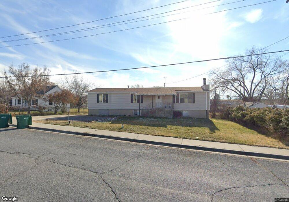
This home is located at 925 W 2100 N, Lehi, UT 84043 and is currently estimated at $657,588, approximately $219 per square foot. 925 W 2100 N is a home located in Utah County with nearby schools including Eaglecrest Elementary School, Lehi Junior High School, and Skyridge High School.
Ownership History
Date
Name
Owned For
Owner Type
Purchase Details
Closed on
Aug 22, 2025
Sold by
Henderson Jacob Mitchell and Henderson Elizabeth
Bought by
Utah Department Of Transportation
Current Estimated Value
Purchase Details
Closed on
Jul 3, 2020
Sold by
Pettys Mark and Pettys Brooke
Bought by
Henderson Jacob Mitchell and Henderson Elizabeth
Home Financials for this Owner
Home Financials are based on the most recent Mortgage that was taken out on this home.
Original Mortgage
$394,250
Interest Rate
3.1%
Mortgage Type
New Conventional
Purchase Details
Closed on
Nov 29, 2016
Sold by
Pettys Mark
Bought by
Pettys Mark and Pettys Brooke
Home Financials for this Owner
Home Financials are based on the most recent Mortgage that was taken out on this home.
Original Mortgage
$283,221
Interest Rate
3.25%
Mortgage Type
FHA
Purchase Details
Closed on
Mar 31, 2003
Sold by
Manning David and Manning Alleen
Bought by
Manning David M and Manning Alleen M
Home Financials for this Owner
Home Financials are based on the most recent Mortgage that was taken out on this home.
Original Mortgage
$140,000
Interest Rate
5.78%
Purchase Details
Closed on
Sep 17, 1997
Sold by
Manning J Dale and Manning Joyce K
Bought by
Manning David and Manning Alleen
Create a Home Valuation Report for This Property
The Home Valuation Report is an in-depth analysis detailing your home's value as well as a comparison with similar homes in the area
Home Values in the Area
Average Home Value in this Area
Purchase History
| Date | Buyer | Sale Price | Title Company |
|---|---|---|---|
| Utah Department Of Transportation | -- | None Listed On Document | |
| Henderson Jacob Mitchell | -- | Access Title Co | |
| Pettys Mark | -- | Accommodation | |
| Pettys Mark | -- | North American Title | |
| Manning David M | -- | Signature Title | |
| Manning David | -- | -- |
Source: Public Records
Mortgage History
| Date | Status | Borrower | Loan Amount |
|---|---|---|---|
| Previous Owner | Henderson Jacob Mitchell | $394,250 | |
| Previous Owner | Pettys Mark | $283,221 | |
| Previous Owner | Manning David M | $140,000 |
Source: Public Records
Tax History Compared to Growth
Tax History
| Year | Tax Paid | Tax Assessment Tax Assessment Total Assessment is a certain percentage of the fair market value that is determined by local assessors to be the total taxable value of land and additions on the property. | Land | Improvement |
|---|---|---|---|---|
| 2025 | $2,697 | $334,290 | $280,200 | $327,600 |
| 2024 | $2,697 | $315,590 | $0 | $0 |
| 2023 | $2,509 | $318,835 | $0 | $0 |
| 2022 | $2,461 | $303,160 | $0 | $0 |
| 2021 | $2,187 | $407,200 | $138,200 | $269,000 |
| 2020 | $2,061 | $379,400 | $128,000 | $251,400 |
| 2019 | $1,811 | $346,600 | $128,000 | $218,600 |
| 2018 | $1,693 | $306,300 | $110,900 | $195,400 |
| 2017 | $1,537 | $147,785 | $0 | $0 |
| 2016 | $1,524 | $136,015 | $0 | $0 |
| 2015 | $1,467 | $124,245 | $0 | $0 |
| 2014 | $1,436 | $120,890 | $0 | $0 |
Source: Public Records
Map
Nearby Homes
- 1011 W Mountain Way Unit 316
- 2287 N 750 W
- 1817 W Bad Rock Cir
- 1272 W 1800 N
- 1249 W 1800 N
- 497 W 2200 N
- 1610 N 1125 W
- 497 W 2280 N
- 902 W 1500 N
- 2687 N 900 W
- 1094 W 1425 N
- 1332 W 1500 N
- 1755 N 250 W
- 1301 N 900 W Unit 12
- 5312 N Springview Ct Unit 106
- 1027 N 3685 W Unit 248
- 2191 W Swift Fox Dr Unit 274
- 999 Empire St
- 2184 W Cape Fox Way N Unit 220
- 1060 N Canvasback Dr Unit 405
- 849 W 2100 N
- 919 W 2100 N
- 931 W 2100 N
- 841 W 2100 N
- 3771 W Lucerne Way
- 888 W 2100 N
- 868 W 2100 N
- 918 W 2100 N
- 844 W 2100 N
- 840 W 2100 N
- 840 E 2100 Peyton S
- 840 E 2100 Chateau S
- 840 W 2100 N Unit PRINC
- 840 W 2100 N Unit HARV
- 946 W 2100 N
- 952 W 2100 N
- 2075 N 900 W
- 978 W 2100 N
- 1985 N 900 W
- 951 W 2100 N