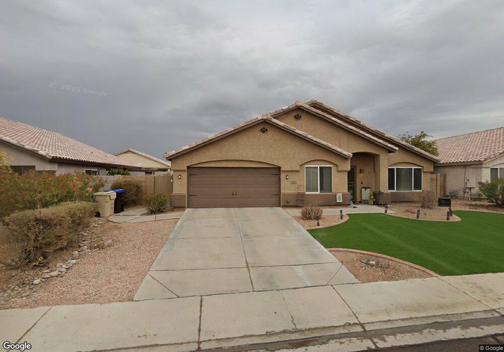
9250 W Marconi Ave Peoria, AZ 85382
Estimated Value: $440,605 - $538,000
--
Bed
3
Baths
2,310
Sq Ft
$218/Sq Ft
Est. Value
About This Home
This home is located at 9250 W Marconi Ave, Peoria, AZ 85382 and is currently estimated at $504,651, approximately $218 per square foot. 9250 W Marconi Ave is a home located in Maricopa County with nearby schools including Desert Harbor Elementary School, Centennial High School, and Sonoran Science Academy-Peoria.
Ownership History
Date
Name
Owned For
Owner Type
Purchase Details
Closed on
May 19, 1997
Sold by
Bpc Inc
Bought by
Beck Timothy W and Beck Amy L
Current Estimated Value
Home Financials for this Owner
Home Financials are based on the most recent Mortgage that was taken out on this home.
Original Mortgage
$140,800
Outstanding Balance
$19,518
Interest Rate
8.14%
Mortgage Type
New Conventional
Estimated Equity
$485,133
Purchase Details
Closed on
May 30, 1996
Sold by
Acacia Credit Fund Iii Lp
Bought by
Bpc Inc
Create a Home Valuation Report for This Property
The Home Valuation Report is an in-depth analysis detailing your home's value as well as a comparison with similar homes in the area
Home Values in the Area
Average Home Value in this Area
Purchase History
| Date | Buyer | Sale Price | Title Company |
|---|---|---|---|
| Beck Timothy W | $142,779 | Fidelity Title | |
| Bpc Inc | $119,950 | Fidelity Title |
Source: Public Records
Mortgage History
| Date | Status | Borrower | Loan Amount |
|---|---|---|---|
| Open | Beck Timothy W | $140,800 |
Source: Public Records
Tax History Compared to Growth
Tax History
| Year | Tax Paid | Tax Assessment Tax Assessment Total Assessment is a certain percentage of the fair market value that is determined by local assessors to be the total taxable value of land and additions on the property. | Land | Improvement |
|---|---|---|---|---|
| 2025 | $1,992 | $25,116 | -- | -- |
| 2024 | $1,958 | $23,920 | -- | -- |
| 2023 | $1,958 | $36,130 | $7,220 | $28,910 |
| 2022 | $1,918 | $27,380 | $5,470 | $21,910 |
| 2021 | $2,050 | $25,330 | $5,060 | $20,270 |
| 2020 | $2,070 | $23,760 | $4,750 | $19,010 |
| 2019 | $2,005 | $23,550 | $4,710 | $18,840 |
| 2018 | $1,926 | $22,530 | $4,500 | $18,030 |
| 2017 | $1,928 | $21,130 | $4,220 | $16,910 |
| 2016 | $1,876 | $20,170 | $4,030 | $16,140 |
| 2015 | $1,781 | $19,200 | $3,840 | $15,360 |
Source: Public Records
Map
Nearby Homes
- 9235 W Marconi Ave
- 16017 N Nicklaus Ln
- 16251 N 91st Dr
- 16414 N Meadow Park Dr
- 9002 W Caribbean Ln
- 15430 N Bowling Green Dr
- 9151 W Greenway Rd Unit 288
- 15406 N Bowling Green Dr
- 9326 W Briarwood Cir
- 8809 W Sandra Terrace
- 15211 N 89th Ave
- 16801 N Pine Valley Dr
- 9310 W Cedar Hill Cir N
- 9414 W Briarwood Cir
- 8653 W Paradise Ln
- 15099 N 89th Ave
- 16832 N Pine Valley Dr
- 9337 W Hidden Valley Cir N
- 15360 N 87th Ave
- 15401 N Cameo Dr
- 9228 W Marconi Ave
- 9244 W Marconi Ave
- 9235 W Lockland Ct
- 9227 W Lockland Ct
- 9220 W Marconi Ave
- 9252 W Marconi Ave
- 9243 W Lockland Ct
- 9227 W Marconi Ave
- 9219 W Lockland Ct
- 9251 W Lockland Ct
- 9219 W Marconi Ave
- 9243 W Marconi Ave
- 9212 W Marconi Ave
- 9211 W Lockland Ct
- 9211 W Marconi Ave
- 9174 W Marconi Ave
- 9228 W Kathleen Rd
- 9181 W Lockland Ct
- 9236 W Kathleen Rd
- 9236 W Lockland Ct