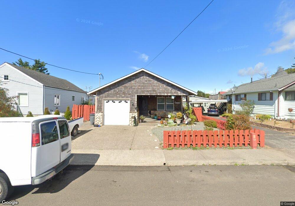
926 2nd Ave Seaside, OR 97138
Estimated Value: $435,000 - $476,000
3
Beds
2
Baths
1,168
Sq Ft
$387/Sq Ft
Est. Value
About This Home
This home is located at 926 2nd Ave, Seaside, OR 97138 and is currently estimated at $452,345, approximately $387 per square foot. 926 2nd Ave is a home located in Clatsop County with nearby schools including Seaside High School.
Ownership History
Date
Name
Owned For
Owner Type
Purchase Details
Closed on
Jun 12, 2025
Sold by
Darrell D Thun Trust and Thun Darrell D
Bought by
Meyer Gavin
Current Estimated Value
Purchase Details
Closed on
Oct 9, 2019
Sold by
Thun Darrell D
Bought by
Thun Darrell D and Darrell D Thun Trust Agreement
Purchase Details
Closed on
May 10, 2019
Sold by
Kelvin Paul E and Kelvin Karen J
Bought by
Thun Darrell
Purchase Details
Closed on
Feb 23, 2005
Sold by
Hensala Kenneth G
Bought by
Kelvin Paul E and Kelvin Karen J
Create a Home Valuation Report for This Property
The Home Valuation Report is an in-depth analysis detailing your home's value as well as a comparison with similar homes in the area
Home Values in the Area
Average Home Value in this Area
Purchase History
| Date | Buyer | Sale Price | Title Company |
|---|---|---|---|
| Meyer Gavin | $450,000 | None Listed On Document | |
| Thun Darrell D | -- | None Available | |
| Thun Darrell | $300,000 | Fidelity Natl Ttl Co Of Or | |
| Kelvin Paul E | $160,000 | Ticor Title Ins Co |
Source: Public Records
Tax History Compared to Growth
Tax History
| Year | Tax Paid | Tax Assessment Tax Assessment Total Assessment is a certain percentage of the fair market value that is determined by local assessors to be the total taxable value of land and additions on the property. | Land | Improvement |
|---|---|---|---|---|
| 2025 | $3,129 | $217,779 | -- | -- |
| 2024 | $3,037 | $211,437 | -- | -- |
| 2023 | $2,948 | $205,280 | $0 | $0 |
| 2022 | $2,867 | $199,302 | $0 | $0 |
| 2021 | $2,806 | $193,498 | $0 | $0 |
| 2020 | $2,741 | $187,863 | $0 | $0 |
| 2019 | $2,666 | $182,393 | $0 | $0 |
| 2018 | $2,560 | $177,082 | $0 | $0 |
| 2017 | $2,443 | $171,925 | $0 | $0 |
| 2016 | $2,149 | $166,919 | $43,253 | $123,666 |
| 2015 | $2,093 | $162,059 | $41,994 | $120,065 |
| 2014 | $2,087 | $157,339 | $0 | $0 |
| 2013 | -- | $152,757 | $0 | $0 |
Source: Public Records
Map
Nearby Homes
- 210 N Roosevelt Dr Unit 2
- 200-220 Roosevelt Dr N
- 200 N Roosevelt Dr
- 930 2nd Ave
- 931 3rd Ave
- 140-150 Roosevelt Dr N
- 140 N Roosevelt Dr
- 921 3rd Ave
- 941 3rd Ave
- 941 W 3rd Ave
- 910 2nd Ave
- 921 2nd Ave
- 911 3rd Ave
- 135 N Roosevelt Dr
- 911 2nd Ave
- 835 3rd Ave
- 850 2nd Ave
- 1010 2nd Ave
- 1010 2nd 1weuoumkbh21
- 817 3rd Ave