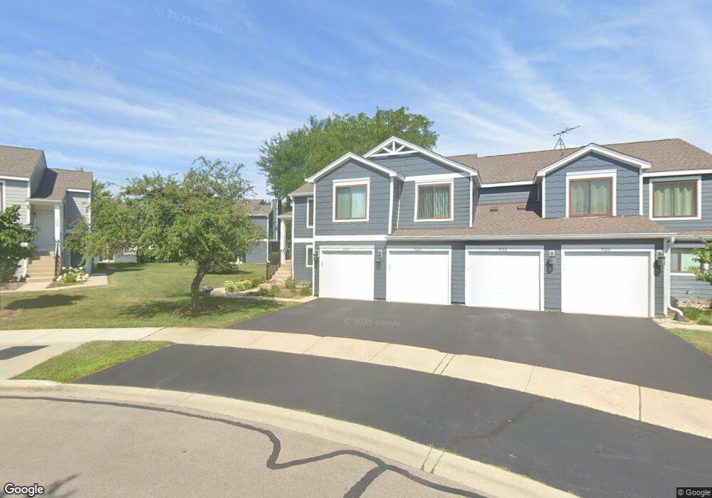
926 Brunswick Cir Unit 271A Schaumburg, IL 60193
South Schaumburg NeighborhoodEstimated Value: $249,000 - $271,000
2
Beds
--
Bath
1,200
Sq Ft
$220/Sq Ft
Est. Value
About This Home
This home is located at 926 Brunswick Cir Unit 271A, Schaumburg, IL 60193 and is currently estimated at $263,473, approximately $219 per square foot. 926 Brunswick Cir Unit 271A is a home located in Cook County with nearby schools including Michael Collins Elementary School, Robert Frost Junior High School, and J B Conant High School.
Ownership History
Date
Name
Owned For
Owner Type
Purchase Details
Closed on
Dec 29, 2006
Sold by
Cashman Kathleen M
Bought by
Filipski Bogdan and Filipski Danuta
Current Estimated Value
Home Financials for this Owner
Home Financials are based on the most recent Mortgage that was taken out on this home.
Original Mortgage
$115,000
Interest Rate
6.24%
Mortgage Type
Unknown
Purchase Details
Closed on
May 25, 2005
Sold by
Mucci John F
Bought by
Mucci John F and John F Mucci Trust
Create a Home Valuation Report for This Property
The Home Valuation Report is an in-depth analysis detailing your home's value as well as a comparison with similar homes in the area
Home Values in the Area
Average Home Value in this Area
Purchase History
| Date | Buyer | Sale Price | Title Company |
|---|---|---|---|
| Filipski Bogdan | $180,000 | Attorneys Title Guaranty Fun | |
| Mucci John F | -- | Attorneys Title Guaranty Fun |
Source: Public Records
Mortgage History
| Date | Status | Borrower | Loan Amount |
|---|---|---|---|
| Closed | Filipski Bogdan | $115,000 |
Source: Public Records
Tax History Compared to Growth
Tax History
| Year | Tax Paid | Tax Assessment Tax Assessment Total Assessment is a certain percentage of the fair market value that is determined by local assessors to be the total taxable value of land and additions on the property. | Land | Improvement |
|---|---|---|---|---|
| 2024 | $3,993 | $17,570 | $4,117 | $13,453 |
| 2023 | $3,843 | $17,570 | $4,117 | $13,453 |
| 2022 | $3,843 | $17,570 | $4,117 | $13,453 |
| 2021 | $3,280 | $14,152 | $2,245 | $11,907 |
| 2020 | $3,291 | $14,152 | $2,245 | $11,907 |
| 2019 | $3,296 | $15,725 | $2,245 | $13,480 |
| 2018 | $2,247 | $10,922 | $1,871 | $9,051 |
| 2017 | $2,229 | $10,922 | $1,871 | $9,051 |
| 2016 | $2,327 | $10,922 | $1,871 | $9,051 |
| 2015 | $2,120 | $9,711 | $1,684 | $8,027 |
| 2014 | $2,113 | $9,711 | $1,684 | $8,027 |
| 2013 | $2,042 | $9,711 | $1,684 | $8,027 |
Source: Public Records
Map
Nearby Homes
- 916 Manchester Cir Unit 91A
- 126 Manchester Ct Unit 61B
- 1100 Boston Harbor Unit 7004
- 205 Nantucket Harbor Unit 104
- 36 Shore Dr
- 421 E Wise Rd
- 426 E Niagara Ave
- 124 E Monterey Ave
- 733 Limerick Ln Unit 7333D
- 711 Tipperary Ct Unit 2D
- 712 Tipperary Ct Unit 1C
- 718 N Point Dr
- 727 Killarney Ct Unit 1C
- 620 S Point Dr
- 631 Derry Ct Unit 3C
- 421 Summit Dr
- 614 Tralee Ct Unit 2-C
- 635 Limerick Ln Unit 2B
- 722 Merlin Dr Unit 16
- 553 Stone Gate Cir
- 924 Brunswick Cir Unit 272A
- 920 Brunswick Cir Unit 271B
- 922 Brunswick Cir Unit 272B
- 915 Manchester Cir Unit 112B
- 930 Brunswick Cir Unit 261B
- 921 Brunswick Cir Unit 281A
- 925 Brunswick Cir Unit 282B
- 934 Brunswick Cir Unit 262A
- 932 Brunswick Cir Unit 262B
- 932 Brunswick Cir Unit 2B
- 923 Brunswick Cir Unit 282A
- 927 Brunswick Cir Unit 281B
- 936 Brunswick Cir Unit 261A
- 917 Manchester Cir Unit 111B
- 921 Manchester Cir Unit 121A
- 911 Manchester Cir Unit 111A
- 913 Manchester Cir Unit 112A
- 925 Manchester Cir Unit 122B
- 927 Manchester Cir Unit 121B
- 931 Brunswick Cir Unit 291A