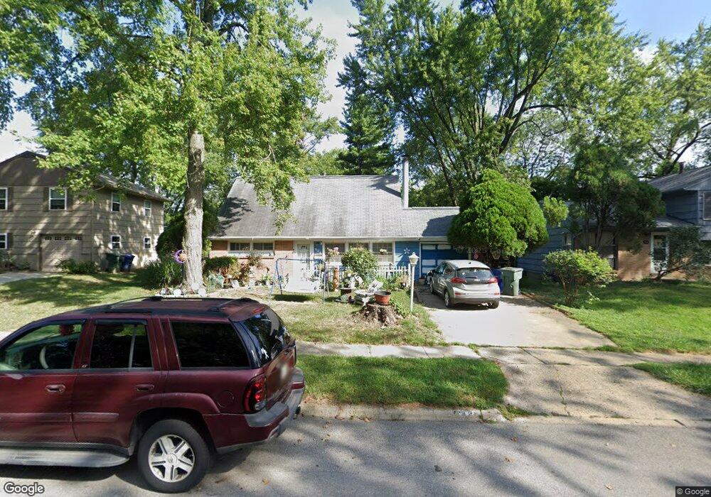
926 Caniff Rd Columbus, OH 43221
Cranbrook NeighborhoodEstimated Value: $346,554 - $372,000
4
Beds
2
Baths
1,270
Sq Ft
$284/Sq Ft
Est. Value
About This Home
This home is located at 926 Caniff Rd, Columbus, OH 43221 and is currently estimated at $360,389, approximately $283 per square foot. 926 Caniff Rd is a home located in Franklin County with nearby schools including Cranbrook Elementary School, Ridgeview Middle School, and Centennial High School.
Ownership History
Date
Name
Owned For
Owner Type
Purchase Details
Closed on
Feb 5, 2024
Sold by
Huffaker Patricia J
Bought by
Stone Sandra Annette
Current Estimated Value
Purchase Details
Closed on
Sep 30, 2020
Sold by
Huffaker Patricia J
Bought by
Huffaker Patricia Joanne and The Patricia Joanne Huffaker T
Purchase Details
Closed on
Mar 22, 1999
Sold by
Huffaker Lymon T and Huffaker Patricia J
Bought by
Huffaker Lymon Theodore and Huffaker Patricia J
Create a Home Valuation Report for This Property
The Home Valuation Report is an in-depth analysis detailing your home's value as well as a comparison with similar homes in the area
Home Values in the Area
Average Home Value in this Area
Purchase History
| Date | Buyer | Sale Price | Title Company |
|---|---|---|---|
| Stone Sandra Annette | -- | None Listed On Document | |
| Huffaker Patricia Joanne | -- | None Listed On Document | |
| Huffaker Patricia Joanne | -- | None Available | |
| Huffaker Lymon Theodore | -- | -- |
Source: Public Records
Tax History Compared to Growth
Tax History
| Year | Tax Paid | Tax Assessment Tax Assessment Total Assessment is a certain percentage of the fair market value that is determined by local assessors to be the total taxable value of land and additions on the property. | Land | Improvement |
|---|---|---|---|---|
| 2024 | $4,069 | $90,660 | $40,640 | $50,020 |
| 2023 | $4,017 | $90,650 | $40,635 | $50,015 |
| 2022 | $3,847 | $74,170 | $21,630 | $52,540 |
| 2021 | $3,854 | $74,170 | $21,630 | $52,540 |
| 2020 | $3,859 | $74,170 | $21,630 | $52,540 |
| 2019 | $2,943 | $57,260 | $21,630 | $35,630 |
| 2018 | $2,753 | $57,260 | $21,630 | $35,630 |
| 2017 | $2,941 | $57,260 | $21,630 | $35,630 |
| 2016 | $2,831 | $51,490 | $14,530 | $36,960 |
| 2015 | $2,570 | $51,490 | $14,530 | $36,960 |
| 2014 | $2,576 | $51,490 | $14,530 | $36,960 |
| 2013 | $1,198 | $49,035 | $13,825 | $35,210 |
Source: Public Records
Map
Nearby Homes
- 970 Oberlin Dr
- 3336 Mansion Way
- 965 Manor Ln Unit W
- 727 Kettering Rd
- 667 Riverview Dr
- 1109 Millcreek Ln
- 3156 Mt Holyoke Rd
- 3845 Shattuck Ave
- 3444 Sunningdale Way
- 713 Marburn Dr
- 1743 Ardleigh Rd Unit 1743
- 174 W Como Ave
- 3015 Welsford Rd
- 3175 Tremont Rd Unit 504
- 3175 Tremont Rd Unit 313
- 1842 Ridgecliff Rd
- 4160 Ruxton Ln
- 126 W Tulane Rd
- 118 W Tulane Rd
- 110 W Tulane Rd