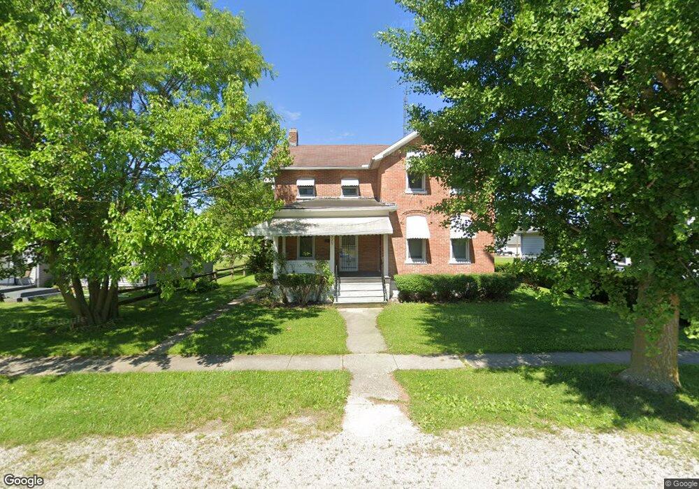
926 Dickinson St Fremont, OH 43420
Estimated Value: $57,000 - $124,269
3
Beds
3
Baths
1,318
Sq Ft
$69/Sq Ft
Est. Value
About This Home
This home is located at 926 Dickinson St, Fremont, OH 43420 and is currently estimated at $90,817, approximately $68 per square foot. 926 Dickinson St is a home located in Sandusky County with nearby schools including Fremont Ross High School, St. Ann Catholic School, and St. Joseph School.
Ownership History
Date
Name
Owned For
Owner Type
Purchase Details
Closed on
Mar 14, 2024
Sold by
Price Vincent A
Bought by
Ctjp Properties Llc
Current Estimated Value
Purchase Details
Closed on
Aug 18, 2011
Sold by
Estate Of Clyde T Price
Bought by
Price Vincent A
Purchase Details
Closed on
May 6, 2008
Sold by
Price Kenny and Price Vincent
Bought by
Price Clyde T
Purchase Details
Closed on
May 8, 2007
Sold by
Atkins Jeanette and Price Clyde T
Bought by
Price Kenny and Price Vincent
Purchase Details
Closed on
May 1, 1985
Bought by
Price Vincent A
Create a Home Valuation Report for This Property
The Home Valuation Report is an in-depth analysis detailing your home's value as well as a comparison with similar homes in the area
Home Values in the Area
Average Home Value in this Area
Purchase History
| Date | Buyer | Sale Price | Title Company |
|---|---|---|---|
| Ctjp Properties Llc | -- | None Listed On Document | |
| Ctjp Properties Llc | -- | None Listed On Document | |
| Price Vincent A | -- | None Available | |
| Price Clyde T | -- | None Available | |
| Price Kenny | -- | None Available | |
| Price Vincent A | $42,000 | -- |
Source: Public Records
Tax History Compared to Growth
Tax History
| Year | Tax Paid | Tax Assessment Tax Assessment Total Assessment is a certain percentage of the fair market value that is determined by local assessors to be the total taxable value of land and additions on the property. | Land | Improvement |
|---|---|---|---|---|
| 2024 | $1,245 | $32,970 | $9,030 | $23,940 |
| 2023 | $1,245 | $29,440 | $8,050 | $21,390 |
| 2022 | $1,191 | $29,440 | $8,050 | $21,390 |
| 2021 | $1,298 | $29,440 | $8,050 | $21,390 |
| 2020 | $1,063 | $25,550 | $8,050 | $17,500 |
| 2019 | $1,061 | $25,550 | $8,050 | $17,500 |
| 2018 | $1,063 | $25,550 | $8,050 | $17,500 |
| 2017 | $962 | $23,030 | $8,050 | $14,980 |
| 2016 | $846 | $23,030 | $8,050 | $14,980 |
| 2015 | $833 | $23,030 | $8,050 | $14,980 |
| 2014 | $868 | $22,890 | $8,120 | $14,770 |
| 2013 | $849 | $22,890 | $8,120 | $14,770 |
Source: Public Records
Map
Nearby Homes
- 927 Wolfe Ave
- 1823 W State St
- 1111 Arlington St
- 816 Lime St
- 1707 North St
- 1720 North St
- 1227 White Ave
- 1520 Fenwick St
- 2119 Lake St
- 1505 Fenwick St
- 1704 Oak Ln
- 1441 White Ave
- 125 Austin St Unit 125
- 515 Everett Rd
- 2531 Cr 65
- 520 Everett Rd
- 2242 Napoleon Rd
- 115 N Taft Ave
- 711 Rawson Ave
- 1009 Napoleon St
- 922 Dickinson St
- 1002 Dickinson St
- 905 Dickinson St
- 1011 Western Ave
- 1011 Western Ave
- 1006 Dickinson St Unit 10
- 1021 Western Ave
- 1012 Dickinson St
- 1025 Western Ave
- 1016 Dickinson St
- 1800 W State St
- 1029 Western Ave
- 1022 Dickinson St
- 1033 Western Ave
- 1717 Burgoon St
- 1035 Western Ave
- 810 N Wilson Ave
- 919 Wolfe Ave
- 835 Wolfe Ave
- 921 Wolfe Ave