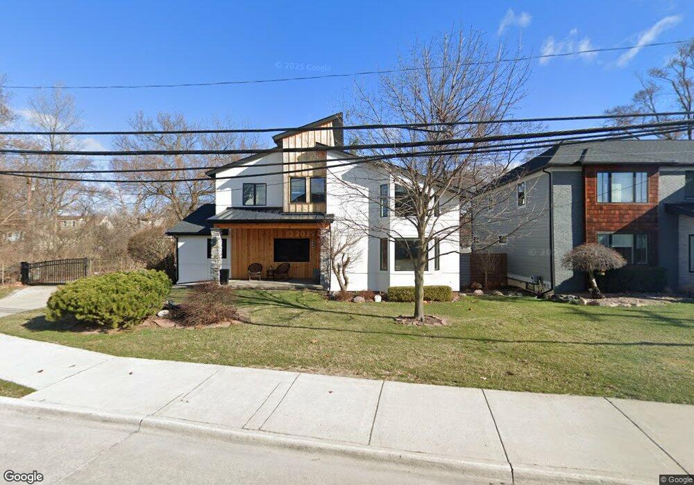
926 N Sherman Dr Royal Oak, MI 48067
Estimated Value: $394,000 - $798,000
3
Beds
5
Baths
2,302
Sq Ft
$261/Sq Ft
Est. Value
About This Home
This home is located at 926 N Sherman Dr, Royal Oak, MI 48067 and is currently estimated at $599,677, approximately $260 per square foot. 926 N Sherman Dr is a home located in Oakland County with nearby schools including Northwood Elementary School, Royal Oak Middle School, and Royal Oak High School.
Ownership History
Date
Name
Owned For
Owner Type
Purchase Details
Closed on
Aug 27, 2018
Sold by
Lifter Michelle
Bought by
Lifter Matthew
Current Estimated Value
Home Financials for this Owner
Home Financials are based on the most recent Mortgage that was taken out on this home.
Original Mortgage
$150,000
Outstanding Balance
$92,366
Interest Rate
4.5%
Mortgage Type
New Conventional
Estimated Equity
$507,311
Purchase Details
Closed on
Jun 29, 2001
Sold by
Mccallum Garth G
Bought by
Lifter Matt
Home Financials for this Owner
Home Financials are based on the most recent Mortgage that was taken out on this home.
Original Mortgage
$117,500
Interest Rate
7.03%
Create a Home Valuation Report for This Property
The Home Valuation Report is an in-depth analysis detailing your home's value as well as a comparison with similar homes in the area
Home Values in the Area
Average Home Value in this Area
Purchase History
| Date | Buyer | Sale Price | Title Company |
|---|---|---|---|
| Lifter Matthew | -- | None Available | |
| Lifter Matt | $175,000 | -- |
Source: Public Records
Mortgage History
| Date | Status | Borrower | Loan Amount |
|---|---|---|---|
| Open | Lifter Matthew | $150,000 | |
| Previous Owner | Lifter Matt | $117,500 |
Source: Public Records
Tax History Compared to Growth
Tax History
| Year | Tax Paid | Tax Assessment Tax Assessment Total Assessment is a certain percentage of the fair market value that is determined by local assessors to be the total taxable value of land and additions on the property. | Land | Improvement |
|---|---|---|---|---|
| 2024 | $5,954 | $332,730 | $0 | $0 |
| 2022 | $4,770 | $153,880 | $0 | $0 |
| 2020 | $5,786 | $138,420 | $0 | $0 |
| 2018 | $4,770 | $121,220 | $0 | $0 |
| 2017 | $4,585 | $121,220 | $0 | $0 |
| 2015 | -- | $114,650 | $0 | $0 |
| 2014 | -- | $109,570 | $0 | $0 |
| 2011 | -- | $101,690 | $0 | $0 |
Source: Public Records
Map
Nearby Homes
- 1051 N Sherman Dr Unit 19
- 506 Hilldale Dr
- 300 Baker St
- 400 Josephine Ave
- 1027 W Eleven Mile Rd
- 1320 Hartrick Ave
- 713 W Farnum Ave
- 800 Lockwood Rd
- 479 Cambridge Rd
- 212 S Maple Ave
- 640 W 11 Mile Rd
- 642 W 11 Mile Rd
- 686 Princeton Rd
- 821 Forestdale Rd
- 402 N West St
- 934 Lockwood Rd
- 414 Oakland Ave
- 800 Cambridge Rd
- 828 Princeton Rd
- 820 Oakridge Ave
- 1005 Park Ave
- 920 N Sherman Dr
- 921 Park Ave
- N Sherman Dr Unit 3, UNIT 9
- 927 Park Ave
- 0 N Sherman Dr
- 917 Park Ave
- 411 Maxwell Ave
- 1009 Park Ave
- 401 Maxwell Ave
- 929 N Sherman Dr
- 911 Park Ave
- 407 Maxwell Ave
- 315 Maxwell Ave
- 1015 Park Ave
- 1019 Park Ave
- 907 Park Ave
- 1025 Park Ave
- 917 N Sherman Dr
- 305 Maxwell Ave