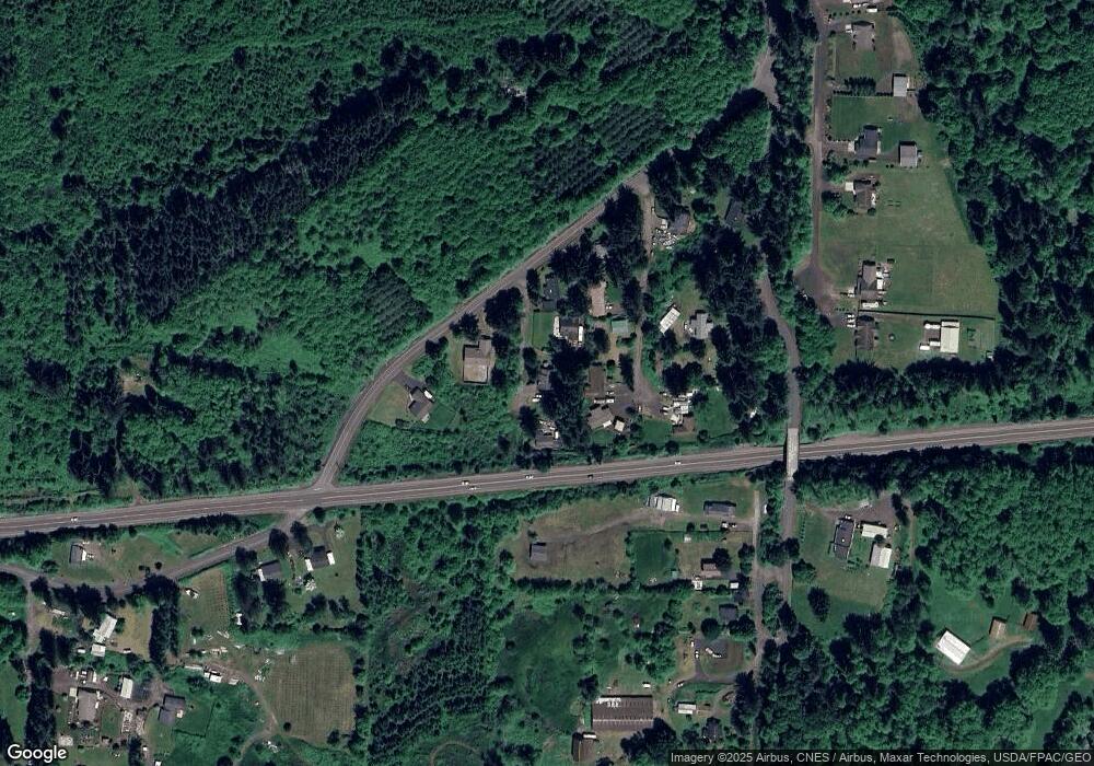
92620 Laurel Rd Astoria, OR 97103
Estimated Value: $411,756 - $481,000
3
Beds
2
Baths
1,439
Sq Ft
$314/Sq Ft
Est. Value
About This Home
This home is located at 92620 Laurel Rd, Astoria, OR 97103 and is currently estimated at $451,439, approximately $313 per square foot. 92620 Laurel Rd is a home located in Clatsop County with nearby schools including Hilda Lahti Elementary School and Knappa High School.
Ownership History
Date
Name
Owned For
Owner Type
Purchase Details
Closed on
Sep 4, 2008
Sold by
Feldscher Steven E and Feldscher Tracy L
Bought by
Millang Shawn and Millang Katrina D
Current Estimated Value
Home Financials for this Owner
Home Financials are based on the most recent Mortgage that was taken out on this home.
Original Mortgage
$229,326
Outstanding Balance
$152,421
Interest Rate
6.59%
Mortgage Type
VA
Estimated Equity
$299,018
Create a Home Valuation Report for This Property
The Home Valuation Report is an in-depth analysis detailing your home's value as well as a comparison with similar homes in the area
Home Values in the Area
Average Home Value in this Area
Purchase History
| Date | Buyer | Sale Price | Title Company |
|---|---|---|---|
| Millang Shawn | $222,000 | Fidelity National Title Co |
Source: Public Records
Mortgage History
| Date | Status | Borrower | Loan Amount |
|---|---|---|---|
| Open | Millang Shawn | $229,326 |
Source: Public Records
Tax History Compared to Growth
Tax History
| Year | Tax Paid | Tax Assessment Tax Assessment Total Assessment is a certain percentage of the fair market value that is determined by local assessors to be the total taxable value of land and additions on the property. | Land | Improvement |
|---|---|---|---|---|
| 2025 | $2,454 | $209,397 | -- | -- |
| 2024 | $2,398 | $203,299 | -- | -- |
| 2023 | $2,314 | $197,379 | $0 | $0 |
| 2022 | $2,269 | $191,631 | $0 | $0 |
| 2021 | $1,763 | $186,050 | $0 | $0 |
| 2020 | $1,986 | $180,632 | $0 | $0 |
| 2019 | $1,919 | $175,372 | $0 | $0 |
| 2018 | $1,822 | $170,265 | $0 | $0 |
| 2017 | $1,742 | $165,307 | $0 | $0 |
| 2016 | $1,917 | $160,493 | $33,567 | $126,926 |
| 2015 | $1,855 | $155,820 | $32,590 | $123,230 |
| 2014 | $2,065 | $151,282 | $0 | $0 |
| 2013 | -- | $146,877 | $0 | $0 |
Source: Public Records
Map
Nearby Homes
- 43018 Hillcrest Loop
- 41965 Wickiup Terrace Ln
- 0 V L 19 97ac Hillcrest Loop
- 0 Crest Dr Unit 300 24581166
- V/L .50ac Crest Dr
- 92201 Crest Dr
- 0 Knappa Dock Rd
- 0 Adj To 93101 Knappa Dock Rd
- 0 Homestead Ln Unit 704840619
- 0 Homestead Ln Unit 25-950
- 93270 Knappa Platt Rd
- 04101 Hillcrest Loop
- 0 Hillcrest Loop Unit 4101
- 0 Hillcrest Loop Unit 432066736
- 92700 Holly Ln
- 92700 Holly Rd
- 92693 Tt Larson Rd
- 92693 T Larson Rd
- 40801 Savola Ln
- 41138 Hillcrest Loop
- 92610 Laurel Rd
- 0 Laurel Rd
- 42152 Old Highway 30
- 92624 Laurel Rd
- 92682 Hawthorne Rd
- 42120 Old Hwy 30
- 42120 Old Highway 30
- 92634 Laurel Rd
- 92683 Hawthorne Rd
- 92700 Maggie Johnson Rd
- 92644 Maggie Johnson Rd
- 92735 Hawthorne Rd
- 92642 Maggie Johnson Rd
- 42080 Old Highway 30
- 92630 Maggie Johnson Rd
- 92730 Maggie Johnson Rd
- 42072 Old Highway 30
- 92703 Little Creek Rd
- 42072 Old Highway 30
- 42072 Old Us Highway 30
