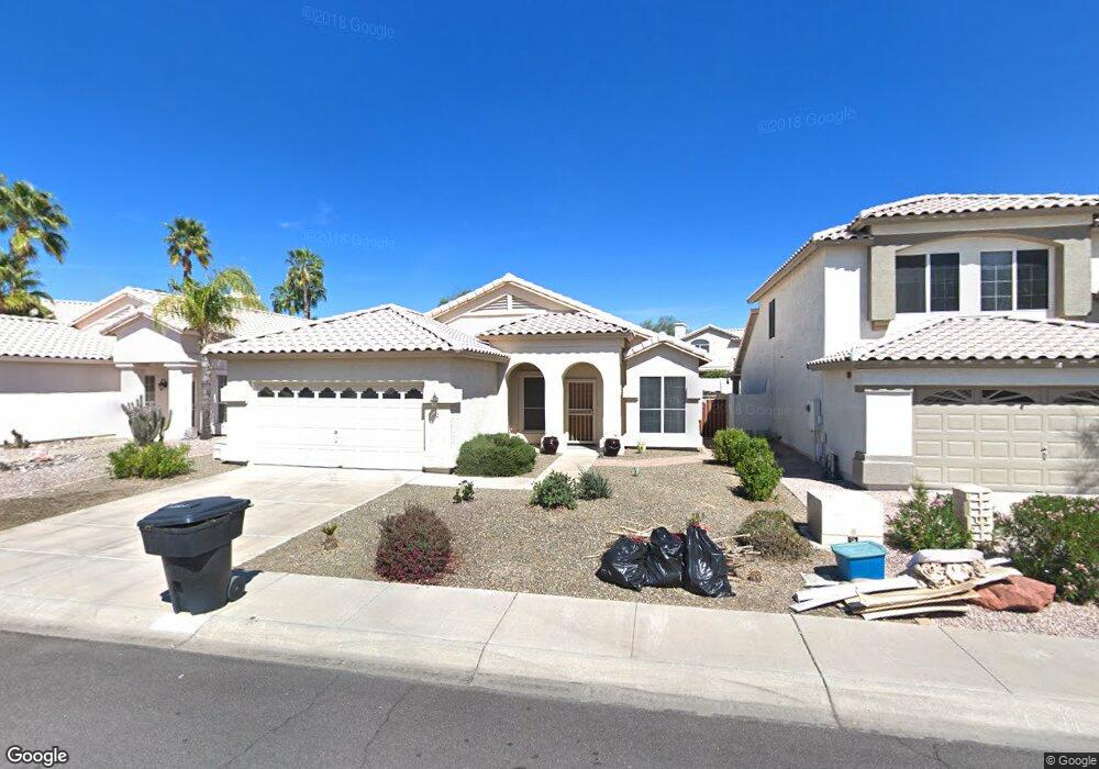
9264 E Karen Dr Scottsdale, AZ 85260
Horizons NeighborhoodEstimated Value: $598,735 - $778,000
3
Beds
2
Baths
1,800
Sq Ft
$399/Sq Ft
Est. Value
About This Home
This home is located at 9264 E Karen Dr, Scottsdale, AZ 85260 and is currently estimated at $718,184, approximately $398 per square foot. 9264 E Karen Dr is a home located in Maricopa County with nearby schools including Redfield Elementary School, Desert Canyon Middle School, and Desert Mountain High School.
Ownership History
Date
Name
Owned For
Owner Type
Purchase Details
Closed on
May 23, 2003
Sold by
Lomonaco Pasquale and Lomonaco Eugenia
Bought by
Thompson Linda A
Current Estimated Value
Home Financials for this Owner
Home Financials are based on the most recent Mortgage that was taken out on this home.
Original Mortgage
$130,000
Interest Rate
5.13%
Mortgage Type
New Conventional
Purchase Details
Closed on
Sep 6, 2001
Sold by
Corpus Christopher P and Corpus Lindis N
Bought by
Monaco Pasquale Lo and Monaco Eugenia Lo
Purchase Details
Closed on
Mar 12, 1997
Sold by
Mares Carroll
Bought by
Corpus Christopher P and Corpus Lindis N
Home Financials for this Owner
Home Financials are based on the most recent Mortgage that was taken out on this home.
Original Mortgage
$142,200
Interest Rate
7.63%
Mortgage Type
New Conventional
Create a Home Valuation Report for This Property
The Home Valuation Report is an in-depth analysis detailing your home's value as well as a comparison with similar homes in the area
Home Values in the Area
Average Home Value in this Area
Purchase History
| Date | Buyer | Sale Price | Title Company |
|---|---|---|---|
| Thompson Linda A | $265,000 | Capital Title Agency Inc | |
| Monaco Pasquale Lo | $210,000 | Capital Title Agency Inc | |
| Corpus Christopher P | $158,000 | North American Title Agency |
Source: Public Records
Mortgage History
| Date | Status | Borrower | Loan Amount |
|---|---|---|---|
| Previous Owner | Thompson Linda A | $130,000 | |
| Previous Owner | Corpus Christopher P | $142,200 |
Source: Public Records
Tax History Compared to Growth
Tax History
| Year | Tax Paid | Tax Assessment Tax Assessment Total Assessment is a certain percentage of the fair market value that is determined by local assessors to be the total taxable value of land and additions on the property. | Land | Improvement |
|---|---|---|---|---|
| 2025 | $2,281 | $38,260 | -- | -- |
| 2024 | $2,139 | $36,438 | -- | -- |
| 2023 | $2,139 | $48,010 | $9,600 | $38,410 |
| 2022 | $2,038 | $37,670 | $7,530 | $30,140 |
| 2021 | $2,210 | $34,480 | $6,890 | $27,590 |
| 2020 | $2,190 | $32,620 | $6,520 | $26,100 |
| 2019 | $2,125 | $31,160 | $6,230 | $24,930 |
| 2018 | $2,077 | $29,610 | $5,920 | $23,690 |
| 2017 | $1,959 | $29,460 | $5,890 | $23,570 |
| 2016 | $1,921 | $28,020 | $5,600 | $22,420 |
| 2015 | $1,846 | $26,480 | $5,290 | $21,190 |
Source: Public Records
Map
Nearby Homes
- 15550 N Frank Lloyd Wright Blvd Unit 1040
- 9080 E Karen Dr
- 15151 N Frank Lloyd Wright Blvd Unit 1088
- 9332 E Raintree Dr Unit 140
- 15050 N Thompson Peak Pkwy Unit 1041
- 15050 N Thompson Peak Pkwy Unit 2033
- 15050 N Thompson Peak Pkwy Unit 1001
- 15050 N Thompson Peak Pkwy Unit 2003
- 15050 N Thompson Peak Pkwy Unit 1035
- 15050 N Thompson Peak Pkwy Unit 2053
- 15050 N Thompson Peak Pkwy Unit 2006
- 15252 N 100th St Unit 1146
- 15252 N 100th St Unit 1153
- 15252 N 100th St Unit 2148
- 15252 N 100th St Unit 1147
- 15252 N 100th St Unit 1134
- 14450 N Thompson Peak Pkwy Unit 110
- 14450 N Thompson Peak Pkwy Unit 212
- 14450 N Thompson Peak Pkwy Unit 134
- 14450 N Thompson Peak Pkwy Unit 103
- 9272 E Karen Dr
- 9256 E Karen Dr
- 9280 E Karen Dr
- 9240 E Karen Dr
- 9259 E Caribbean Ln
- 9275 E Caribbean Ln
- 9223 E Caribbean Ln
- 9283 E Caribbean Ln
- 9288 E Karen Dr
- 9271 E Karen Dr
- 9224 E Karen Dr
- 9255 E Karen Dr
- 9279 E Karen Dr
- 9297 E Caribbean Ln
- 9247 E Karen Dr
- 9287 E Karen Dr
- 9207 E Caribbean Ln
- 9208 E Karen Dr
- 9305 E Caribbean Ln
- 9295 E Karen Dr