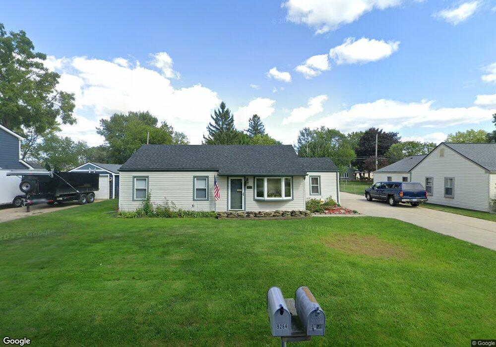
9264 Elmhurst Ave Plymouth, MI 48170
Estimated Value: $296,562 - $331,000
--
Bed
1
Bath
1,137
Sq Ft
$272/Sq Ft
Est. Value
About This Home
This home is located at 9264 Elmhurst Ave, Plymouth, MI 48170 and is currently estimated at $309,391, approximately $272 per square foot. 9264 Elmhurst Ave is a home located in Wayne County with nearby schools including Canton High School, Smith Elementary School, and West Middle School.
Ownership History
Date
Name
Owned For
Owner Type
Purchase Details
Closed on
Dec 19, 1994
Sold by
Chesterine S Stretanski
Bought by
Stocker Dennis P Payne and Stocker Patricia A
Current Estimated Value
Home Financials for this Owner
Home Financials are based on the most recent Mortgage that was taken out on this home.
Original Mortgage
$67,500
Interest Rate
9.24%
Mortgage Type
New Conventional
Create a Home Valuation Report for This Property
The Home Valuation Report is an in-depth analysis detailing your home's value as well as a comparison with similar homes in the area
Home Values in the Area
Average Home Value in this Area
Purchase History
| Date | Buyer | Sale Price | Title Company |
|---|---|---|---|
| Stocker Dennis P Payne | $75,000 | -- |
Source: Public Records
Mortgage History
| Date | Status | Borrower | Loan Amount |
|---|---|---|---|
| Closed | Stocker Dennis P Payne | $67,500 |
Source: Public Records
Tax History Compared to Growth
Tax History
| Year | Tax Paid | Tax Assessment Tax Assessment Total Assessment is a certain percentage of the fair market value that is determined by local assessors to be the total taxable value of land and additions on the property. | Land | Improvement |
|---|---|---|---|---|
| 2025 | $1,670 | $144,700 | $0 | $0 |
| 2024 | $1,670 | $127,400 | $0 | $0 |
| 2023 | $1,591 | $115,500 | $0 | $0 |
| 2022 | $2,116 | $101,200 | $0 | $0 |
| 2021 | $2,064 | $98,400 | $0 | $0 |
| 2019 | $1,996 | $88,380 | $0 | $0 |
| 2018 | $1,361 | $73,040 | $0 | $0 |
| 2017 | $952 | $28,700 | $0 | $0 |
| 2016 | $1,785 | $68,100 | $0 | $0 |
| 2015 | $5,700 | $62,470 | $0 | $0 |
| 2013 | $5,523 | $61,100 | $0 | $0 |
| 2012 | -- | $58,800 | $28,580 | $30,220 |
Source: Public Records
Map
Nearby Homes
- 9264 Brookline Ave
- 9230 Brookline Ave
- 9453 Brookline Ave
- 9405 Northern Ave
- 9060 N Sheldon Rd
- 8880 Elmhurst Ave
- 8870 Brookline Ave
- 8876 N Sheldon Rd
- 9101 Ball St
- 8845 Oakview St
- 1199 S Sheldon Rd Unit 77
- 1338 S Harvey St
- 44703 Erin Dr
- 1078 Simpson St
- 8830 Northern Ave
- 44750 Erin Dr Unit 40
- 8834 Northern Ave
- 44736 Lynn Dr
- 44877 Erin Dr Unit 2
- 0 Joy Rd Unit Parcel 3
- 9252 Elmhurst Ave
- 9282 Elmhurst Ave
- 9245 Marlowe Ave
- 9261 Marlowe Ave
- 9294 Elmhurst Ave
- 9234 Elmhurst Ave
- 9231 Marlowe Ave
- 9251 Elmhurst Ave
- 9275 Marlowe Ave
- 9271 Elmhurst Ave
- 9215 Marlowe Ave
- 9224 Elmhurst Ave
- 9231 Elmhurst Ave
- 9277 Elmhurst Ave
- 9295 Marlowe Ave
- 9225 Elmhurst Ave
- 9205 Marlowe Ave
- 9208 Elmhurst Ave
- 9314 Elmhurst Ave
- 9200 Marlowe Ave