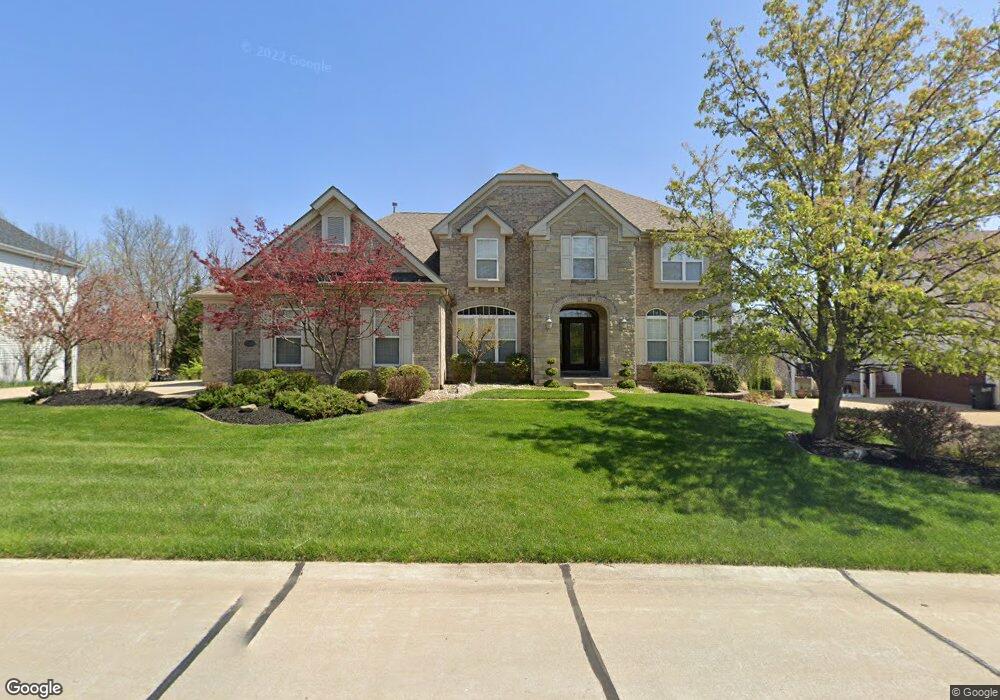
9268 Caddyshack Cir Saint Louis, MO 63127
Estimated Value: $1,040,020 - $1,404,000
4
Beds
4
Baths
4,764
Sq Ft
$253/Sq Ft
Est. Value
About This Home
This home is located at 9268 Caddyshack Cir, Saint Louis, MO 63127 and is currently estimated at $1,207,255, approximately $253 per square foot. 9268 Caddyshack Cir is a home located in St. Louis County with nearby schools including Concord Elementary School, Sperreng Middle School, and Lindbergh High School.
Ownership History
Date
Name
Owned For
Owner Type
Purchase Details
Closed on
Aug 7, 2003
Sold by
The Jones Co Homes Llc
Bought by
Aoun Michael C and Sanders Aoun Kathleen A
Current Estimated Value
Home Financials for this Owner
Home Financials are based on the most recent Mortgage that was taken out on this home.
Original Mortgage
$400,000
Outstanding Balance
$155,280
Interest Rate
4%
Mortgage Type
Purchase Money Mortgage
Estimated Equity
$1,051,975
Create a Home Valuation Report for This Property
The Home Valuation Report is an in-depth analysis detailing your home's value as well as a comparison with similar homes in the area
Home Values in the Area
Average Home Value in this Area
Purchase History
| Date | Buyer | Sale Price | Title Company |
|---|---|---|---|
| Aoun Michael C | $525,606 | -- |
Source: Public Records
Mortgage History
| Date | Status | Borrower | Loan Amount |
|---|---|---|---|
| Open | Aoun Michael C | $400,000 | |
| Closed | Aoun Michael C | $45,000 |
Source: Public Records
Tax History
| Year | Tax Paid | Tax Assessment Tax Assessment Total Assessment is a certain percentage of the fair market value that is determined by local assessors to be the total taxable value of land and additions on the property. | Land | Improvement |
|---|---|---|---|---|
| 2025 | $10,240 | $162,790 | $31,080 | $131,710 |
| 2024 | $10,240 | $143,200 | $23,310 | $119,890 |
| 2023 | $10,218 | $143,200 | $23,310 | $119,890 |
| 2022 | $10,330 | $139,250 | $23,310 | $115,940 |
| 2021 | $10,278 | $139,250 | $23,310 | $115,940 |
| 2020 | $9,714 | $127,050 | $18,600 | $108,450 |
| 2019 | $9,688 | $127,050 | $18,600 | $108,450 |
| 2018 | $10,091 | $123,710 | $11,650 | $112,060 |
| 2017 | $9,983 | $123,710 | $11,650 | $112,060 |
| 2016 | $8,626 | $106,970 | $11,650 | $95,320 |
Source: Public Records
Map
Nearby Homes
- 12932 Sunset Bluff Ct
- 13013 Stone Castle Ct
- 28 Black Oak Dr
- 12838 Weber Hill Rd
- 12830 Weber Hill Rd
- 12871 Weber Hill Rd
- 12685 Alberts Laumeier Ct
- 13310 W Watson Rd
- 0 Unknown Unit MIS25071866
- 0 Unknown Unit MIS25071884
- 9515 Country Club Green
- 12420 Rott Rd Unit 1B
- 12420 Rott Rd Unit 2B
- 12420 Rott Rd Unit 2A
- 12415 Court Dr
- 9418 Sunset Reserve Dr
- 12259 Sunset Reserve Ct
- 12410 Grandview Lake Dr
- 9320 Lincoln Dr
- 118 Monica Dr
- 9272 Caddyshack Cir
- 9264 Caddyshack Cir
- 9276 Caddyshack Cir
- 9261 Caddyshack Cir
- 9260 Caddyshack Cir
- 9256 Caddyshack Cir
- 13041 Pagada Pkwy
- 9252 Caddyshack Cir
- 9306 Caddyshack Cir
- 13037 Pagada Pkwy
- 9310 Caddyshack Cir
- 13033 Pagada Pkwy
- 9307 Caddyshack Cir
- 13029 Pagada Pkwy
- 9314 Caddyshack Cir
- 9266 Rott Rd
- 13025 Pagada Pkwy
- 9315 Caddyshack Cir
- 9318 Caddyshack Cir
- 13008 Sunny Dawn Ct
Your Personal Tour Guide
Ask me questions while you tour the home.