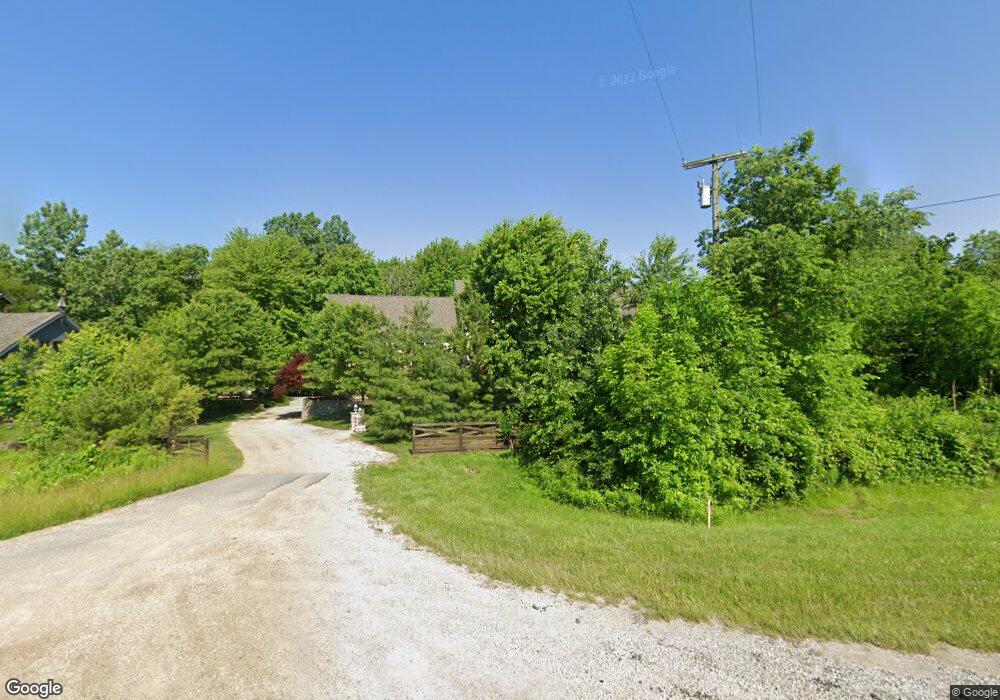
9269 Us Highway 42 N Plain City, OH 43064
Estimated Value: $668,000 - $849,960
4
Beds
3
Baths
2,954
Sq Ft
$253/Sq Ft
Est. Value
About This Home
This home is located at 9269 Us Highway 42 N, Plain City, OH 43064 and is currently estimated at $746,490, approximately $252 per square foot. 9269 Us Highway 42 N is a home located in Union County with nearby schools including Plain City Elementary School, Jonathan Alder Junior High School, and Canaan Middle School.
Ownership History
Date
Name
Owned For
Owner Type
Purchase Details
Closed on
Mar 14, 2008
Sold by
Icenhour Dustin and Icenhour Jennifer
Bought by
Icenhour Dustin M and Icenhour Robert L
Current Estimated Value
Home Financials for this Owner
Home Financials are based on the most recent Mortgage that was taken out on this home.
Original Mortgage
$188,790
Outstanding Balance
$119,867
Interest Rate
6.1%
Mortgage Type
New Conventional
Estimated Equity
$626,623
Purchase Details
Closed on
Nov 14, 2003
Sold by
Southard Thomas S and Southard Tamara L
Bought by
Icenhour Dustin
Purchase Details
Closed on
Sep 28, 2001
Sold by
Boyhan John T
Bought by
Southard Thomas S
Create a Home Valuation Report for This Property
The Home Valuation Report is an in-depth analysis detailing your home's value as well as a comparison with similar homes in the area
Home Values in the Area
Average Home Value in this Area
Purchase History
| Date | Buyer | Sale Price | Title Company |
|---|---|---|---|
| Icenhour Dustin M | -- | Attorney | |
| Icenhour Dustin | $32,000 | -- | |
| Southard Thomas S | $23,000 | -- |
Source: Public Records
Mortgage History
| Date | Status | Borrower | Loan Amount |
|---|---|---|---|
| Open | Icenhour Dustin M | $188,790 |
Source: Public Records
Tax History Compared to Growth
Tax History
| Year | Tax Paid | Tax Assessment Tax Assessment Total Assessment is a certain percentage of the fair market value that is determined by local assessors to be the total taxable value of land and additions on the property. | Land | Improvement |
|---|---|---|---|---|
| 2024 | $10,022 | $259,490 | $32,800 | $226,690 |
| 2023 | $10,022 | $259,490 | $32,800 | $226,690 |
| 2022 | $10,241 | $259,490 | $32,800 | $226,690 |
| 2021 | $8,512 | $203,740 | $25,230 | $178,510 |
| 2020 | $8,119 | $203,740 | $25,230 | $178,510 |
| 2019 | $8,063 | $203,140 | $25,230 | $177,910 |
| 2018 | $7,773 | $190,310 | $21,120 | $169,190 |
| 2017 | $7,765 | $190,310 | $21,120 | $169,190 |
| 2016 | $7,829 | $190,310 | $21,120 | $169,190 |
| 2015 | $6,437 | $149,370 | $21,120 | $128,250 |
| 2014 | $6,428 | $149,370 | $21,120 | $128,250 |
| 2013 | $7,198 | $165,790 | $21,120 | $144,670 |
Source: Public Records
Map
Nearby Homes
- 10119 Biscayne Ct
- 10035 Corona Ln
- 9530 Mission Dr
- 10205 Coronado Ct
- 9617 New California Dr
- 9601 Bur Oak Dr Unit Lot 148
- 9561 Bur Oak Dr Unit Lot 152
- 9602 Bur Oak Dr Unit Lot 119
- 11033 Sacramento Ct
- 9755 Fresno Ct
- 9288 Horseshoe St
- Mercer Plan at Pioneer Crossing
- Bedford Plan at Pioneer Crossing
- Newberry Plan at Pioneer Crossing
- Linwood Plan at Pioneer Crossing
- Alcott Plan at Pioneer Crossing
- Continental Plan at Pioneer Crossing
- Countryview Plan at Pioneer Crossing
- 10589 Laguna Cir
- 10260 Carmel Dr
- 9254 Us Highway 42 N
- 9324 U S 42
- 9324 Us Highway 42 N Unit 42
- 9324 Us Highway 42 N
- 9190 North St
- 282- North St
- 259 North St
- 249 North St
- 9123 North St
- 9040 Currier Rd
- 9171 Us Highway 42 N
- 9220 North St
- 9187 North St
- 9170 Railroad St
- 9161 Us Highway 42 N
- 9188 Railroad St
- 9270 North St
- 10129 Corona Ln
- 9204 Railroad St
- 9245 North St