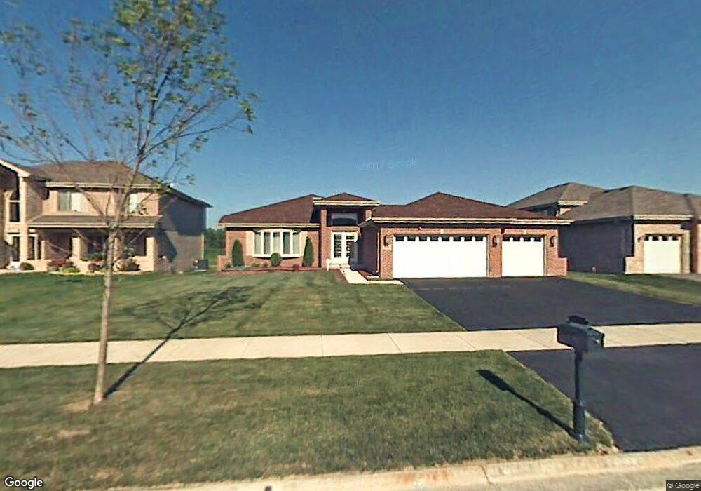
927 Destiny Dr Matteson, IL 60443
West Matteson NeighborhoodEstimated Value: $389,000 - $429,000
About This Home
This home is located at 927 Destiny Dr, Matteson, IL 60443 and is currently estimated at $409,396, approximately $177 per square foot. 927 Destiny Dr is a home located in Cook County with nearby schools including Colin Powell Middle School.
Ownership History
We collect this data history from publicly available records. To have your information removed, we recommend requesting removal directly through your county’s website.
Purchase Details
Home Financials for this Owner
Home Financials are based on the most recent Mortgage that was taken out on this home.Purchase Details
Purchase Details
Home Financials for this Owner
Home Financials are based on the most recent Mortgage that was taken out on this home.Home Values in the Area
Average Home Value in this Area
Purchase History
We collect this data history from publicly available records. To have your information removed, we recommend requesting removal directly through your county’s website.
| Date | Buyer | Sale Price | Title Company |
|---|---|---|---|
| -- | None Listed On Document | ||
| -- | None Listed On Document | ||
| -- | None Available | ||
| $322,500 | Cti |
Mortgage History
We collect this data history from publicly available records. To have your information removed, we recommend requesting removal directly through your county’s website.
| Date | Status | Borrower | Loan Amount |
|---|---|---|---|
| Previous Owner | $161,000 | ||
| Previous Owner | $176,000 |
Tax History
We collect this data history from publicly available records. To have your information removed, we recommend requesting removal directly through your county’s website.
| Year | Tax Paid | Tax Assessment Tax Assessment Total Assessment is a certain percentage of the fair market value that is determined by local assessors to be the total taxable value of land and additions on the property. | Land | Improvement |
|---|---|---|---|---|
| 2025 | $11,206 | $33,000 | $4,930 | $28,070 |
| 2024 | $11,206 | $33,000 | $4,930 | $28,070 |
| 2023 | $8,664 | $33,000 | $4,930 | $28,070 |
| 2022 | $8,664 | $22,341 | $4,314 | $18,027 |
| 2021 | $8,833 | $22,339 | $4,313 | $18,026 |
| 2020 | $8,750 | $22,339 | $4,313 | $18,026 |
| 2019 | $9,373 | $23,327 | $4,005 | $19,322 |
| 2018 | $9,231 | $23,327 | $4,005 | $19,322 |
| 2017 | $9,032 | $23,327 | $4,005 | $19,322 |
| 2016 | $8,310 | $20,339 | $3,697 | $16,642 |
| 2015 | $8,050 | $20,339 | $3,697 | $16,642 |
| 2014 | $8,902 | $22,411 | $3,697 | $18,714 |
| 2013 | $9,150 | $24,397 | $3,697 | $20,700 |
Map
- 1038 Regent Dr
- 997 Regent Dr
- 6216 Pond View Dr
- 818 Princeton Ave
- 21158 Sophia Dr
- 5631 Colgate Ln
- 6159 Marsh Ln
- 21223 Alessandra Dr
- 21154 Whitney Dr
- 911 Berry Path Trail Unit 1191
- 21229 Sophia Dr
- 5503 Georgetown Dr
- 918 Notre Dame Dr
- 848 Notre Dame Dr
- 651 Central Ave
- 21143 Gray Hawk Dr Unit 2554
- 6403 Blue Sky Ln Unit 2532
- 0 Ridgeland Ave
- 6503 Blue Sky Ln Unit 2502
- 6500 Pasture Side Trail
- 923 Destiny Dr
- 935 Destiny Dr
- 919 Destiny Dr
- 5933 Newbury Ln
- 5850 Amherst Place
- 915 Destiny Dr
- 939 Destiny Dr
- 930 Destiny Dr
- 5932 Newbury Ln
- 5949 Newbury Ln
- 911 Destiny Dr
- 934 Destiny Dr
- 5948 Newbury Ln
- 938 Destiny Dr
- 910 Destiny Dr
- 921 Warwick Dr
- 907 Destiny Dr
- 925 Warwick Dr
- 5901 Amherst Place
- 5865 Amherst Place
Ask me questions while you tour the home.