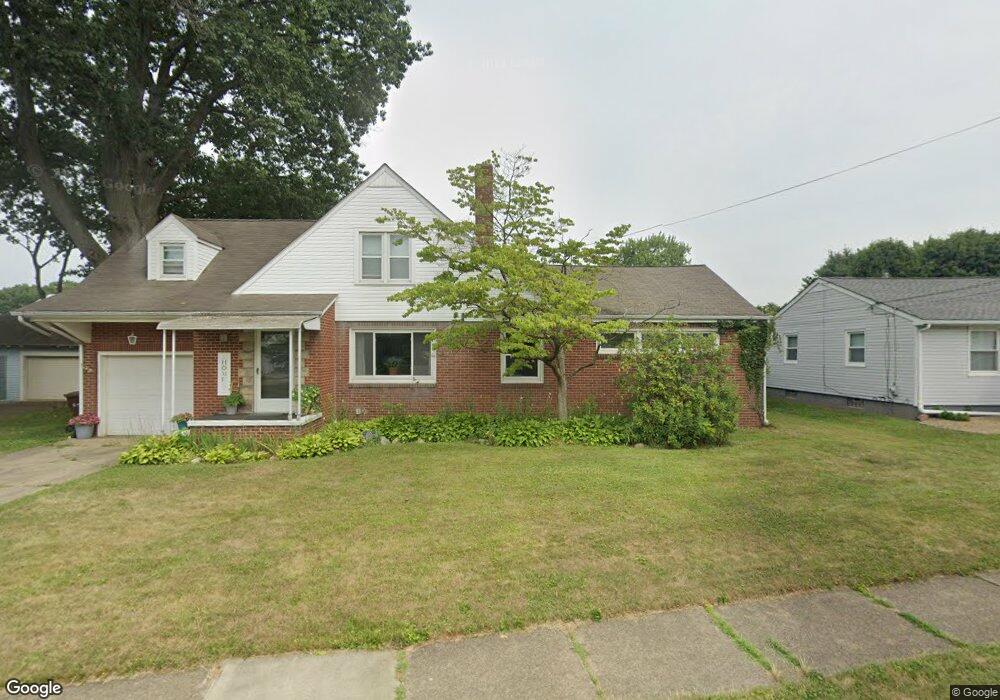
927 E Gorgas St Louisville, OH 44641
Estimated Value: $178,000 - $207,000
3
Beds
2
Baths
1,765
Sq Ft
$107/Sq Ft
Est. Value
About This Home
This home is located at 927 E Gorgas St, Louisville, OH 44641 and is currently estimated at $188,343, approximately $106 per square foot. 927 E Gorgas St is a home located in Stark County with nearby schools including Louisville High School and St. Thomas Aquinas High School & Middle School.
Ownership History
Date
Name
Owned For
Owner Type
Purchase Details
Closed on
Dec 28, 1994
Sold by
Domer Janet C
Bought by
Meister Scott A and Meister Torrie
Current Estimated Value
Home Financials for this Owner
Home Financials are based on the most recent Mortgage that was taken out on this home.
Original Mortgage
$66,100
Interest Rate
8%
Mortgage Type
New Conventional
Create a Home Valuation Report for This Property
The Home Valuation Report is an in-depth analysis detailing your home's value as well as a comparison with similar homes in the area
Home Values in the Area
Average Home Value in this Area
Purchase History
| Date | Buyer | Sale Price | Title Company |
|---|---|---|---|
| Meister Scott A | $82,700 | -- |
Source: Public Records
Mortgage History
| Date | Status | Borrower | Loan Amount |
|---|---|---|---|
| Closed | Meister Scott A | $66,100 |
Source: Public Records
Tax History Compared to Growth
Tax History
| Year | Tax Paid | Tax Assessment Tax Assessment Total Assessment is a certain percentage of the fair market value that is determined by local assessors to be the total taxable value of land and additions on the property. | Land | Improvement |
|---|---|---|---|---|
| 2025 | -- | $49,560 | $15,190 | $34,370 |
| 2024 | -- | $49,560 | $15,190 | $34,370 |
| 2023 | $1,822 | $42,390 | $11,970 | $30,420 |
| 2022 | $1,828 | $42,390 | $11,970 | $30,420 |
| 2021 | $1,833 | $42,390 | $11,970 | $30,420 |
| 2020 | $1,536 | $38,570 | $10,780 | $27,790 |
| 2019 | $1,800 | $45,050 | $10,780 | $34,270 |
| 2018 | $1,793 | $45,050 | $10,780 | $34,270 |
| 2017 | $1,656 | $40,150 | $8,680 | $31,470 |
| 2016 | $1,690 | $40,150 | $8,680 | $31,470 |
| 2015 | $1,695 | $40,150 | $8,680 | $31,470 |
| 2014 | $1,647 | $36,260 | $7,840 | $28,420 |
| 2013 | $827 | $36,260 | $7,840 | $28,420 |
Source: Public Records
Map
Nearby Homes
- 308 Superior St
- 728 E Broad St
- 520 S Silver St
- 641 S Nickelplate St
- 0 Michigan Blvd
- 325 Lincoln Ave
- 204 E Broad St
- 107 E Broad St
- 1170 Winding Ridge Ave
- 1812 E Broad St
- 910 Crosswyck Cir
- 428 Honeycrisp Dr NE
- 3047 Mcintosh Dr NE
- 432 Honeycrisp Dr NE
- 2962 Mcintosh Dr NE
- 2963 Mcintosh Dr NE
- 430 Honeycrisp Dr NE
- 2957 Mcintosh Dr NE
- 2015 E Main St
- 300 Kennedy St
- 935 E Gorgas St
- 921 E Gorgas St
- 922 Schaffer Ct
- 920 Schaffer Ct
- 1007 E Gorgas St
- 917 E Gorgas St
- 930 E Gorgas St
- 1011 E Gorgas St
- 926 E Gorgas St
- 934 E Gorgas St
- 930 E Main St
- 924 E Main St
- 1000 E Main St
- 918 E Main St
- 1015 E Gorgas St
- 1006 E Gorgas St
- 916 E Gorgas St
- 905 E Gorgas St
- 206 S Silver St
- 206 S Silver St