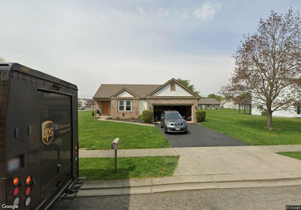
927 Lateglow Ct Newark, OH 43055
Estimated Value: $291,000 - $325,000
3
Beds
2
Baths
1,514
Sq Ft
$200/Sq Ft
Est. Value
About This Home
This home is located at 927 Lateglow Ct, Newark, OH 43055 and is currently estimated at $303,468, approximately $200 per square foot. 927 Lateglow Ct is a home located in Licking County with nearby schools including Legend Elementary School, Liberty Middle School, and Newark High School.
Ownership History
Date
Name
Owned For
Owner Type
Purchase Details
Closed on
Feb 2, 1996
Sold by
Sovereign Dev
Bought by
Sole Steven J and Sole Rene
Current Estimated Value
Home Financials for this Owner
Home Financials are based on the most recent Mortgage that was taken out on this home.
Original Mortgage
$99,350
Interest Rate
7.24%
Mortgage Type
Balloon
Purchase Details
Closed on
Dec 22, 1995
Sold by
Owen Potato Farm Inc
Bought by
Sovereign Dev Corp
Home Financials for this Owner
Home Financials are based on the most recent Mortgage that was taken out on this home.
Original Mortgage
$99,350
Interest Rate
7.24%
Mortgage Type
Balloon
Create a Home Valuation Report for This Property
The Home Valuation Report is an in-depth analysis detailing your home's value as well as a comparison with similar homes in the area
Home Values in the Area
Average Home Value in this Area
Purchase History
| Date | Buyer | Sale Price | Title Company |
|---|---|---|---|
| Sole Steven J | $112,300 | -- | |
| Sovereign Dev Corp | $38,000 | -- |
Source: Public Records
Mortgage History
| Date | Status | Borrower | Loan Amount |
|---|---|---|---|
| Closed | Sole Steven J | $99,350 |
Source: Public Records
Tax History Compared to Growth
Tax History
| Year | Tax Paid | Tax Assessment Tax Assessment Total Assessment is a certain percentage of the fair market value that is determined by local assessors to be the total taxable value of land and additions on the property. | Land | Improvement |
|---|---|---|---|---|
| 2024 | $2,931 | $81,980 | $26,640 | $55,340 |
| 2023 | $1,788 | $81,980 | $26,640 | $55,340 |
| 2022 | $2,236 | $55,760 | $15,540 | $40,220 |
| 2021 | $2,345 | $55,760 | $15,540 | $40,220 |
| 2020 | $2,403 | $55,760 | $15,540 | $40,220 |
| 2019 | $2,258 | $50,580 | $10,360 | $40,220 |
| 2018 | $2,260 | $0 | $0 | $0 |
| 2017 | $2,130 | $0 | $0 | $0 |
| 2016 | $2,102 | $0 | $0 | $0 |
| 2015 | $2,122 | $0 | $0 | $0 |
| 2014 | $2,752 | $0 | $0 | $0 |
| 2013 | $3,030 | $0 | $0 | $0 |
Source: Public Records
Map
Nearby Homes
- 1006 Kingsbury Ct Unit 1006
- 584 Moull St Unit A
- 712 Stone Ridge Way
- 855 E Village Dr
- 473 Meadowbrook Dr
- 711 Sherwick Rd
- 440 Reverie Place
- 188 Meadow Dr
- 184 Meadow Dr
- 709 Meadow Dr
- 632 Granville Rd
- 979 Granville Rd
- 565 Granville St
- 245 Rugg Ave
- 227 N Quentin Rd
- 189 N Quentin Rd
- 425 N 11th St
- 181 S Quentin Rd
- 408 Granville St
- 498 Marion Manor Woods
- 935 Lateglow Ct
- 935 Late Glow Ct
- 936 Empire Dr
- 943 Lateglow Ct
- 930 Lateglow Ct
- 922 Lateglow Ct
- 914 Empire Dr
- 938 Lateglow Ct
- 938 Late Glow Ct
- 916 Lateglow Ct
- 907 Lateglow Ct
- 946 Lateglow Ct
- 951 Lateglow Ct
- 908 Empire Dr
- 952 Empire Dr
- 713 Midway Dr
- 954 Lateglow Ct
- 929 Adams Ave
- 921 Adams Ave
- 906 Lateglow Ct