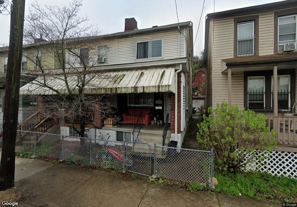
927 Robinson St Mc Kees Rocks, PA 15136
Stowe Township NeighborhoodEstimated Value: $62,000 - $70,000
3
Beds
1
Bath
1,081
Sq Ft
$60/Sq Ft
Est. Value
About This Home
This home is located at 927 Robinson St, Mc Kees Rocks, PA 15136 and is currently estimated at $65,333, approximately $60 per square foot. 927 Robinson St is a home located in Allegheny County with nearby schools including Sto-Rox Primary Center, Sto-Rox Upper Elementary School, and Sto-Rox Junior/Senior High School.
Ownership History
Date
Name
Owned For
Owner Type
Purchase Details
Closed on
Jul 20, 2018
Sold by
Community Home Alliance Llc
Bought by
Br4 Llc
Current Estimated Value
Home Financials for this Owner
Home Financials are based on the most recent Mortgage that was taken out on this home.
Original Mortgage
$14,500
Outstanding Balance
$12,594
Interest Rate
4.6%
Mortgage Type
Purchase Money Mortgage
Estimated Equity
$52,739
Purchase Details
Closed on
Feb 9, 2018
Sold by
Buzonas Theresa
Bought by
Community Home Alliance Llc A Pennsylvan
Purchase Details
Closed on
Sep 1, 1977
Bought by
Buzonas Leonard J and Buzonas Theresa
Create a Home Valuation Report for This Property
The Home Valuation Report is an in-depth analysis detailing your home's value as well as a comparison with similar homes in the area
Home Values in the Area
Average Home Value in this Area
Purchase History
| Date | Buyer | Sale Price | Title Company |
|---|---|---|---|
| Br4 Llc | $16,000 | Pv Settlement Llc | |
| Community Home Alliance Llc A Pennsylvan | $7,000 | Pv Settlement Llc | |
| Buzonas Leonard J | -- | -- |
Source: Public Records
Mortgage History
| Date | Status | Borrower | Loan Amount |
|---|---|---|---|
| Open | Br4 Llc | $14,500 |
Source: Public Records
Tax History Compared to Growth
Tax History
| Year | Tax Paid | Tax Assessment Tax Assessment Total Assessment is a certain percentage of the fair market value that is determined by local assessors to be the total taxable value of land and additions on the property. | Land | Improvement |
|---|---|---|---|---|
| 2025 | $653 | $15,500 | $3,400 | $12,100 |
| 2024 | $653 | $15,500 | $3,400 | $12,100 |
| 2023 | $627 | $15,500 | $3,400 | $12,100 |
| 2022 | $607 | $15,500 | $3,400 | $12,100 |
| 2021 | $592 | $15,500 | $3,400 | $12,100 |
| 2020 | $592 | $15,500 | $3,400 | $12,100 |
| 2019 | $592 | $15,500 | $3,400 | $12,100 |
| 2018 | $73 | $15,500 | $3,400 | $12,100 |
| 2017 | $578 | $15,500 | $3,400 | $12,100 |
| 2016 | $73 | $15,500 | $3,400 | $12,100 |
| 2015 | $73 | $15,500 | $3,400 | $12,100 |
| 2014 | $540 | $15,500 | $3,400 | $12,100 |
Source: Public Records
Map
Nearby Homes
- 755 Frederick St
- 27 Highland Ave
- 22 Harlem Ave
- 19 Shaw Ave
- 711 Fruit Way
- 709 Fruit Way
- 45 Harlem Ave
- 38 May Ave
- 82 Harlem Ave
- 109 Ella St
- 300 Helen St
- 125 Frazier Ave
- 1213 Island Ave
- 533 Woodward Ave
- 315 Catherine St
- 420 Broadway Ave
- 620 Broadway Ave
- 338 Catherine St
- 853 Railroad St
- 634 Broadway Ave
- 929 Robinson St
- 925 Robinson St
- 931 Robinson St
- 923 Robinson St
- 921 Robinson St
- 921 Robinson St Unit east side Ridge by p
- 919 Robinson St
- 919 Robinson St
- 933 Robinson St
- 922 Robinson St
- 917 Robinson St
- 937 Robinson St
- 920 Robinson St
- 915 Robinson St
- 918 Robinson St
- 908 Island Ave
- 920 Island Ave
- 916 Robinson St
- 913 Robinson St
- 914 Robinson St