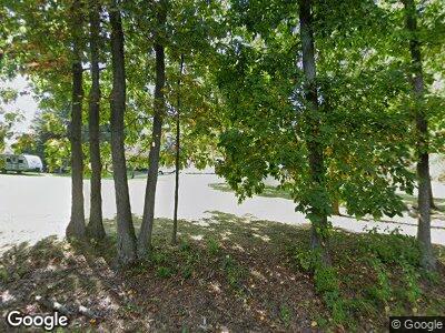
9270 2nd St Mattawan, MI 49071
Estimated Value: $317,000 - $464,000
3
Beds
3
Baths
1,680
Sq Ft
$225/Sq Ft
Est. Value
About This Home
This home is located at 9270 2nd St, Mattawan, MI 49071 and is currently estimated at $378,018, approximately $225 per square foot. 9270 2nd St is a home located in Kalamazoo County with nearby schools including Mattawan Early Elementary School, Mattawan Later Elementary School, and Mattawan Middle School.
Ownership History
Date
Name
Owned For
Owner Type
Purchase Details
Closed on
Mar 15, 2019
Sold by
Anderson Randy
Bought by
Marie Carley Nathan Aaron and Marie Anna Carley Samantha
Current Estimated Value
Home Financials for this Owner
Home Financials are based on the most recent Mortgage that was taken out on this home.
Original Mortgage
$202,950
Interest Rate
4.4%
Mortgage Type
New Conventional
Purchase Details
Closed on
Sep 27, 2018
Sold by
Anderson Dustin J and Anderson Samantha
Bought by
Anderson Randy
Purchase Details
Closed on
Apr 17, 2009
Sold by
Anderson Randy L and Anderson Joyce D
Bought by
Anderson Dustin J and Anderson Samantha
Home Financials for this Owner
Home Financials are based on the most recent Mortgage that was taken out on this home.
Original Mortgage
$69,600
Interest Rate
5.05%
Mortgage Type
Purchase Money Mortgage
Create a Home Valuation Report for This Property
The Home Valuation Report is an in-depth analysis detailing your home's value as well as a comparison with similar homes in the area
Home Values in the Area
Average Home Value in this Area
Purchase History
| Date | Buyer | Sale Price | Title Company |
|---|---|---|---|
| Marie Carley Nathan Aaron | $225,500 | Chicago Title Of Mi Inc | |
| Anderson Randy | $90,000 | None Available | |
| Anderson Dustin J | $87,000 | Chicago Title |
Source: Public Records
Mortgage History
| Date | Status | Borrower | Loan Amount |
|---|---|---|---|
| Open | Carley Nathan Aaron | $204,600 | |
| Closed | Marie Carley Nathan Aaron | $202,950 | |
| Previous Owner | Anderson Dustin J | $50,434 | |
| Previous Owner | Anderson Dustin J | $69,600 | |
| Previous Owner | Anderson Randy L | $50,000 |
Source: Public Records
Tax History Compared to Growth
Tax History
| Year | Tax Paid | Tax Assessment Tax Assessment Total Assessment is a certain percentage of the fair market value that is determined by local assessors to be the total taxable value of land and additions on the property. | Land | Improvement |
|---|---|---|---|---|
| 2024 | $1,209 | $146,200 | $0 | $0 |
| 2023 | $1,153 | $132,100 | $0 | $0 |
| 2022 | $3,495 | $118,700 | $0 | $0 |
| 2021 | $3,397 | $112,800 | $0 | $0 |
| 2020 | $3,290 | $97,600 | $0 | $0 |
| 2019 | $2,669 | $91,700 | $0 | $0 |
| 2018 | $1,804 | $83,600 | $0 | $0 |
| 2017 | -- | $84,600 | $0 | $0 |
| 2016 | -- | $83,100 | $0 | $0 |
| 2015 | -- | $87,000 | $21,100 | $65,900 |
| 2014 | -- | $87,000 | $0 | $0 |
Source: Public Records
Map
Nearby Homes
- 8774 W R Ave
- 8586 Brighten Trail
- 10737 Paw Lake Dr
- 8532 Brighten Trail
- 8262 Vinewood Point
- 8317 Barony Point
- 69434 22nd St
- 22240 60th Ave
- 8272 Bainbridge Dr
- 58693 Blue Stem Cir
- 58481 Blue Stem Cir
- 8197 Turning Stone
- 8114 Turning Stone
- 8074 Limestone Ridge
- 8450 W P Q Ave
- 8248 W Q Ave
- 8063 Turning Stone
- 7899 Turning Stone
- 7767 Port Hope Dr
- 23312 60th Ave
