Estimated Value: $356,857 - $605,000
3
Beds
3
Baths
--
Sq Ft
7,579
Sq Ft
About This Home
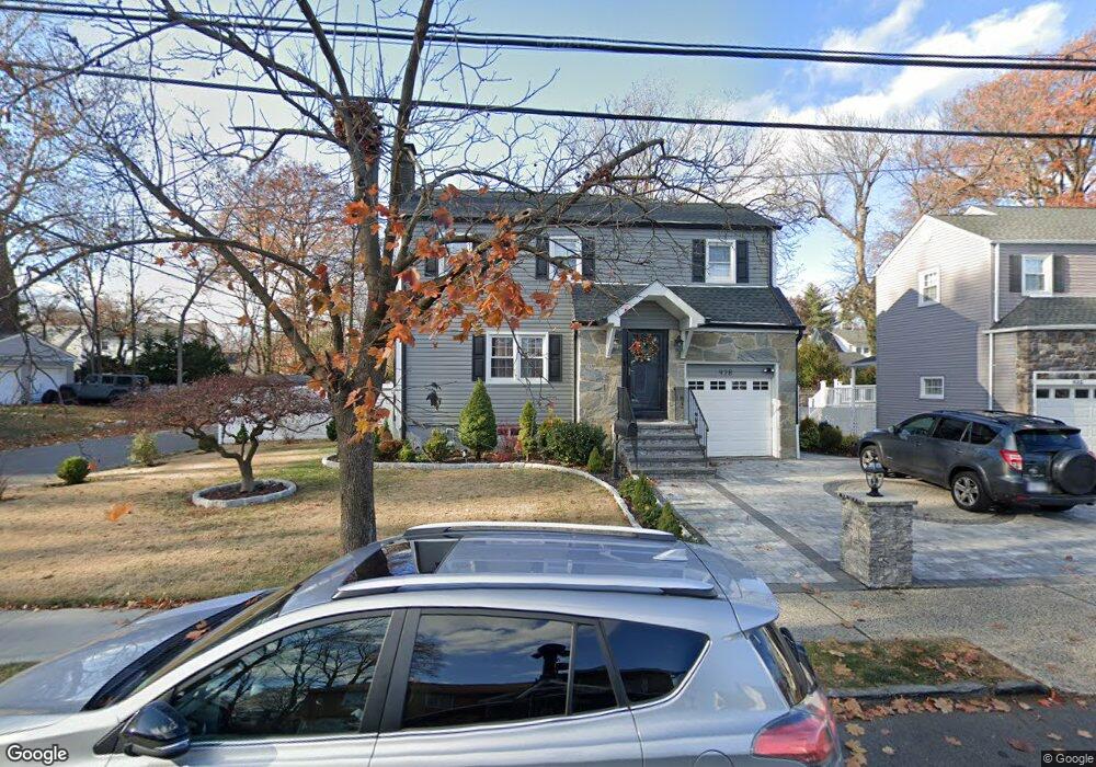
This home is located at 928 Arnet Ave, Union, NJ 07083 and is currently estimated at $507,714. 928 Arnet Ave is a home located in Union County with nearby schools including Livingston Elementary School and Union High School.
Ownership History
Date
Name
Owned For
Owner Type
Purchase Details
Closed on
Oct 25, 2004
Sold by
Dorcin Kately
Bought by
Pierre Murant Jean and Pierre Mireiele Jean
Current Estimated Value
Purchase Details
Closed on
Jun 22, 1998
Sold by
Becker Rose
Bought by
Dorcin Kately and Desir Algabin
Home Financials for this Owner
Home Financials are based on the most recent Mortgage that was taken out on this home.
Original Mortgage
$146,217
Interest Rate
7.04%
Mortgage Type
FHA
Create a Home Valuation Report for This Property
The Home Valuation Report is an in-depth analysis detailing your home's value as well as a comparison with similar homes in the area
Home Values in the Area
Average Home Value in this Area
Purchase History
| Date | Buyer | Sale Price | Title Company |
|---|---|---|---|
| Pierre Murant Jean | $310,000 | -- | |
| Dorcin Kately | $153,000 | Chicago Title Insurance Co |
Source: Public Records
Mortgage History
| Date | Status | Borrower | Loan Amount |
|---|---|---|---|
| Previous Owner | Dorcin Kately | $146,217 |
Source: Public Records
Tax History
| Year | Tax Paid | Tax Assessment Tax Assessment Total Assessment is a certain percentage of the fair market value that is determined by local assessors to be the total taxable value of land and additions on the property. | Land | Improvement |
|---|---|---|---|---|
| 2025 | $11,466 | $51,300 | $21,800 | $29,500 |
| 2024 | $11,116 | $51,300 | $21,800 | $29,500 |
| 2023 | $11,116 | $51,300 | $21,800 | $29,500 |
| 2022 | $10,730 | $51,300 | $21,800 | $29,500 |
| 2021 | $10,470 | $51,300 | $21,800 | $29,500 |
| 2020 | $10,261 | $51,300 | $21,800 | $29,500 |
| 2019 | $10,123 | $51,300 | $21,800 | $29,500 |
| 2018 | $9,951 | $51,300 | $21,800 | $29,500 |
| 2017 | $9,803 | $51,300 | $21,800 | $29,500 |
| 2016 | $9,564 | $51,300 | $21,800 | $29,500 |
| 2015 | $9,406 | $51,300 | $21,800 | $29,500 |
| 2014 | $9,195 | $51,300 | $21,800 | $29,500 |
Source: Public Records
Map
Nearby Homes
- 969 Arnet Ave
- 985 Arnet Ave
- 875 Salem Rd
- 950 Carteret Ave
- 365 Broadwell Ave
- 130 Valley View Rd
- 1453 Morris Ave
- 600 Plymouth Rd
- 925 Woodland Ave
- 1393 Cornell Place
- 292 Crann St
- 437 Durling Rd
- 569 Scotland Rd
- 578 Winchester Ave
- 420 Hollywood Ave
- 1250 Erhardt St
- 260 Millard Ave
- 222 Boston Ave
- 1611 N Sunset Place
- 305 Hillside Rd Unit 7
Your Personal Tour Guide
Ask me questions while you tour the home.