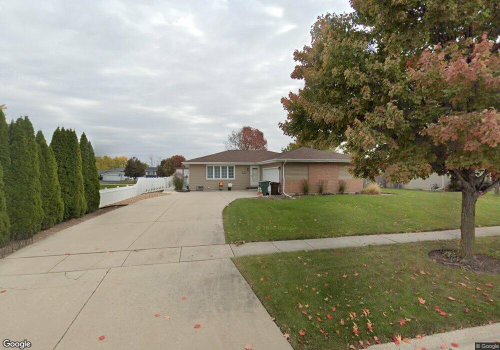
928 Barnside Rd New Lenox, IL 60451
Estimated Value: $338,709 - $464,000
Studio
--
Bath
--
Sq Ft
15,246
Sq Ft Lot
About This Home
This home is located at 928 Barnside Rd, New Lenox, IL 60451 and is currently estimated at $398,177. 928 Barnside Rd is a home located in Will County with nearby schools including Bentley Elementary School, Arnold J Tyler School, and Alex M Martino Jr High School.
Ownership History
Date
Name
Owned For
Owner Type
Purchase Details
Closed on
Oct 17, 2017
Sold by
Thompson Richard L and Thompson Susan D
Bought by
Thompson Richard L and Thompson Susan D
Current Estimated Value
Purchase Details
Closed on
May 11, 2001
Sold by
Thompson Brian Keith and Thompson Linda Carol
Bought by
Thompson Richard L and Thompson Susan
Home Financials for this Owner
Home Financials are based on the most recent Mortgage that was taken out on this home.
Original Mortgage
$177,472
Interest Rate
7.02%
Mortgage Type
FHA
Create a Home Valuation Report for This Property
The Home Valuation Report is an in-depth analysis detailing your home's value as well as a comparison with similar homes in the area
Home Values in the Area
Average Home Value in this Area
Purchase History
| Date | Buyer | Sale Price | Title Company |
|---|---|---|---|
| Thompson Richard L | -- | None Available | |
| Thompson Richard L | $180,000 | Chicago Title Insurance Co |
Source: Public Records
Mortgage History
| Date | Status | Borrower | Loan Amount |
|---|---|---|---|
| Closed | Thompson Richard L | $177,472 |
Source: Public Records
Tax History
| Year | Tax Paid | Tax Assessment Tax Assessment Total Assessment is a certain percentage of the fair market value that is determined by local assessors to be the total taxable value of land and additions on the property. | Land | Improvement |
|---|---|---|---|---|
| 2024 | $8,374 | $111,183 | $33,360 | $77,823 |
| 2023 | $8,374 | $101,352 | $30,410 | $70,942 |
| 2022 | $7,560 | $93,369 | $28,015 | $65,354 |
| 2021 | $7,170 | $87,810 | $26,347 | $61,463 |
| 2020 | $6,962 | $84,677 | $25,407 | $59,270 |
| 2019 | $6,660 | $82,051 | $24,619 | $57,432 |
| 2018 | $6,502 | $79,223 | $23,770 | $55,453 |
| 2017 | $6,175 | $76,946 | $23,087 | $53,859 |
| 2016 | $5,991 | $74,887 | $22,469 | $52,418 |
| 2015 | $5,768 | $72,530 | $21,762 | $50,768 |
| 2014 | $5,768 | $71,634 | $21,493 | $50,141 |
| 2013 | $5,768 | $72,600 | $21,783 | $50,817 |
Source: Public Records
Map
Nearby Homes
- 921 Knollside Rd
- 318 William St
- 1067 Southgate Rd Unit 34
- 836 Regent St
- 115 E Woodlawn Rd
- 1825 Brogan Dr
- 328 E Lincoln Hwy
- 911 Somerset St
- 1000 S Cedar Rd
- 178 W Otto Dr
- 289 Osage Ln
- 1787 Lakes Park Dr
- 3126 Timberlake Ave
- 1777 Lakes Park Dr
- 3171 Waterwood Ln
- 309 Osage Ln
- 2970 Timberlake Ave
- 3000 Timberlake Ave
- 3003 Timberlake Ave
- 2930 Amaranth Ct
Your Personal Tour Guide
Ask me questions while you tour the home.