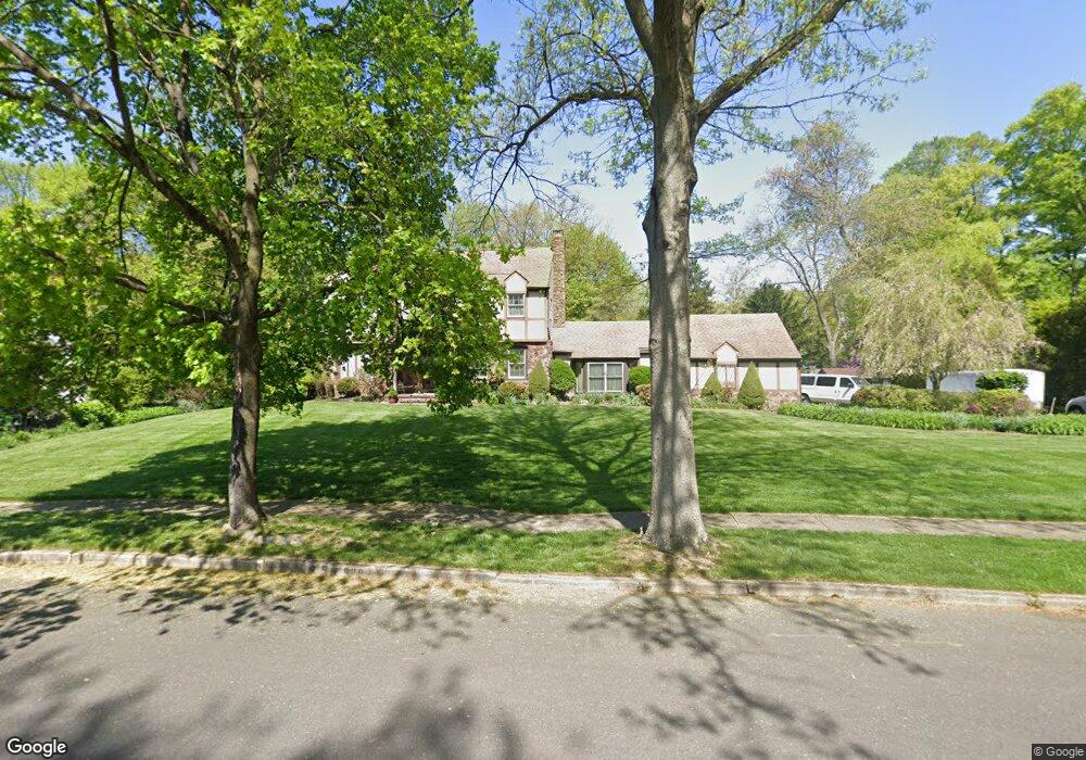
928 Fernwood Rd Moorestown, NJ 08057
Estimated Value: $753,000 - $979,000
--
Bed
--
Bath
2,703
Sq Ft
$319/Sq Ft
Est. Value
About This Home
This home is located at 928 Fernwood Rd, Moorestown, NJ 08057 and is currently estimated at $863,241, approximately $319 per square foot. 928 Fernwood Rd is a home located in Burlington County with nearby schools including George C. Baker Elementary School, Moorestown Upper Elementary School, and William Allen Middle School.
Ownership History
Date
Name
Owned For
Owner Type
Purchase Details
Closed on
Aug 1, 1988
Bought by
Binter Randolph K and Binter Karen B
Current Estimated Value
Create a Home Valuation Report for This Property
The Home Valuation Report is an in-depth analysis detailing your home's value as well as a comparison with similar homes in the area
Home Values in the Area
Average Home Value in this Area
Purchase History
| Date | Buyer | Sale Price | Title Company |
|---|---|---|---|
| Binter Randolph K | $287,500 | -- |
Source: Public Records
Tax History Compared to Growth
Tax History
| Year | Tax Paid | Tax Assessment Tax Assessment Total Assessment is a certain percentage of the fair market value that is determined by local assessors to be the total taxable value of land and additions on the property. | Land | Improvement |
|---|---|---|---|---|
| 2025 | $14,333 | $505,200 | $213,000 | $292,200 |
| 2024 | $13,898 | $505,200 | $213,000 | $292,200 |
| 2023 | $13,898 | $505,200 | $213,000 | $292,200 |
| 2022 | $13,757 | $505,200 | $213,000 | $292,200 |
| 2021 | $13,574 | $505,200 | $213,000 | $292,200 |
| 2020 | $13,489 | $505,200 | $213,000 | $292,200 |
| 2019 | $13,251 | $505,200 | $213,000 | $292,200 |
| 2018 | $12,893 | $505,200 | $213,000 | $292,200 |
| 2017 | $13,004 | $505,200 | $213,000 | $292,200 |
| 2016 | $12,958 | $505,200 | $213,000 | $292,200 |
| 2015 | $12,802 | $505,200 | $213,000 | $292,200 |
| 2014 | $12,155 | $505,200 | $213,000 | $292,200 |
Source: Public Records
Map
Nearby Homes
- 2801 Riverton Rd
- 2807 Hunterdon Dr
- 2611 Barton Ct
- 2716 Branch Pike
- 343 Tom Brown Rd
- 310 Devon Rd
- 62 Sussex Dr
- 347 Tom Brown Rd
- 543 Bethel Ave
- 502 Pomona Rd
- 213 Wayne Dr
- 116 Wayne Dr
- 142 Fox Chase Dr
- 2408 New Albany Rd
- 316 Farmdale Rd
- 308 Farmdale Rd
- 322 Boxwood Ln
- 205 Crider Ave Unit 205
- 863 Golf View Rd
- 423 Park Blvd
- 924 Fernwood Rd
- 932 Fernwood Rd
- 6 Cardinal Dr
- 10 Cardinal Dr
- 921 Fernwood Rd
- 925 Fernwood Rd
- 920 Fernwood Rd
- 936 Fernwood Rd
- 2 Cardinal Dr
- 917 Fernwood Rd
- 14 Cardinal Dr
- 916 Heritage Rd
- 18 Cardinal Dr
- 916 Fernwood Rd
- 1 Cardinal Dr
- 940 Fernwood Rd
- 912 Heritage Rd
- 913 Fernwood Rd
- 22 Cardinal Dr
- 1008 Riverton Rd