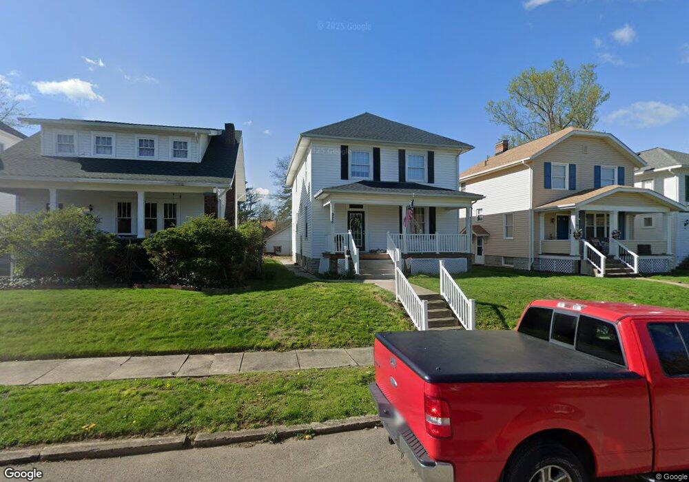
928 Laurel Ave Zanesville, OH 43701
Estimated Value: $212,220 - $231,000
4
Beds
2
Baths
1,798
Sq Ft
$123/Sq Ft
Est. Value
About This Home
This home is located at 928 Laurel Ave, Zanesville, OH 43701 and is currently estimated at $221,305, approximately $123 per square foot. 928 Laurel Ave is a home located in Muskingum County with nearby schools including John McIntire Elementary School, Zanesville Middle School, and Zanesville High School.
Ownership History
Date
Name
Owned For
Owner Type
Purchase Details
Closed on
Mar 16, 2012
Sold by
Blackstone Tara A and Warne Tara
Bought by
Warne Carlton T
Current Estimated Value
Purchase Details
Closed on
Jul 14, 2003
Sold by
Coconis Shannon N and Coconis Chad
Bought by
Warne Carlton T and Warne Tara
Home Financials for this Owner
Home Financials are based on the most recent Mortgage that was taken out on this home.
Original Mortgage
$120,745
Outstanding Balance
$51,760
Interest Rate
5.37%
Mortgage Type
FHA
Estimated Equity
$169,545
Purchase Details
Closed on
Jul 19, 1999
Sold by
Buzza Mary E
Bought by
Green Chad Coconis Shannon N
Home Financials for this Owner
Home Financials are based on the most recent Mortgage that was taken out on this home.
Original Mortgage
$74,000
Interest Rate
7.43%
Mortgage Type
New Conventional
Create a Home Valuation Report for This Property
The Home Valuation Report is an in-depth analysis detailing your home's value as well as a comparison with similar homes in the area
Home Values in the Area
Average Home Value in this Area
Purchase History
| Date | Buyer | Sale Price | Title Company |
|---|---|---|---|
| Warne Carlton T | -- | Attorney | |
| Warne Carlton T | $121,033 | -- | |
| Green Chad Coconis Shannon N | $77,900 | -- |
Source: Public Records
Mortgage History
| Date | Status | Borrower | Loan Amount |
|---|---|---|---|
| Open | Warne Carlton T | $120,745 | |
| Closed | Green Chad Coconis Shannon N | $74,000 |
Source: Public Records
Tax History Compared to Growth
Tax History
| Year | Tax Paid | Tax Assessment Tax Assessment Total Assessment is a certain percentage of the fair market value that is determined by local assessors to be the total taxable value of land and additions on the property. | Land | Improvement |
|---|---|---|---|---|
| 2024 | $1,743 | $46,725 | $5,880 | $40,845 |
| 2023 | $1,422 | $36,680 | $4,410 | $32,270 |
| 2022 | $1,396 | $36,680 | $4,410 | $32,270 |
| 2021 | $1,384 | $36,680 | $4,410 | $32,270 |
| 2020 | $1,290 | $33,320 | $3,990 | $29,330 |
| 2019 | $1,290 | $33,320 | $3,990 | $29,330 |
| 2018 | $1,267 | $33,320 | $3,990 | $29,330 |
| 2017 | $1,178 | $28,805 | $4,025 | $24,780 |
| 2016 | $1,223 | $29,480 | $4,030 | $25,450 |
| 2015 | $1,226 | $29,480 | $4,030 | $25,450 |
| 2013 | $1,362 | $29,480 | $4,030 | $25,450 |
Source: Public Records
Map
Nearby Homes
- 933 Adair Ave
- 955 Adair Ave
- 1019 Adair Ave
- 919 Sunset Ave
- 828 Locust Ave
- 1251 Marwood Dr
- 720 Locust Ave
- 1137 Roosevelt Ave
- 1516 Myrtle Ave
- 1119 Abbey Place
- 1630 Marion Ave
- 641 Fairmont Ave
- 714 Saint Louis Ave
- 626 Saint Louis Ave
- 1430 Euclid Ave
- 839 Brown St
- 513 Van Horn Ave
- 1605 Jackson St
- 370 Sheridan St
- 1435 Bluff St