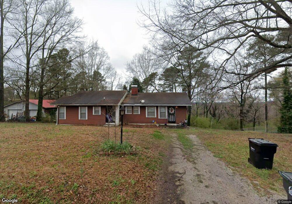
928 Lynndale Ln Birmingham, AL 35214
Forestdale NeighborhoodEstimated Value: $118,000 - $167,000
3
Beds
1
Bath
1,609
Sq Ft
$89/Sq Ft
Est. Value
About This Home
This home is located at 928 Lynndale Ln, Birmingham, AL 35214 and is currently estimated at $143,331, approximately $89 per square foot. 928 Lynndale Ln is a home located in Jefferson County with nearby schools including Minor Community School, Minor Middle School, and Minor High School.
Ownership History
Date
Name
Owned For
Owner Type
Purchase Details
Closed on
Feb 15, 2005
Sold by
Mcwhorter Russell Dale and Lantrip Barbara Ann Mcwhorter
Bought by
Donald Jatawn L
Current Estimated Value
Home Financials for this Owner
Home Financials are based on the most recent Mortgage that was taken out on this home.
Original Mortgage
$71,250
Outstanding Balance
$42,070
Interest Rate
8.3%
Mortgage Type
Purchase Money Mortgage
Estimated Equity
$101,261
Create a Home Valuation Report for This Property
The Home Valuation Report is an in-depth analysis detailing your home's value as well as a comparison with similar homes in the area
Home Values in the Area
Average Home Value in this Area
Purchase History
| Date | Buyer | Sale Price | Title Company |
|---|---|---|---|
| Donald Jatawn L | $75,000 | -- |
Source: Public Records
Mortgage History
| Date | Status | Borrower | Loan Amount |
|---|---|---|---|
| Open | Donald Jatawn L | $71,250 |
Source: Public Records
Tax History Compared to Growth
Tax History
| Year | Tax Paid | Tax Assessment Tax Assessment Total Assessment is a certain percentage of the fair market value that is determined by local assessors to be the total taxable value of land and additions on the property. | Land | Improvement |
|---|---|---|---|---|
| 2024 | $562 | $12,280 | -- | -- |
| 2023 | $529 | $12,280 | $2,910 | $9,370 |
| 2022 | $461 | $10,250 | $710 | $9,540 |
| 2021 | $322 | $7,480 | $710 | $6,770 |
| 2020 | $322 | $7,480 | $710 | $6,770 |
| 2019 | $322 | $7,480 | $0 | $0 |
| 2018 | $265 | $6,340 | $0 | $0 |
| 2017 | $265 | $6,340 | $0 | $0 |
| 2016 | $265 | $6,340 | $0 | $0 |
| 2015 | $265 | $6,340 | $0 | $0 |
| 2014 | $294 | $6,820 | $0 | $0 |
| 2013 | $294 | $6,820 | $0 | $0 |
Source: Public Records
Map
Nearby Homes
- 1415 Pratt Hwy
- 705 Rushway Ln
- 1024 Melody Dr Unit 1
- 1457 Pratt Hwy
- 637 Blanton Ln
- 739 Kenwood Dr
- 1344 Haven Dr
- 1345 Haven Dr
- 541 Telford Ln
- 711 Oak Ridge Dr
- 528 Blue Bell Rd
- 539 Crumly Chapel Rd
- 1020 Pratt Hwy
- 1401 Heflin Ave W
- 1515 Haven Dr N
- 1024 Heflin Ave W
- 1029 Heflin Ave W
- 808 Ozark Ave
- 305 Dunbar Ct Unit 15.000
- 2021 Hanchey Rd
- 916 Lynndale Ln
- 932 Lynndale Ln
- 932 Lynn Dale Ln
- 912 Lynndale Ln
- 933 Lynndale Ln
- 929 Lynndale Ln
- 917 Lynndale Ln
- 937 Lynndale Ln
- 925 Lynndale Ln
- 941 Lynndale Ln
- 942 Lynndale Ln
- 913 Lynndale Ln
- 913 Lynn Dale Ln
- 908 Lynn Dale Ln
- 921 Lynndale Ln
- 921 Lynn Dale Ln
- 820 Fairbrook Dr
- 904 Lynndale Ln
- 904 Lynn Dale Ln
- 905 Lynndale Ln