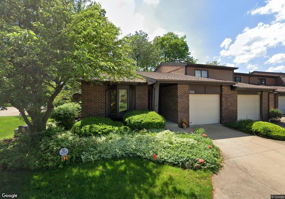
928 Morningstar Dr Unit 928 Akron, OH 44307
Downtown Akron NeighborhoodEstimated Value: $145,321 - $169,000
3
Beds
2
Baths
1,260
Sq Ft
$123/Sq Ft
Est. Value
About This Home
This home is located at 928 Morningstar Dr Unit 928, Akron, OH 44307 and is currently estimated at $155,080, approximately $123 per square foot. 928 Morningstar Dr Unit 928 is a home located in Summit County with nearby schools including St. Bernard-St. Mary Elementary School.
Ownership History
Date
Name
Owned For
Owner Type
Purchase Details
Closed on
Mar 17, 2006
Sold by
Kelley Ce Elia D
Bought by
Adams Melvyn C and Adams Essie M
Current Estimated Value
Home Financials for this Owner
Home Financials are based on the most recent Mortgage that was taken out on this home.
Original Mortgage
$115,696
Interest Rate
6.33%
Mortgage Type
VA
Create a Home Valuation Report for This Property
The Home Valuation Report is an in-depth analysis detailing your home's value as well as a comparison with similar homes in the area
Home Values in the Area
Average Home Value in this Area
Purchase History
| Date | Buyer | Sale Price | Title Company |
|---|---|---|---|
| Adams Melvyn C | $112,000 | First American Title Ins |
Source: Public Records
Mortgage History
| Date | Status | Borrower | Loan Amount |
|---|---|---|---|
| Closed | Adams Melvyn C | $115,696 |
Source: Public Records
Tax History Compared to Growth
Tax History
| Year | Tax Paid | Tax Assessment Tax Assessment Total Assessment is a certain percentage of the fair market value that is determined by local assessors to be the total taxable value of land and additions on the property. | Land | Improvement |
|---|---|---|---|---|
| 2025 | $1,326 | $34,083 | $4,032 | $30,051 |
| 2024 | $1,326 | $34,083 | $4,032 | $30,051 |
| 2023 | $1,326 | $34,083 | $4,032 | $30,051 |
| 2022 | $1,365 | $28,939 | $3,420 | $25,519 |
| 2021 | $1,367 | $28,939 | $3,420 | $25,519 |
| 2020 | $1,346 | $28,940 | $3,420 | $25,520 |
| 2019 | $1,213 | $25,200 | $3,420 | $21,780 |
| 2018 | $1,194 | $25,200 | $3,420 | $21,780 |
| 2017 | $967 | $25,200 | $3,420 | $21,780 |
| 2016 | $968 | $21,720 | $3,420 | $18,300 |
| 2015 | $967 | $21,720 | $3,420 | $18,300 |
| 2014 | $960 | $21,720 | $3,420 | $18,300 |
| 2013 | $1,472 | $29,480 | $3,420 | $26,060 |
Source: Public Records
Map
Nearby Homes
- 263 Millcreek Dr Unit 263
- 783 Boulevard St
- 810 Amherst St
- 834 Kenyon St
- 108 Furnace Run Dr Unit 14108
- 385 Campbell St
- 949 Raymond St
- 849 Amherst St
- 832 Yale St
- 829 Yale St
- 151 Russell Ave
- 837 Yale St
- 849 Yale St
- 817 Raymond St
- 677 Vernon Odom Blvd
- 577 Rhodes Ave
- 639 Bellevue Ave
- 267 W Long St
- 1132 Bristol Terrace
- 650 Easter Ave
- 926 Morningstar Dr
- 924 Morningstar Dr Unit 924
- 922 Morningstar Dr Unit 922
- 920 Morningstar Dr
- 918 Morningstar Dr Unit 918
- 921 Morningstar Dr
- 923 Morningstar Dr Unit 923
- 917 Morningstar Dr Unit 917
- 931 Morningstar Dr
- 929 Morningstar Dr Unit 929
- 919 Morningstar Dr
- 935 Morningstar Dr Unit 935
- 933 Morningstar Dr
- 937 Morningstar Dr Unit 937
- 939 Morningstar Dr Unit 939
- 941 Morningstar Dr
- 943 Morningstar Dr
- 945 Morningstar Dr
- 256 Millcreek Dr
- 947 Morningstar Dr