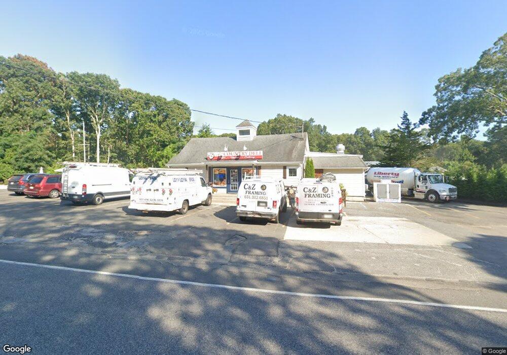
928 Noyack Rd Southampton, NY 11968
Estimated Value: $1,176,270 - $2,227,000
--
Bed
--
Bath
--
Sq Ft
0.92
Acres
About This Home
This home is located at 928 Noyack Rd, Southampton, NY 11968 and is currently estimated at $1,783,423. 928 Noyack Rd is a home with nearby schools including Southampton Elementary School, Southampton Intermediate School, and Southampton High School.
Ownership History
Date
Name
Owned For
Owner Type
Purchase Details
Closed on
Jan 11, 2019
Sold by
Reisig Philip and Reisig Everett
Bought by
928 Noyac Road Llc
Current Estimated Value
Purchase Details
Closed on
Nov 7, 2007
Sold by
Reisig Philip Everett
Bought by
Reisig Philip Everett
Purchase Details
Closed on
Sep 27, 2007
Sold by
Reisig Philip Everett
Bought by
Reisig Philip Everett
Create a Home Valuation Report for This Property
The Home Valuation Report is an in-depth analysis detailing your home's value as well as a comparison with similar homes in the area
Home Values in the Area
Average Home Value in this Area
Purchase History
| Date | Buyer | Sale Price | Title Company |
|---|---|---|---|
| 928 Noyac Road Llc | $300,000 | -- | |
| 928 Noyac Road Llc | $300,000 | -- | |
| Reisig Philip Everett | -- | Joseph W Mc Heffey | |
| Reisig Philip Everett | -- | Joseph W Mc Heffey | |
| Reisig Philip Everett | -- | Joseph W Mc Heffey | |
| Reisig Philip Everett | -- | Joseph W Mc Heffey |
Source: Public Records
Tax History Compared to Growth
Tax History
| Year | Tax Paid | Tax Assessment Tax Assessment Total Assessment is a certain percentage of the fair market value that is determined by local assessors to be the total taxable value of land and additions on the property. | Land | Improvement |
|---|---|---|---|---|
| 2024 | -- | $661,800 | $428,400 | $233,400 |
| 2023 | -- | $428,400 | $428,400 | $0 |
| 2022 | $2,604 | $664,000 | $664,000 | $0 |
| 2021 | $2,604 | $428,400 | $428,400 | $0 |
| 2020 | $1,786 | $428,400 | $428,400 | $0 |
| 2019 | $1,786 | $0 | $0 | $0 |
| 2018 | -- | $492,600 | $492,600 | $0 |
| 2017 | $2,440 | $540,600 | $540,600 | $0 |
| 2016 | $2,524 | $540,600 | $540,600 | $0 |
| 2015 | -- | $540,600 | $540,600 | $0 |
| 2014 | -- | $540,600 | $540,600 | $0 |
Source: Public Records
Map
Nearby Homes
- 11 Scotts Landing Rd
- 22 Turtle Cove Dr
- 45 Old Sag Harbor Rd
- 64 Turtle Cove Dr
- 7 Ashwood Ct
- 8 Ashwood Ct
- 8 Seaweed Rd
- 35 Lohan Ct
- 43 Lohan Ct
- 44 Ocean View Pkwy
- 38 E Beach Dr
- 40 E Beach Dr
- 6 Ocean View Pkwy
- 493 Water Mill Towd Rd
- 61 Hidden Cove Ct
- 37 Peconic Bay Ave
- 1610 Majors Path
- 1578 Majors Path
- 33 Woods Ln
- 86 Roses Grove Rd
- 189 Warfield Way
- 175 Warfield Way
- 199 Warfield Way
- 163 Warfield Way
- 29 Warfield Way
- 23 Warfield Way
- 43 Warfield Way
- 200 Warfield Way
- 157 Warfield Way
- 180 Warfield Way
- 190 Warfield Way
- 4 Scotts Landing Rd
- 170 Warfield Way
- 9 Scotts Landing Rd
- 160 Warfield Way
- 53 Warfield Way
- 15 Scotts Landing Rd
- 6 Scotts Landing Rd
- 635 Water Mill Towd Rd
- 147 Warfield Way
