Estimated Value: $1,065,474 - $1,310,000
3
Beds
3
Baths
2,340
Sq Ft
$515/Sq Ft
Est. Value
About This Home
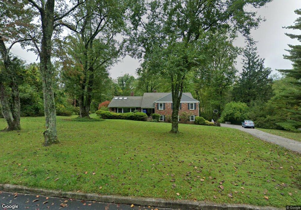
This home is located at 928 Spring Ln, Devon, PA 19333 and is currently estimated at $1,204,369, approximately $514 per square foot. 928 Spring Ln is a home located in Chester County with nearby schools including Beaumont Elementary School, Tredyffrin-Easttown Middle School, and Conestoga Senior High School.
Ownership History
Date
Name
Owned For
Owner Type
Purchase Details
Closed on
Jun 30, 1999
Sold by
Rotondo Michael F and Rotondo Lydia D
Bought by
Pealer Steven A and Pealer Diane K
Current Estimated Value
Home Financials for this Owner
Home Financials are based on the most recent Mortgage that was taken out on this home.
Original Mortgage
$150,000
Interest Rate
7.39%
Create a Home Valuation Report for This Property
The Home Valuation Report is an in-depth analysis detailing your home's value as well as a comparison with similar homes in the area
Home Values in the Area
Average Home Value in this Area
Purchase History
| Date | Buyer | Sale Price | Title Company |
|---|---|---|---|
| Pealer Steven A | $400,000 | -- |
Source: Public Records
Mortgage History
| Date | Status | Borrower | Loan Amount |
|---|---|---|---|
| Closed | Pealer Steven A | $150,000 |
Source: Public Records
Tax History
| Year | Tax Paid | Tax Assessment Tax Assessment Total Assessment is a certain percentage of the fair market value that is determined by local assessors to be the total taxable value of land and additions on the property. | Land | Improvement |
|---|---|---|---|---|
| 2025 | $10,209 | $273,700 | $83,760 | $189,940 |
| 2024 | $10,209 | $273,700 | $83,760 | $189,940 |
| 2023 | $9,545 | $273,700 | $83,760 | $189,940 |
| 2022 | $9,284 | $273,700 | $83,760 | $189,940 |
| 2021 | $9,083 | $273,700 | $83,760 | $189,940 |
| 2020 | $8,830 | $273,700 | $83,760 | $189,940 |
| 2019 | $8,584 | $273,700 | $83,760 | $189,940 |
| 2018 | $8,436 | $273,700 | $83,760 | $189,940 |
| 2017 | $8,245 | $273,700 | $83,760 | $189,940 |
| 2016 | -- | $273,700 | $83,760 | $189,940 |
| 2015 | -- | $273,700 | $83,760 | $189,940 |
| 2014 | -- | $273,700 | $83,760 | $189,940 |
Source: Public Records
Map
Nearby Homes
- 814 Newtown Rd
- 1105 Waterloo Rd
- 3663 Wyola Dr
- 1012 Waltham Rd
- 1108 Prescott Rd
- 641 Andover Rd
- 709 Newtown Rd
- 600 Waynesfield Dr
- 718 S Waterloo Rd
- 837-Lot1 Nathan Hale
- 850 Farragut Rd
- 518 Newtown Rd
- 514 Newtown Rd
- 1 Dunminning Rd
- 130 Beaumont Rd
- 6 Wingstone Ln
- 422 S Waterloo Rd
- 846 Maplewood Rd
- 3716 Rose Trader Ln
- 334 Echo Valley Ln
- 922 Spring Ln
- 934 Spring Ln
- 527 Millbrook Rd
- 929 Newtown Rd
- 929 Spring Ln
- 923 Newtown Rd
- 935 Spring Ln
- 923 Spring Ln
- 917 Newtown Rd
- 533 Millbrook Rd
- 948 Newtown Rd
- 985 S Waterloo Rd
- 507 Millbrook Rd
- 526 Millbrook Rd
- 911 Newtown Rd
- 518 Millbrook Rd
- 532 Millbrook Rd
- 928 Newtown Rd
- 920 Castlehill Ln
- 510 Millbrook Rd
Your Personal Tour Guide
Ask me questions while you tour the home.