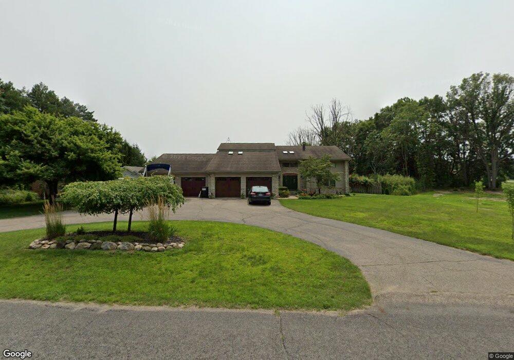
9285 Pq Ave Mattawan, MI 49071
Estimated Value: $535,000 - $550,000
4
Beds
3
Baths
2,900
Sq Ft
$187/Sq Ft
Est. Value
About This Home
This home is located at 9285 Pq Ave, Mattawan, MI 49071 and is currently estimated at $543,043, approximately $187 per square foot. 9285 Pq Ave is a home located in Kalamazoo County with nearby schools including Mattawan Early Elementary School, Mattawan Later Elementary School, and Mattawan Middle School.
Ownership History
Date
Name
Owned For
Owner Type
Purchase Details
Closed on
Jun 25, 2015
Sold by
Rogers Thomas C and Rogers Marie E
Bought by
Lehman Eric R and Lehman Michelle L
Current Estimated Value
Home Financials for this Owner
Home Financials are based on the most recent Mortgage that was taken out on this home.
Original Mortgage
$275,793
Interest Rate
3.97%
Mortgage Type
FHA
Purchase Details
Closed on
Apr 7, 2011
Sold by
Rogers Thomas C and Rogers Marie E
Bought by
Lehman Eric R and Lehman Michelle L
Create a Home Valuation Report for This Property
The Home Valuation Report is an in-depth analysis detailing your home's value as well as a comparison with similar homes in the area
Home Values in the Area
Average Home Value in this Area
Purchase History
| Date | Buyer | Sale Price | Title Company |
|---|---|---|---|
| Lehman Eric R | $280,000 | Attorneys Title | |
| Lehman Eric R | -- | None Available |
Source: Public Records
Mortgage History
| Date | Status | Borrower | Loan Amount |
|---|---|---|---|
| Previous Owner | Lehman Eric R | $275,793 |
Source: Public Records
Tax History Compared to Growth
Tax History
| Year | Tax Paid | Tax Assessment Tax Assessment Total Assessment is a certain percentage of the fair market value that is determined by local assessors to be the total taxable value of land and additions on the property. | Land | Improvement |
|---|---|---|---|---|
| 2025 | $4,822 | $204,200 | $0 | $0 |
| 2024 | $1,527 | $185,300 | $0 | $0 |
| 2023 | $1,456 | $169,900 | $0 | $0 |
| 2022 | $4,299 | $144,100 | $0 | $0 |
| 2021 | $4,431 | $138,100 | $0 | $0 |
| 2020 | $4,301 | $140,500 | $0 | $0 |
| 2019 | $3,926 | $150,900 | $0 | $0 |
| 2018 | $2,536 | $146,300 | $0 | $0 |
| 2017 | -- | $144,700 | $0 | $0 |
| 2016 | -- | $142,100 | $0 | $0 |
| 2015 | -- | $118,800 | $27,200 | $91,600 |
| 2014 | -- | $118,800 | $0 | $0 |
Source: Public Records
Map
Nearby Homes
- 931 Treasure Island Dr
- 1009 Treasure Island Dr
- 6850 Dustin Cir Unit 1
- 1466 N Eagle Lake Dr
- 9844 W P Ave
- 1300 N Eagle Lake Dr
- 7932 Finnagen Dr
- 7721 5th St
- 6606 Spaniel Dr
- 1208 N Eagle Lake Dr
- 6798 Apple Blossom Ln
- 429 W Crooked Lake Dr
- 6603 S 5th St
- 8450 W Pq Ave
- 898 E Eagle Lake Dr
- 8244 W Q Ave
- 6632 E Eagle Lake Dr
- 8257 S 2nd St
- 8586 Brighten Trail
- 8532 Brighten Trail
- 9286 Pq Ave
- 9191 W Pq Ave
- 7288 Selah Ct
- 7281 Chianti Cir
- 7250 Selah Ct
- 9145 W P Q Ave
- 7292 Chianti Cir
- 7270 Chianti Cir
- 9111 W P Q Ave
- 9111 Pq Ave
- 7216 Eagle Heights Dr
- 7216 Eagle Heights Dr
- 7216 Eagle Heights Dr
- 9311 Pq Ave
- 9110 Pq Ave
- 7250 Chianti Cir
- 7231 Chianti Cir
- 9089 W P Q Ave
- 9089 Pq Ave
- 7232 Chianti Cir