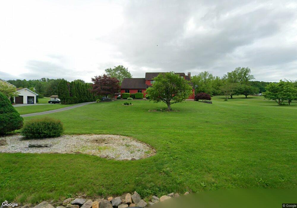
9286 Longswamp Rd Alburtis, PA 18011
Longswamp NeighborhoodEstimated Value: $399,000 - $592,000
4
Beds
3
Baths
2,336
Sq Ft
$219/Sq Ft
Est. Value
About This Home
This home is located at 9286 Longswamp Rd, Alburtis, PA 18011 and is currently estimated at $511,463, approximately $218 per square foot. 9286 Longswamp Rd is a home located in Berks County with nearby schools including Brandywine Heights Elementary School, Brandywine Intermediate School, and Brandywine Heights High School.
Ownership History
Date
Name
Owned For
Owner Type
Purchase Details
Closed on
Sep 28, 2005
Sold by
Gleason Jeffrey J and Gleason Sally A
Bought by
Lyons Michael and Lyons Katherine
Current Estimated Value
Home Financials for this Owner
Home Financials are based on the most recent Mortgage that was taken out on this home.
Original Mortgage
$200,000
Interest Rate
6.14%
Mortgage Type
Fannie Mae Freddie Mac
Purchase Details
Closed on
Mar 11, 2005
Sold by
Masser Michael L and Masser Pamela Lee
Bought by
Gleason Jeffrey L and Gleason Sally A
Home Financials for this Owner
Home Financials are based on the most recent Mortgage that was taken out on this home.
Original Mortgage
$267,500
Interest Rate
7.45%
Mortgage Type
Fannie Mae Freddie Mac
Create a Home Valuation Report for This Property
The Home Valuation Report is an in-depth analysis detailing your home's value as well as a comparison with similar homes in the area
Home Values in the Area
Average Home Value in this Area
Purchase History
| Date | Buyer | Sale Price | Title Company |
|---|---|---|---|
| Lyons Michael | $292,000 | None Available | |
| Gleason Jeffrey L | $267,500 | First American Title Ins Co |
Source: Public Records
Mortgage History
| Date | Status | Borrower | Loan Amount |
|---|---|---|---|
| Previous Owner | Lyons Michael | $200,000 | |
| Previous Owner | Gleason Jeffrey L | $267,500 |
Source: Public Records
Tax History Compared to Growth
Tax History
| Year | Tax Paid | Tax Assessment Tax Assessment Total Assessment is a certain percentage of the fair market value that is determined by local assessors to be the total taxable value of land and additions on the property. | Land | Improvement |
|---|---|---|---|---|
| 2025 | $2,079 | $173,800 | $34,500 | $139,300 |
| 2024 | $8,217 | $173,800 | $34,500 | $139,300 |
| 2023 | $8,049 | $173,800 | $34,500 | $139,300 |
| 2022 | $7,870 | $173,800 | $34,500 | $139,300 |
| 2021 | $7,811 | $173,800 | $34,500 | $139,300 |
| 2020 | $7,752 | $173,800 | $34,500 | $139,300 |
| 2019 | $7,639 | $173,800 | $34,500 | $139,300 |
| 2018 | $7,559 | $173,800 | $34,500 | $139,300 |
| 2017 | $7,425 | $173,800 | $34,500 | $139,300 |
| 2016 | $1,768 | $173,800 | $34,500 | $139,300 |
| 2015 | $1,733 | $173,800 | $34,500 | $139,300 |
| 2014 | $1,733 | $173,800 | $34,500 | $139,300 |
Source: Public Records
Map
Nearby Homes
- 3371 Mathews Ln
- 354 W 2nd St
- 241 Flint Hill Rd
- 31 Barbara Dr
- 121 S Main St Unit 123
- 428 Thomas St
- 1108 S Barbara Dr
- 108 E 2nd St
- 317 Lockridge Ln
- 8975 Mertztown Rd
- 8312 Mertztown Rd
- 1702 Windmill Ln
- 1649 Thorndale Rd
- 1649 Thorndale Rd Unit LOT 70
- 1716 Brookstone Dr
- 8051 Heritage Dr
- 8524 Mayfair Ct
- 8524 Mayfair Ct Unit LOT I-65
- 1316 Buck Hill Ln
- 8914 Brookdale Rd
- 9288 Longswamp Rd
- 9216 Longswamp Rd
- 9284 Longswamp Rd
- 9282 Longswamp Rd
- 9184 Longswamp Rd
- 9290 Longswamp Rd
- 9140 Longswamp Rd
- 9268 Longswamp Rd
- 0 Fairchild St Unit 1003262687
- 3422 Fairchild St
- 929 Longswamp Rd
- 3425 Fairchild St
- 9278 Longswamp Rd
- 3434 Fairchild St
- 8 Spring Lane (Fairchild)
- 3433 Fairchild St
- 7 Schlossburg St
- 8980 Longswamp Rd
- 8991 Longswamp Rd
- 21 Schlossburg St