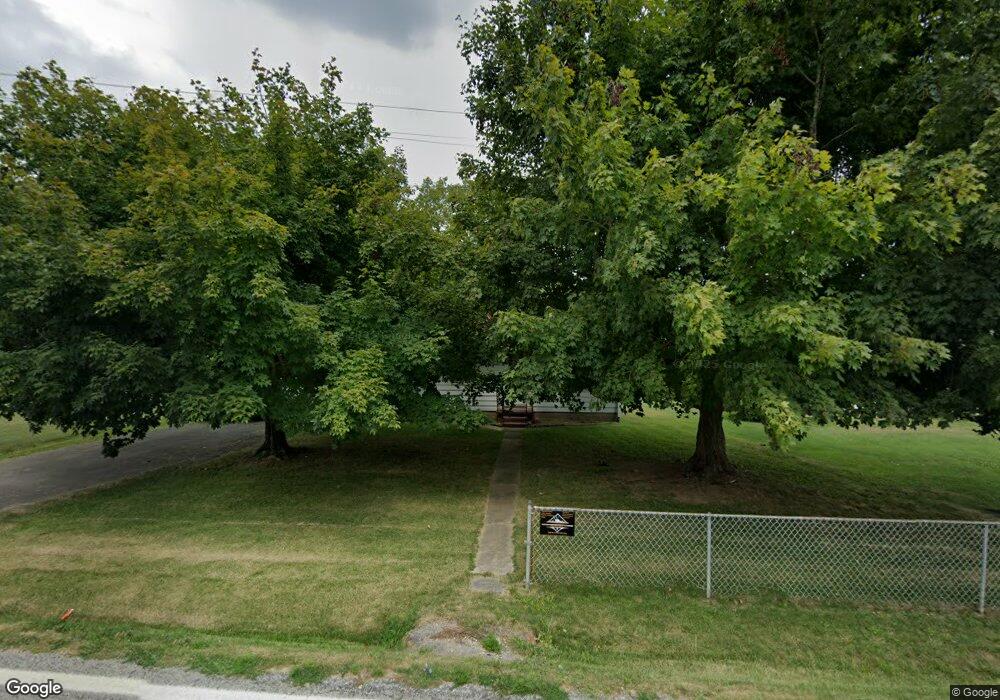
9287 State Route 243 South Point, OH 45680
Estimated Value: $77,000 - $161,000
2
Beds
1
Bath
1,064
Sq Ft
$98/Sq Ft
Est. Value
About This Home
This home is located at 9287 State Route 243, South Point, OH 45680 and is currently estimated at $103,860, approximately $97 per square foot. 9287 State Route 243 is a home located in Lawrence County with nearby schools including Dawson-Bryant Elementary School, Dawson-Bryant Middle School, and Dawson-Bryant High School.
Ownership History
Date
Name
Owned For
Owner Type
Purchase Details
Closed on
Apr 9, 2020
Sold by
Baisden Seigle and Baisden Vivian
Bought by
Ausmus Levi and Ausmus Kathleen
Current Estimated Value
Purchase Details
Closed on
Jul 25, 2011
Sold by
Brammer Pauline N and Burcham Stephen D
Bought by
Baisden Seigle and Baisden Vivian
Purchase Details
Closed on
Sep 18, 2003
Sold by
Hummell William C and Hummell H
Bought by
Brammer Pauline N
Purchase Details
Closed on
Mar 31, 1993
Sold by
Willis Edna M
Bought by
Hummell William C and Hummell H
Purchase Details
Closed on
Dec 21, 1992
Sold by
Brammer Lettie
Bought by
Willis Edna M
Create a Home Valuation Report for This Property
The Home Valuation Report is an in-depth analysis detailing your home's value as well as a comparison with similar homes in the area
Home Values in the Area
Average Home Value in this Area
Purchase History
| Date | Buyer | Sale Price | Title Company |
|---|---|---|---|
| Ausmus Levi | $36,000 | None Available | |
| Baisden Seigle | $36,000 | Attorney | |
| Brammer Pauline N | $32,000 | -- | |
| Hummell William C | $20,000 | -- | |
| Willis Edna M | $20,000 | -- |
Source: Public Records
Tax History Compared to Growth
Tax History
| Year | Tax Paid | Tax Assessment Tax Assessment Total Assessment is a certain percentage of the fair market value that is determined by local assessors to be the total taxable value of land and additions on the property. | Land | Improvement |
|---|---|---|---|---|
| 2024 | -- | $18,570 | $2,120 | $16,450 |
| 2023 | $550 | $18,570 | $2,120 | $16,450 |
| 2022 | $547 | $18,570 | $2,120 | $16,450 |
| 2021 | $450 | $15,270 | $2,010 | $13,260 |
| 2020 | $466 | $15,270 | $2,010 | $13,260 |
| 2019 | $464 | $15,270 | $2,010 | $13,260 |
| 2018 | $460 | $14,970 | $1,970 | $13,000 |
| 2017 | $459 | $14,970 | $1,970 | $13,000 |
| 2016 | $424 | $14,970 | $1,970 | $13,000 |
| 2015 | $427 | $14,480 | $1,980 | $12,500 |
| 2014 | $421 | $14,480 | $1,980 | $12,500 |
| 2013 | $421 | $14,480 | $1,980 | $12,500 |
Source: Public Records
Map
Nearby Homes
- 9040 Ohio 243
- 66 County Road 30
- 6881 State Route 243
- 3493 County Road 31
- 1122 Township Road 266
- 1122 Township Road 266
- 3171 County Road 31
- 66 Township Road 1523
- 25 Township Road 1524
- 3569 County Road 6
- 4404 County Road 15
- 71 Private Dr
- 6757 County Road 15
- 6897 County Road 15
- 859 County Road 53
- 885 County Road 53
- 1334 McKinney Creek-Hesson Hollow Rd N
- 1334 Township Road 214th N
- 00 Township Road 219 N
- 7428 County Road 15
- 9301 State Route 243
- 9247 State Route 243
- 9317 State Route 243
- 8829 State Route 243
- 9164 State Route 243
- 4113 County Road 55
- 9466 State Route 243
- 9097 State Route 243
- 4091 County Road 55
- 9088 State Route 243
- 9504 State Route 243
- 9504 Ohio 243
- 4036 County Road 55
- 9526 State Route 243
- 4014 County Road 55
- 9526 Ohio 243
- 203 Private Road 1653 Unit 17
- 3954 County Road 55
- 8969 State Route 243
- 3943 County Road 55