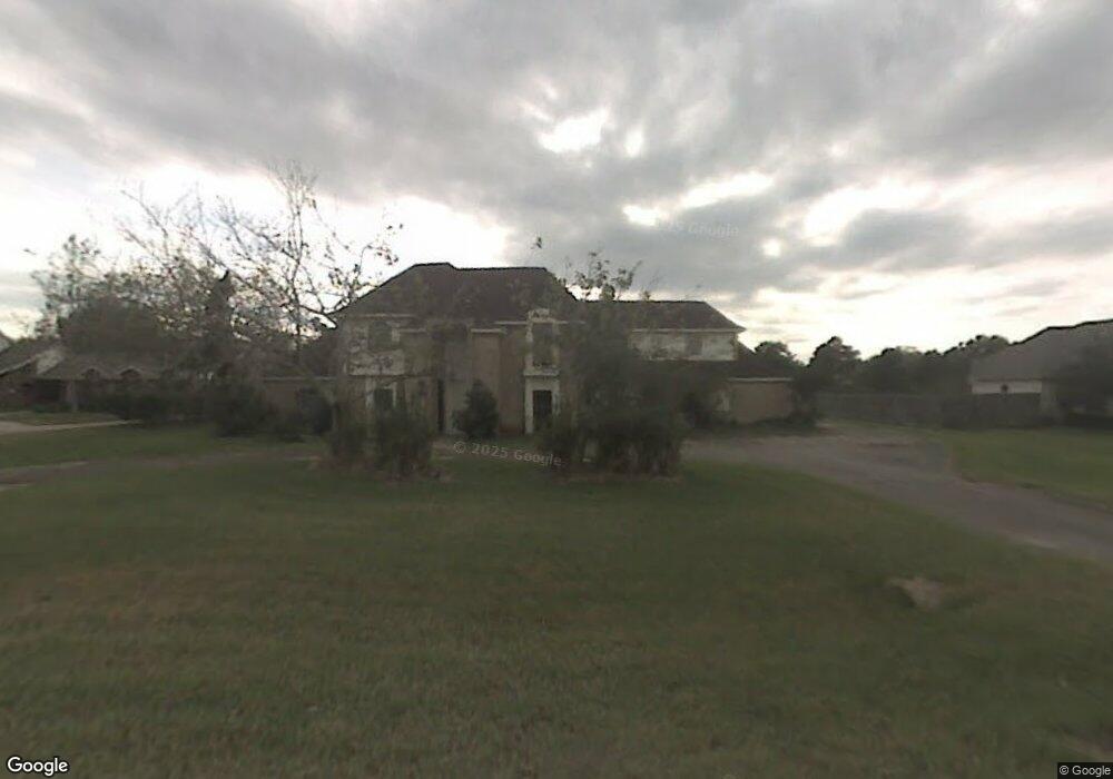
929 Layfair Place Friendswood, TX 77546
Estimated Value: $553,000 - $741,871
--
Bed
3
Baths
3,283
Sq Ft
$200/Sq Ft
Est. Value
About This Home
This home is located at 929 Layfair Place, Friendswood, TX 77546 and is currently estimated at $657,290, approximately $200 per square foot. 929 Layfair Place is a home located in Galveston County with nearby schools including C.W. Cline Elementary School, Windsong Elementary School, and Friendswood Junior High School.
Ownership History
Date
Name
Owned For
Owner Type
Purchase Details
Closed on
Jun 9, 2015
Sold by
Crouther Joseph L
Bought by
Crouther Gloria D
Current Estimated Value
Home Financials for this Owner
Home Financials are based on the most recent Mortgage that was taken out on this home.
Original Mortgage
$194,400
Outstanding Balance
$151,423
Interest Rate
3.91%
Mortgage Type
Stand Alone First
Estimated Equity
$505,867
Purchase Details
Closed on
Dec 13, 2013
Sold by
Crouther Joseph L
Bought by
Crouther Gloria D
Purchase Details
Closed on
Aug 18, 1999
Sold by
Deborde Gerald and Deborde Linda
Bought by
Crouther Joseph L and Crouther Gloria D
Home Financials for this Owner
Home Financials are based on the most recent Mortgage that was taken out on this home.
Original Mortgage
$179,900
Interest Rate
7.68%
Create a Home Valuation Report for This Property
The Home Valuation Report is an in-depth analysis detailing your home's value as well as a comparison with similar homes in the area
Home Values in the Area
Average Home Value in this Area
Purchase History
| Date | Buyer | Sale Price | Title Company |
|---|---|---|---|
| Crouther Gloria D | -- | Sendera Title | |
| Crouther Gloria D | -- | None Available | |
| Crouther Joseph L | -- | First American Title Ins Co |
Source: Public Records
Mortgage History
| Date | Status | Borrower | Loan Amount |
|---|---|---|---|
| Open | Crouther Gloria D | $194,400 | |
| Closed | Crouther Joseph L | $179,900 |
Source: Public Records
Tax History Compared to Growth
Tax History
| Year | Tax Paid | Tax Assessment Tax Assessment Total Assessment is a certain percentage of the fair market value that is determined by local assessors to be the total taxable value of land and additions on the property. | Land | Improvement |
|---|---|---|---|---|
| 2025 | $3,468 | $410,166 | -- | -- |
| 2024 | $3,468 | $372,878 | -- | -- |
| 2023 | $3,468 | $338,980 | $0 | $0 |
| 2022 | $6,787 | $308,164 | $0 | $0 |
| 2021 | $6,543 | $579,770 | $42,360 | $537,410 |
| 2020 | $6,136 | $437,400 | $42,360 | $395,040 |
| 2019 | $5,879 | $310,740 | $42,360 | $268,380 |
| 2018 | $5,376 | $210,480 | $42,360 | $168,120 |
| 2017 | $5,416 | $208,540 | $42,360 | $166,180 |
| 2016 | $5,419 | $208,670 | $42,360 | $166,310 |
| 2015 | $1,896 | $208,670 | $42,360 | $166,310 |
| 2014 | -- | $217,980 | $42,360 | $175,620 |
Source: Public Records
Map
Nearby Homes
- 1608 Keystone Dr
- 1531 Briar Bend Dr
- 1606 Falcon Ridge Blvd
- 1802 Creekside Dr
- 1783 Lake Crest Ln
- 1668 Turner Ct
- 1509 Windsor Dr
- 505 Hunters Ln
- 1906 Blue Quail Dr
- 506 Lakeside Ln
- 1010 High Ridge Dr
- 1804 Sandy Lake Dr
- 1305 Edgewater Dr
- 1217 Red Wing Dr
- 812 Sandringham Dr
- 1207 Yorkshire Dr
- 705 High Ridge Dr
- 1402 Osborne Dr
- 801 Lancaster Dr
- 3 Wilderness Trail
- 927 Layfair Place
- 931 Layfair Place
- 1615 Keystone Dr
- 1701 Keystone Dr
- 1613 Keystone Dr
- 1703 Keystone Dr
- 925 Layfair Place
- 928 Layfair Place
- 1611 Keystone Dr
- 1705 Keystone Dr
- 926 Layfair Place
- 930 Layfair Place
- 1609 Keystone Dr
- 932 Layfair Place
- 1707 Keystone Dr
- 935 Layfair Place
- 1616 Keystone Dr
- 923 Layfair Place
- 1614 Keystone Dr
- 1702 Keystone Dr